Clinton

Log in to your account

AroundUs is a community-driven map of interesting places, built by curious explorers like you. It grows with every review, story, and photo you share.
Connect to save your favorite spots, contribute locations, and create personalized routes.
Continue with Google
Continue with Apple
Continue with X
Continue with Facebook
Continue with email
By continuing, you accept our Terms and Conditions and our Privacy Policy
Create an account
Add to collection
Map
Suggest a change
Share

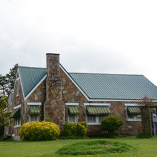
Clinton, Administrative division in Arkansas, United States

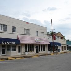
Clinton is an administrative division in Arkansas that serves as a local government entity providing services to residents. The administrative center handles permits, maintains records, and gives people access to essential documentation and information.

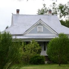
Clinton developed as an administrative division in the late 1800s when the settlement grew and needed formal government structures. This change allowed the community to manage its own affairs and plan for the future.

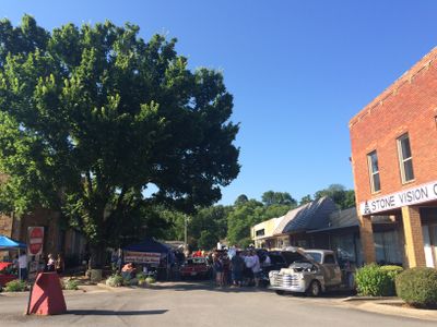
Local governance brings residents together through regular town meetings where people discuss community projects and municipal matters. These gatherings shape how neighbors know each other and how decisions get made for the area.

Visitors can go to the administrative center during business hours to get permits or retrieve documents they need. It helps to call ahead to find out the office hours and what paperwork you should bring with you.

The area has specialized zoning rules for farming that allow traditional farms and modern agricultural technology to exist side by side. This balance shows how the community keeps both old and new ways of farming working together.

GPS coordinates: 35.59147,-92.46044

Latest update: December 7, 2025 20:43

Photos
Around this place
Greers Ferry Lake
United States of America

Greers Ferry Lake

30.6 km
Melvin Chrisco House
United States of America

Melvin Chrisco House

24.9 km
Middle Fork of the Little Red River Bridge
United States of America

Middle Fork of the Little Red River Bridge

14.8 km
Walter Patterson Filling Station
United States of America

Walter Patterson Filling Station

291 m
Van Buren County Courthouse
United States of America

Van Buren County Courthouse

267 m
Old Highway 16 Bridge
United States of America

Old Highway 16 Bridge

24.7 km
Lee Service Station
United States of America

Lee Service Station

25.6 km
Silas Owens Sr. House
United States of America

Silas Owens Sr. House

30.2 km
Farmers Bank Building
United States of America

Farmers Bank Building

27.9 km
Dr. Clay House
United States of America

Dr. Clay House

28 km
Joclin-Bradley-Bowling House
United States of America

Joclin-Bradley-Bowling House

646 m
Collums-Baker House
United States of America

Collums-Baker House

17.7 km
Charlie Hall House
United States of America

Charlie Hall House

28.5 km
Damascus CCC Camp, Co. No. 3781 Historic District
United States of America

Damascus CCC Camp, Co. No. 3781 Historic District

25.2 km
Columbus Hatchett House
United States of America

Columbus Hatchett House

27.7 km
Van Buren County Road 2E Bridge
United States of America

Van Buren County Road 2E Bridge

23.3 km
American Legion Post No. 131
United States of America

American Legion Post No. 131

28 km
Damascus Gymnasium
United States of America

Damascus Gymnasium

25.3 km
Walter Patterson House
United States of America

Walter Patterson House

2.3 km
Carl and Esther Lee House
United States of America

Carl and Esther Lee House

25.4 km
Richard and Mettie Ealy House
United States of America

Richard and Mettie Ealy House

31.1 km
Brewer School
United States of America

Brewer School

26.6 km
Earl and Oza Crownover-Brown House
United States of America

Earl and Oza Crownover-Brown House

26.5 km
Leslie-Rolen House
United States of America

Leslie-Rolen House

27.9 km
Clinton Commercial Historic District
United States of America

Clinton Commercial Historic District

455 m
Art Scanlan House
United States of America

Art Scanlan House

17.1 km
Solomon Grove Smith-Hughes Building
United States of America

Solomon Grove Smith-Hughes Building

30.3 km
Natural Bridge of Arkansas
United States of America

Natural Bridge of Arkansas

6.8 km
Show the full map
Reviews

Visited this place? Tap the stars to rate it and share your experience / photos with the community! Try now! You can cancel it anytime.

« Clinton - Administrative division in Arkansas, United States » is provided by Around Us (aroundus.com). Images and texts are derived from Wikimedia project under a Creative Commons license. You are allowed to copy, distribute, and modify copies of this page, under the conditions set by the license, as long as this note is clearly visible.

Discover hidden gems everywhere you go!

From secret cafés to breathtaking viewpoints, skip the crowded tourist spots and find places that match your style. Our app makes it easy with voice search, smart filtering, route optimization, and insider tips from travelers worldwide. Download now for the complete mobile experience.

Around Us App Screenshot

A unique approach to discovering new places

Le Figaro

All the places worth exploring

France Info

A tailor-made excursion in just a few clicks

20 Minutes