Geography of the United States, Geographic territory of the United States, North America
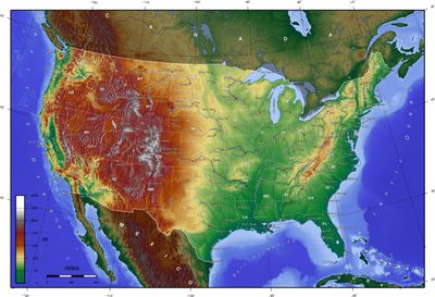
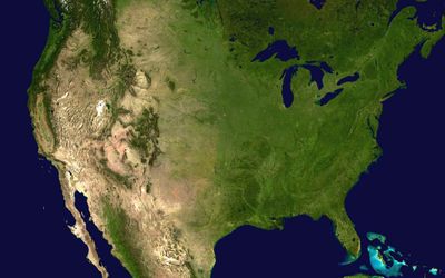
The territory includes coastlines on two oceans, deserts in the Southwest, mountains in the West, and temperate forests in the East. The landscape changes from arctic tundra in Alaska to tropical islands in the Pacific and extends across vast plains in the center of the continent.
The current extent formed through a series of purchases and treaties in the 19th century that expanded the original territory on the East Coast westward to the Pacific. The annexation of Texas and the cession by Mexico enlarged the territory toward the south.
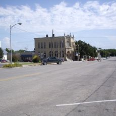
The vast prairies of the Midwest shape the image of a region where agriculture sets the rhythm of daily life and small towns are scattered across hundreds of kilometers. In the coastal areas, life concentrates in large port cities, while the mountain regions are marked by ranches and national parks.
Travelers quickly notice how climate and vegetation shift when crossing different regions, from humid coastal strips to dry plateaus. Distances between larger cities can require several days of travel, especially in the sparsely populated West.
The Great Salt Lake in Utah has a higher salt content than the ocean, making floating there almost effortless. The Rocky Mountains form a natural divide that determines whether rivers flow toward the Atlantic or the Pacific.
The community of curious travelers
AroundUs brings together thousands of curated places, local tips, and hidden gems, enriched daily by 60,000 contributors worldwide.