Enable Location

We need your location to show you interesting places around you

Discover nearby places

Find interesting locations and hidden gems around you

Precise directions

Get accurate directions and distances to places

Your location is never shared with other users. It's only used when you tap the location button.

El Dorado State Park

Log in to your account

Save your favorite places
Create custom travel routes
Rate and review places
Access the full interactive map
Continue with Google
Continue with Apple
Continue with email
By continuing, you accept our Terms and Conditions and our Privacy Policy
Create an account
Add to collection
Map
Suggest a change
Share

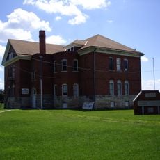
El Dorado State Park, State park in El Dorado, Kansas, US.

El Dorado State Park is a 2,000-acre nature reserve that surrounds a large reservoir ideal for boating, fishing, and water recreation. The shoreline features rocky banks and the waters support diverse fish species and wildlife habitats throughout the area.

The United States Army Corps of Engineers completed the El Dorado Reservoir in 1981, transforming the area into a water recreation destination. This construction project established the park as an important recreational resource for the region and surrounding communities.

Hiking trails and fishing spots scattered throughout the park invite visitors to explore the natural character of the Flint Hills region. Locals and tourists come here to experience the landscape and wildlife that define this part of Kansas.

The park entrance is located a few miles east of El Dorado on US-54 highway, making it easy to access by car. Multiple camping facilities range from basic to full-service options, so you can choose what works best for your needs.

Submerged railroad beds and old tree stumps beneath the water surface create unique habitats for several fish species found in the reservoir. These underwater structures make this a distinctive fishing destination within the state.

Location: Kansas

Website: https://ksoutdoors.com/State-Parks/Locations/El-Dorado

GPS coordinates: 37.86110,-96.77190

Latest update: December 13, 2025 11:42

Photos
Around this place
Allen-Lambe House
United States of America

Allen-Lambe House

49.6 km
Cessna Stadium
United States of America

Cessna Stadium

48.6 km
El Dorado Lake
United States of America

El Dorado Lake

4.8 km
Harvey House
United States of America

Harvey House

44.3 km
Ulrich Museum of Art
United States of America

Ulrich Museum of Art

48.9 km
Beaumont St. Louis and San Francisco Railroad Water Tank
United States of America

Beaumont St. Louis and San Francisco Railroad Water Tank

31.1 km
Greenwood Hotel
United States of America

Greenwood Hotel

42.3 km
Augusta Historic Theatre
United States of America

Augusta Historic Theatre

28 km
Peabody Historical Library Museum
United States of America

Peabody Historical Library Museum

44.9 km
Clements Stone Arch Bridge
United States of America

Clements Stone Arch Bridge

48.4 km
Robertson House
United States of America

Robertson House

43.2 km
C. N. James Cabin
United States of America

C. N. James Cabin

28.5 km
Peabody Downtown Historic District
United States of America

Peabody Downtown Historic District

44.9 km
Peabody City Park
United States of America

Peabody City Park

45.2 km
W.H. Morgan House
United States of America

W.H. Morgan House

44.9 km
Cottonwood River Pratt Truss Bridge
United States of America

Cottonwood River Pratt Truss Bridge

44.7 km
Fairmount Congregational Church
United States of America

Fairmount Congregational Church

48.9 km
Butler County Courthouse
United States of America

Butler County Courthouse

8.6 km
Crocker Ranch
United States of America

Crocker Ranch

39.9 km
Peabody Township Library
United States of America

Peabody Township Library

45 km
El Dorado Carnegie Library
United States of America

El Dorado Carnegie Library

8.6 km
Burns Union School
United States of America

Burns Union School

27.3 km
Eureka Carnegie Library
United States of America

Eureka Carnegie Library

42.2 km
Douglass Township Community Building
United States of America

Douglass Township Community Building

44.1 km
Loomis–Parry Residence
United States of America

Loomis–Parry Residence

27 km
Frank Lloyd Wright's Allen House
United States of America

Frank Lloyd Wright's Allen House

49.6 km
Teter Rock
United States of America

Teter Rock

35.9 km
Little Walnut River Pratt Truss Bridge
United States of America

Little Walnut River Pratt Truss Bridge

32.3 km
Show the full map
Reviews

Visited this place? Tap the stars to rate it and share your experience / photos with the community! Try now! You can cancel it anytime.

« El Dorado State Park - State park in El Dorado, Kansas, US » is provided by Around Us (aroundus.com). Images and texts are derived from Wikimedia project under a Creative Commons license. You are allowed to copy, distribute, and modify copies of this page, under the conditions set by the license, as long as this note is clearly visible.

Discover hidden gems everywhere you go!

From secret cafés to breathtaking viewpoints, skip the crowded tourist spots and find places that match your style. Our app makes it easy with voice search, smart filtering, route optimization, and insider tips from travelers worldwide. Download now for the complete mobile experience.

Around Us App Screenshot

A unique approach to discovering new places

Le Figaro

All the places worth exploring

France Info

A tailor-made excursion in just a few clicks

20 Minutes