
Schenectady, Administrative city in New York, United States.
Schenectady is an administrative city in Schenectady County in New York State, located at the confluence of the Mohawk and Hudson rivers at about 74 meters (243 feet) elevation. The city spreads across both banks of the Mohawk and is crossed by several bridges linking older neighborhoods with newer residential areas to the south and west.
Dutch settlers established farms along the Mohawk in the late 17th century after purchasing land from the Mohawk people. The community was rebuilt after a fire in 1690 and grew during the 19th century into a center of railroad and electrical industry.
The name comes from the Mohawk language and means beyond the pines, referring to the original forests along the river. Today the city is still marked by descendants of Dutch and German immigrants, whose family names and traditions remain present in daily life and whose old brick houses still line the streets.
Most visitors use Albany airport about 30 minutes to the east or arrive by train at the Amtrak station in the city center. Public buses run by the Capital District Transportation Authority connect downtown with surrounding suburbs and operate at regular intervals during the day.
General Electric opened its first research and development center here, where engineers developed fundamental technologies for power grids and electric propulsion. In one of the laboratories a team invented the first practical turbo generator, which formed the basis for modern power plants.
Location: Schenectady County
Inception: 1765
Elevation above the sea: 74 m
Website: http://cityofschenectady.com
GPS coordinates: 42.80417,-73.92917
Latest update: December 4, 2025 14:21

General Electric Research Laboratory
1.9 km
Proctor's Theatre
1.4 km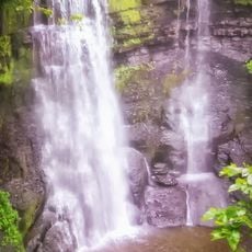
Plotter Kill Preserve
9.2 km
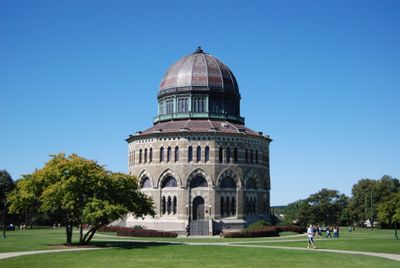
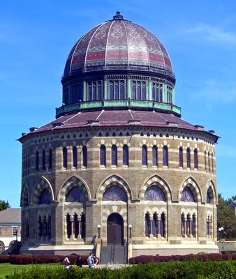
Nott Memorial
1.5 km
Empire State Aerosciences Museum
6.3 km
Schenectady City Hall
1.4 km
Mabee House
10.8 km
Dudley Observatory
937 m
Enlarged Double Lock No. 23, Old Erie Canal
5.2 km
Great Flats Nature Trail
4.5 km
Clifton Park Center Baptist Church and Cemetery
10 km
Irving Langmuir House
1.5 km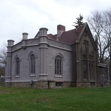
John Schoolcraft House
11.3 km
Abraham Glen House
3.3 km
Grooms Tavern Complex
7.7 km
Bridge 8, Erie Canal
6.2 km
Nathan Garnsey House
8.8 km
Vischer Ferry Historic District
9 km
Mohawk Valley Grange Hall
7.7 km
Cyrus Rexford House
6.6 km
Stephen Pangburn House
8.1 km
St. Mark's Lutheran Church
11.6 km
Mandeville Gallery
1.5 km
Abraham Best House
8.5 km
Bridge 10, Erie Canal
3.3 km
Gillespie House
10.2 km
Charles Parker House
8.5 km
Gifford Grange Hall
10 kmReviews
Visited this place? Tap the stars to rate it and share your experience / photos with the community! Try now! You can cancel it anytime.
Discover hidden gems everywhere you go!
From secret cafés to breathtaking viewpoints, skip the crowded tourist spots and find places that match your style. Our app makes it easy with voice search, smart filtering, route optimization, and insider tips from travelers worldwide. Download now for the complete mobile experience.

A unique approach to discovering new places❞
— Le Figaro
All the places worth exploring❞
— France Info
A tailor-made excursion in just a few clicks❞
— 20 Minutes