Morgan County

Log in to your account

AroundUs is a community-driven map of interesting places, built by curious explorers like you. It grows with every review, story, and photo you share.
Connect to save your favorite spots, contribute locations, and create personalized routes.
Continue with Google
Continue with Apple
Continue with X
Continue with Facebook
Continue with email
By continuing, you accept our Terms and Conditions and our Privacy Policy
Create an account
Add to collection
Map
Suggest a change
Share

Morgan County, Administrative county in central Missouri, United States.

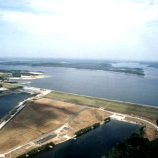
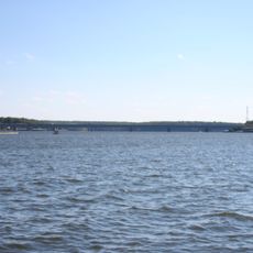
Morgan County is an administrative county in central Missouri that spans approximately 598 square miles of land and 16 square miles of water. The county borders six other Missouri counties, including Cooper and Camden, and serves as an important regional center.

The area was established on January 5, 1833, and named after General Daniel Morgan, who fought during the American Revolutionary War. Its founding came during Missouri's period of westward growth and administrative development.

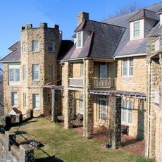
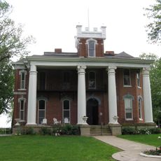
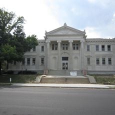
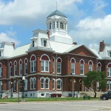
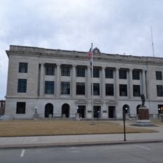
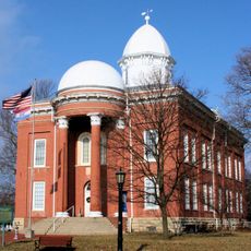
The Morgan County Courthouse in Versailles displays French architectural details with a mansard roof, reflecting the county's administrative importance. The building anchors the town's center and tells visitors about the region's history through its design.

Visitors can access essential public services through various county departments, including the Circuit Clerk, Public Administrator, and Morgan County Health Center. The main administrative facilities are concentrated around Versailles, making them easy to locate.

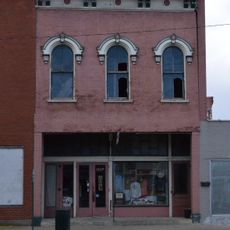
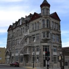
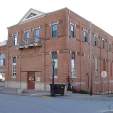
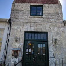
The Martin Hotel in Versailles, built in 1853, hosted notable guests including P.T. Barnum and Jesse James during the post-Civil War years. The building demonstrates how the town attracted travelers and businesspeople despite regional upheaval.

Location: Missouri

Inception: 1833

Capital city: Versailles

Shares border with: Cooper County, Camden County, Miller County, Moniteau County, Benton County, Pettis County

Website: http://morgan-county.org

GPS coordinates: 38.43000,-92.89000

Latest update: December 7, 2025 20:48

Photos
Around this place
Lake of the Ozarks
United States of America

Lake of the Ozarks

34.3 km
Party Cove
United States of America

Party Cove

41.9 km
Truman Reservoir
United States of America

Truman Reservoir

48.6 km
Lake of the Ozarks State Park
United States of America

Lake of the Ozarks State Park

41.9 km
Bothwell Lodge State Historic Site
United States of America

Bothwell Lodge State Historic Site

49.8 km
Grand Glaize Bridge
United States of America

Grand Glaize Bridge

39.4 km
Bridal Cave
United States of America

Bridal Cave

42 km
Ravenswood
United States of America

Ravenswood

43.9 km
Building at 217 West Main Street
United States of America

Building at 217 West Main Street

43.7 km
508th Missile Squadron
United States of America

508th Missile Squadron

22.2 km
Upper Bridge
United States of America

Upper Bridge

48.1 km
Harris House
United States of America

Harris House

43 km
Sedalia Public Library
United States of America

Sedalia Public Library

42.9 km
Prairie View
United States of America

Prairie View

40.6 km
Fiery Fork Conservation Area
United States of America

Fiery Fork Conservation Area

38.5 km
William H. Gentry House
United States of America

William H. Gentry House

47.4 km
Missouri, Kansas and Texas Railroad Depot
United States of America

Missouri, Kansas and Texas Railroad Depot

42.2 km
Morgan County Courthouse
United States of America

Morgan County Courthouse

3.2 km
Missouri/Sedalia Trust Company
United States of America

Missouri/Sedalia Trust Company

42.7 km
Sedalia Commercial Historic District
United States of America

Sedalia Commercial Historic District

42.6 km
McVey School
United States of America

McVey School

39.8 km
Finke Opera House
United States of America

Finke Opera House

36.4 km
Gray-Wood Buildings
United States of America

Gray-Wood Buildings

36.5 km
Moniteau County Courthouse Square
United States of America

Moniteau County Courthouse Square

36.5 km
Bothwell Lodge State Historic Site
United States of America

Bothwell Lodge State Historic Site

49.8 km
Camden County Historical Society
United States of America

Camden County Historical Society

46.7 km
Missouri State Fair
United States of America

Missouri State Fair

43.5 km
Lake of the Ozarks State Park Highway 134 Historic District
United States of America

Lake of the Ozarks State Park Highway 134 Historic District

44.5 km
Show the full map
Reviews

Visited this place? Tap the stars to rate it and share your experience / photos with the community! Try now! You can cancel it anytime.

Administrative divisions
« Morgan County - Administrative county in central Missouri, United States » is provided by Around Us (aroundus.com). Images and texts are derived from Wikimedia project under a Creative Commons license. You are allowed to copy, distribute, and modify copies of this page, under the conditions set by the license, as long as this note is clearly visible.

Discover hidden gems everywhere you go!

From secret cafés to breathtaking viewpoints, skip the crowded tourist spots and find places that match your style. Our app makes it easy with voice search, smart filtering, route optimization, and insider tips from travelers worldwide. Download now for the complete mobile experience.

Around Us App Screenshot

A unique approach to discovering new places

Le Figaro

All the places worth exploring

France Info

A tailor-made excursion in just a few clicks

20 Minutes