Dallas County

Log in to your account

AroundUs is a community-driven map of interesting places, built by curious explorers like you. It grows with every review, story, and photo you share.
Connect to save your favorite spots, contribute locations, and create personalized routes.
Continue with Google
Continue with Apple
Continue with X
Continue with Facebook
Continue with email
By continuing, you accept our Terms and Conditions and our Privacy Policy
Create an account
Add to collection
Map
Suggest a change
Share

Dallas County, Administrative county in Missouri, United States

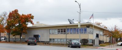
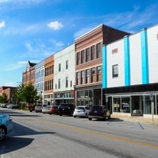
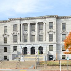
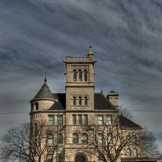
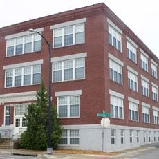
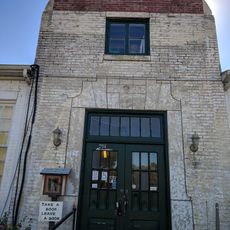
Dallas County is a county in Missouri that spans a rural area with Buffalo as its administrative center. The courthouse in Buffalo serves as the central location where county services such as registration, assessments, and law enforcement are based.

The area was originally organized as Niangua County in 1842 before being renamed in 1844 after Vice President George M. Dallas. This change reflected the territorial development of the region during that period.

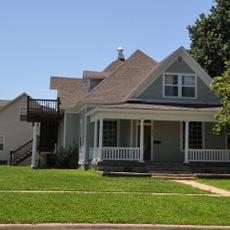
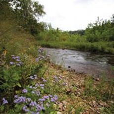
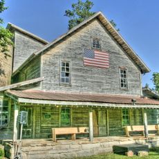
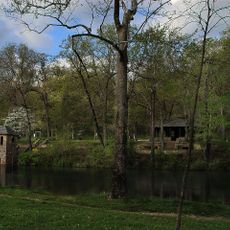
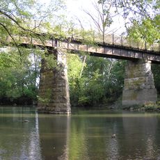
The county preserves strong farming traditions with family-run operations that have shaped the local way of life for generations. These farms remain visible throughout the landscape and define how the community functions today.

Buffalo is easy to reach and offers a central location for visiting county offices and public services. The region is best accessed by car, and daytime visits work well when government offices are open.

The region is home to the largest concentration of Kauffman Amish Mennonites, who speak Pennsylvania German as their primary language. This heritage shapes the community in visible ways and gives the area its distinctive character.

Location: Missouri

Inception: 1841

Capital city: Buffalo

Shares border with: Camden County, Laclede County, Webster County, Greene County, Polk County, Hickory County

Website: https://buffalococ.com/dallasgov.htm

GPS coordinates: 37.67000,-93.02000

Latest update: December 7, 2025 20:49

Photos
Around this place
Ha Ha Tonka State Park
United States of America

Ha Ha Tonka State Park

40.4 km
Fantastic Caverns
United States of America

Fantastic Caverns

52 km
Bennett Spring State Park
United States of America

Bennett Spring State Park

15.2 km
Bridal Cave
United States of America

Bridal Cave

47.8 km
Pomme de Terre State Park
United States of America

Pomme de Terre State Park

34.5 km
Stone Chapel
United States of America

Stone Chapel

55.6 km
Commercial Street Historic District
United States of America

Commercial Street Historic District

54.5 km
Rainey Funeral Home Building
United States of America

Rainey Funeral Home Building

38.3 km
George Dimmitt Memorial Hospital
United States of America

George Dimmitt Memorial Hospital

50.9 km
Ralph E. Burley House
United States of America

Ralph E. Burley House

31.7 km
Bentley House
United States of America

Bentley House

55 km
Greene County Courthouse
United States of America

Greene County Courthouse

55.6 km
Benton Avenue AME Church
United States of America

Benton Avenue AME Church

55.7 km
Bolivar Public Library
United States of America

Bolivar Public Library

35 km
Wallace House
United States of America

Wallace House

31.5 km
U.S. Customhouse and Post Office
United States of America

U.S. Customhouse and Post Office

56 km
Lincoln School
United States of America

Lincoln School

55.5 km
Ploger-Moneymaker Place
United States of America

Ploger-Moneymaker Place

31.5 km
Fiery Fork Conservation Area
United States of America

Fiery Fork Conservation Area

46.9 km
Bailey School
United States of America

Bailey School

55.9 km
D.M. Oberman Manufacturing Co. Building
United States of America

D.M. Oberman Manufacturing Co. Building

56 km
Boegel and Hine Flour Mill-Wommack Mill
United States of America

Boegel and Hine Flour Mill-Wommack Mill

34 km
Bennett Spring Dining Lodge
United States of America

Bennett Spring Dining Lodge

15.7 km
KY3-Sendemast
United States of America

KY3-Sendemast

55.7 km
Camden County Historical Society
United States of America

Camden County Historical Society

48.8 km
Jefferson Avenue Footbridge
United States of America

Jefferson Avenue Footbridge

54.2 km
Bennett Spring State Park Shelter House and Water Gauge Station
United States of America

Bennett Spring State Park Shelter House and Water Gauge Station

15.2 km
SLSF Sac River Bridge
United States of America

SLSF Sac River Bridge

45.5 km
Show the full map
Reviews

Visited this place? Tap the stars to rate it and share your experience / photos with the community! Try now! You can cancel it anytime.

Administrative divisions
« Dallas County - Administrative county in Missouri, United States » is provided by Around Us (aroundus.com). Images and texts are derived from Wikimedia project under a Creative Commons license. You are allowed to copy, distribute, and modify copies of this page, under the conditions set by the license, as long as this note is clearly visible.

Discover hidden gems everywhere you go!

From secret cafés to breathtaking viewpoints, skip the crowded tourist spots and find places that match your style. Our app makes it easy with voice search, smart filtering, route optimization, and insider tips from travelers worldwide. Download now for the complete mobile experience.

Around Us App Screenshot

A unique approach to discovering new places

Le Figaro

All the places worth exploring

France Info

A tailor-made excursion in just a few clicks

20 Minutes