Pomme de Terre State Park

Log in to your account

AroundUs is a community-driven map of interesting places, built by curious explorers like you. It grows with every review, story, and photo you share.
Connect to save your favorite spots, contribute locations, and create personalized routes.
Continue with Google
Continue with Apple
Continue with X
Continue with Facebook
Continue with email
By continuing, you accept our Terms and Conditions and our Privacy Policy
Create an account

Pomme de Terre State Park

Add to collection
Map
Suggest a change
Share

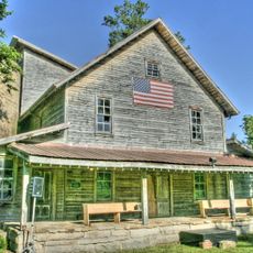
Pomme de Terre State Park, State park near Pomme de Terre Lake, Missouri, US.

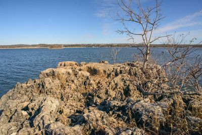
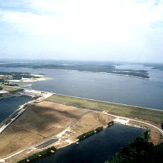
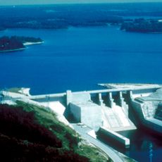
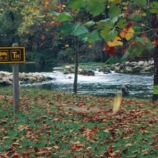
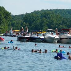
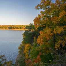
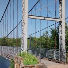
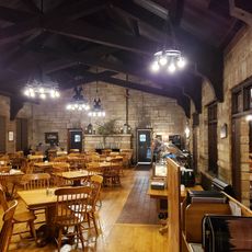
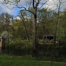
Pomme de Terre State Park is a 734-acre recreational area on a lake in central Missouri. The grounds include two public swimming beaches, winding hiking trails through forest and meadows, and various overnight options ranging from tent camping to comfortable waterfront cottages.

The area served as a boundary between Native Americans and settlers in the 1800s before becoming a recreational park in 1960. This transformation from a contested frontier zone to a public leisure space marked a major shift in how the region was valued and used.

The name comes from French fur trappers who explored the region and named it after wild fruits they found growing there. Visitors walking along the shoreline can still sense the connection to these early trading routes.

The grounds offer 240 tent sites, three yurts, and four camper cabins directly on the water, plus a boat house and a comfortable lake house for longer stays. Boat launch areas are available throughout the park, and swimming beaches have gently sloping entries while trails are clearly marked for different fitness levels.

The park is home to post and dwarf oak trees over 200 years old with unusually short, rounded crowns shaped by the dry soil conditions in the region. These distinctive trees are scattered throughout the grounds and show how plants adapt to challenging environments.

Location: Hickory County

Inception: 1960

Website: https://mostateparks.com/park/pomme-de-terre-state-park

GPS coordinates: 37.87140,-93.31780

Latest update: December 13, 2025 11:40

Photos
Around this place
Party Cove
United States of America

Party Cove

63.5 km
Ha Ha Tonka State Park
United States of America

Ha Ha Tonka State Park

50 km
Truman Reservoir
United States of America

Truman Reservoir

44.3 km
Stockton Lake
United States of America

Stockton Lake

47.3 km
Fantastic Caverns
United States of America

Fantastic Caverns

65.1 km
Bennett Spring State Park
United States of America

Bennett Spring State Park

44 km
Lake of the Ozarks State Park
United States of America

Lake of the Ozarks State Park

63.5 km
Weaubleau structure
United States of America

Weaubleau structure

30.4 km
Bridal Cave
United States of America

Bridal Cave

50.6 km
Harry S Truman State Park
United States of America

Harry S Truman State Park

46.6 km
Upper Bridge
United States of America

Upper Bridge

41.9 km
Caplinger Mills Historic District
United States of America

Caplinger Mills Historic District

43.7 km
George Dimmitt Memorial Hospital
United States of America

George Dimmitt Memorial Hospital

24.3 km
Ralph E. Burley House
United States of America

Ralph E. Burley House

61.7 km
Gilmore Barn
United States of America

Gilmore Barn

63.4 km
Bolivar Public Library
United States of America

Bolivar Public Library

29.9 km
Wallace House
United States of America

Wallace House

61.3 km
Ploger-Moneymaker Place
United States of America

Ploger-Moneymaker Place

61.2 km
Fiery Fork Conservation Area
United States of America

Fiery Fork Conservation Area

39.9 km
Stockton Community Building
United States of America

Stockton Community Building

46.2 km
Boegel and Hine Flour Mill-Wommack Mill
United States of America

Boegel and Hine Flour Mill-Wommack Mill

56.3 km
Glasgow Commercial Historic District
United States of America

Glasgow Commercial Historic District

60.9 km
South Main Street Historic District
United States of America

South Main Street Historic District

43.9 km
Bennett Spring Dining Lodge
United States of America

Bennett Spring Dining Lodge

43.7 km
Camden County Historical Society
United States of America

Camden County Historical Society

56.2 km
Bennett Spring State Park Shelter House and Water Gauge Station
United States of America

Bennett Spring State Park Shelter House and Water Gauge Station

44 km
SLSF Sac River Bridge
United States of America

SLSF Sac River Bridge

44.6 km
Caplinger Mills Bridge
United States of America

Caplinger Mills Bridge

43.4 km
Show the full map
Reviews

Visited this place? Tap the stars to rate it and share your experience / photos with the community! Try now! You can cancel it anytime.

« Pomme de Terre State Park - State park near Pomme de Terre Lake, Missouri, US » is provided by Around Us (aroundus.com). Images and texts are derived from Wikimedia project under a Creative Commons license. You are allowed to copy, distribute, and modify copies of this page, under the conditions set by the license, as long as this note is clearly visible.

Discover hidden gems everywhere you go!

From secret cafés to breathtaking viewpoints, skip the crowded tourist spots and find places that match your style. Our app makes it easy with voice search, smart filtering, route optimization, and insider tips from travelers worldwide. Download now for the complete mobile experience.

Around Us App Screenshot

A unique approach to discovering new places

Le Figaro

All the places worth exploring

France Info

A tailor-made excursion in just a few clicks

20 Minutes