Chest opened
+${chestReward.xp} XP
Explorer
NOUVEAU ×${chestReward.collectible.quantity}
tapez pour fermer

See the monuments around you in AR Open chests in the app

Around Us is built for your phone — point your camera at the streets and discover the monuments and places around you in augmented reality. Around Us is built for your phone — chests unlock when you walk, explore and capture nearby places.

•

Enable Location

We need your location to show you interesting places around you

Discover nearby places

Find interesting locations and hidden gems around you

Precise directions

Get accurate directions and distances to places

Your location is never shared with other users. It's only used when you tap the location button.

Caplinger Mills Historic District

Log in to your account

Start exploring — it's free

Trusted by 92,634 travelers worldwide

Continue with Google
Continue with Apple
or

We will send you a code to connect

By continuing, you accept our Terms and Conditions and our Privacy Policy

Check your inbox

We've sent a pincode in your inbox. Please enter the code below.

Caplinger Mills Historic District, Historic district in Cedar County, Missouri.

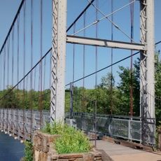
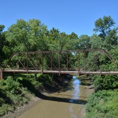
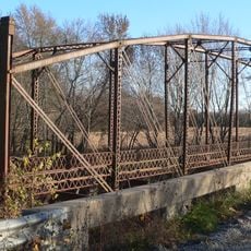
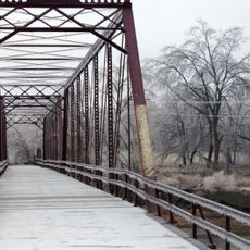
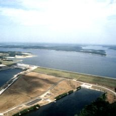
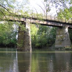
Caplinger Mills Historic District in Cedar County, Missouri, preserves one contributing site and three contributing structures tied to water power: a grist mill site, a dam, a power house, and an 1895 double-span Pratt bridge with two pony truss approach spans. The complex developed between about 1895 and 1943 at the Sac River crossing.

The district's water-power works took shape between about 1895 and 1943, when a grist mill site, dam, powerhouse and a double-span Pratt bridge with two pony-truss approach spans were built at the Sac River crossing. The complex was listed on the National Register of Historic Places in 1993.

The district grew around water power on the Sac River, with a grist mill site, dam, power house and the 1895 Pratt bridge built between about 1895 and 1943. The mill ground grain into flour for local farmers, and the dam and power house later generated electricity for the surrounding area.

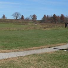
The site sits at Washington Avenue and the Sac River crossing, where all buildings are easy to see from the ground. A short walking route connects the four structures, making a visit straightforward without long distances.

The metal bridge was built in 1895 by the Chicago Bridge Company and still displays its original steel structure. Its two lower truss spans make it a notable example of bridge engineering from that era.

The community of curious travelers

AroundUs brings together thousands of curated places, local tips, and hidden gems, enriched daily by 92,634 contributors worldwide.

Start exploring
Location
GPS coordinates
37.79750,-93.80583
Latest update
October 24, 2026 17:52
Around this place
Harry S. Truman Reservoir
United States of America

Harry S. Truman Reservoir

34.7 mi
Stockton Lake
United States of America

Stockton Lake

8.2 mi
Fantastic Caverns
United States of America

Fantastic Caverns

43 mi
Weaubleau structure
United States of America

Weaubleau structure

15.9 mi
Harry S Truman Birthplace State Historic Site
United States of America

Harry S Truman Birthplace State Historic Site

33 mi
Prairie State Park
United States of America

Prairie State Park

46.4 mi
Pomme de Terre State Park
United States of America

Pomme de Terre State Park

27.1 mi
Harry S Truman State Park
United States of America

Harry S Truman State Park

38.9 mi
Osage Village State Historic Site
United States of America

Osage Village State Historic Site

25.4 mi
United States of America

Fort Carondelet

27.6 mi
Upper Bridge
United States of America

Upper Bridge

38.4 mi
Golden Prairie
United States of America

Golden Prairie

35.5 mi
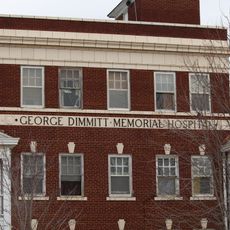
George Dimmitt Memorial Hospital
United States of America

George Dimmitt Memorial Hospital

12.6 mi
Gilmore Barn
United States of America

Gilmore Barn

36.5 mi
Bolivar Public Library
United States of America

Bolivar Public Library

25.1 mi
Vernon County Courthouse
United States of America

Vernon County Courthouse

30.3 mi
Greenfield Opera House
United States of America

Greenfield Opera House

26.5 mi
Bates County Courthouse
United States of America

Bates County Courthouse

43.7 mi
Papinville Marais des Cygnes River Bridge
United States of America

Papinville Marais des Cygnes River Bridge

29.8 mi
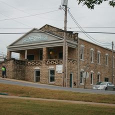
Stockton Community Building
United States of America

Stockton Community Building

6.8 mi
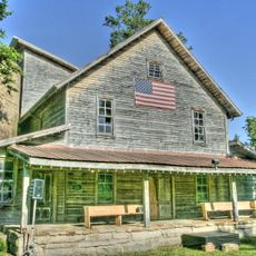
Boegel and Hine Flour Mill-Wommack Mill
United States of America

Boegel and Hine Flour Mill-Wommack Mill

46 mi
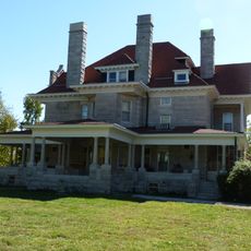
Phelps Country Estate
United States of America

Phelps Country Estate

44.6 mi
Glasgow Commercial Historic District
United States of America

Glasgow Commercial Historic District

29.8 mi
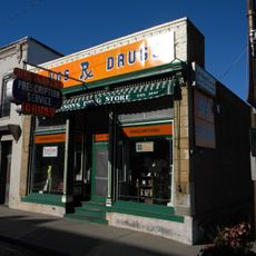
South Main Street Historic District
United States of America

South Main Street Historic District

24.9 mi
Long Shoals Bridge
United States of America

Long Shoals Bridge

46.6 mi
Henry County Museum
United States of America

Henry County Museum

39.7 mi
SLSF Sac River Bridge
United States of America

SLSF Sac River Bridge

27.4 mi
Caplinger Mills Bridge
United States of America

Caplinger Mills Bridge

0.3 mi
Show the full map
Reviews
Share your experience

No review yet

Discussions
Start a discussion...

No discussion yet

« Caplinger Mills Historic District - Historic district in Cedar County, Missouri » is provided by Around Us (aroundus.com). Images and texts are derived from Wikimedia project under a Creative Commons license. You are allowed to copy, distribute, and modify copies of this page, under the conditions set by the license, as long as this note is clearly visible.

Discover hidden gems everywhere you go!

From secret cafés to breathtaking viewpoints, skip the crowded tourist spots and find places that match your style. Our app makes it easy with voice search, smart filtering, route optimization, and insider tips from travelers worldwide. Download now for the complete mobile experience.
Around Us App Screenshot
❝

A unique approach to discovering new places❞

— Le Figaro

❝

All the places worth exploring❞

— France Info

❝

A tailor-made excursion in just a few clicks❞

— 20 Minutes

Around Us
Travel Guide & Maps
Download

Send to your phone

QR Code
1

Open the camera app on your mobile.

2

Point at the QR code with your camera. A notification will appear.

3

Tap the notification to open the link.