Enable Location

We need your location to show you interesting places around you

Discover nearby places

Find interesting locations and hidden gems around you

Precise directions

Get accurate directions and distances to places

Your location is never shared with other users. It's only used when you tap the location button.

Dade County

Log in to your account

Start exploring — it's free

Trusted by 61,977 travelers worldwide

Continue with Google
Continue with Apple
or

We will send you a code to connect

By continuing, you accept our Terms and Conditions and our Privacy Policy

Check your inbox

We've sent a pincode in your inbox. Please enter the code below.

Dade County, Administrative county in Southwest Missouri, United States

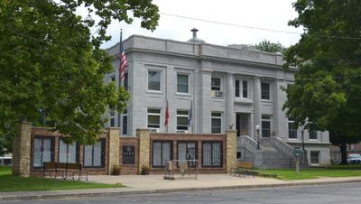
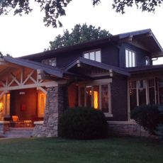
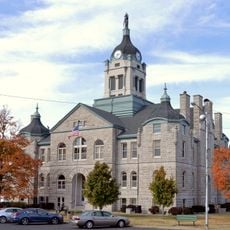
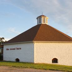
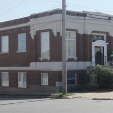
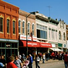
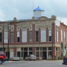
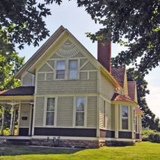
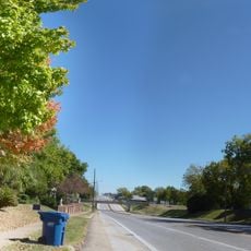
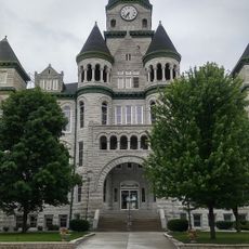
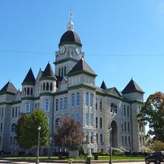
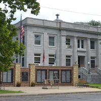
Dade County is an administrative region in southwestern Missouri that encompasses several small towns and rural communities spread across the landscape. The area includes Greenfield as its county seat, where the courthouse serves as the main center for governmental operations and public services.

The region was officially established as Dade County on January 29, 1841, and named in honor of Major Francis L. Dade, who died in the Second Seminole War. This naming choice reflects the historical connection between the county and 19th-century military events.

The county maintains several educational institutions, including Dadeville, Everton, Greenfield, and Lockwood school districts serving the local population of 7,569 residents.

The region borders eight different Missouri counties, making it well-connected to neighboring areas for travel and regional matters. For administrative purposes, Greenfield and its courthouse serve as the main point of contact for government services.

The territory connects to eight different Missouri counties, creating a central position that facilitates regional cooperation and shared resources among neighboring jurisdictions.

The community of curious travelers

AroundUs brings together thousands of curated places, local tips, and hidden gems, enriched daily by 60,000 contributors worldwide.

Start exploring
Location
Inception
January 29, 1841
Capital city
Greenfield
Shares border with
Cedar County, Lawrence County, Barton County, Jasper County, Polk County, Greene County
GPS coordinates
37.43000,-93.85000
Latest update
December 10, 2025 15:52
Around this place
Stockton Lake
United States of America

Stockton Lake

24.7 km
Fantastic Caverns
United States of America

Fantastic Caverns

46.3 km
Harry S Truman Birthplace State Historic Site
United States of America

Harry S Truman Birthplace State Historic Site

37.9 km
66 Drive-In
United States of America

66 Drive-In

54.1 km
Battle of Carthage State Historic Site
United States of America

Battle of Carthage State Historic Site

48.9 km
Caplinger Mills Historic District
United States of America

Caplinger Mills Historic District

41.1 km
Lewis Shaw Coleman House
United States of America

Lewis Shaw Coleman House

52.4 km
Golden Prairie
United States of America

Golden Prairie

27.6 km
George Dimmitt Memorial Hospital
United States of America

George Dimmitt Memorial Hospital

47.2 km
Lawrence County Courthouse
United States of America

Lawrence County Courthouse

36.5 km
Gilmore Barn
United States of America

Gilmore Barn

32.2 km
Bolivar Public Library
United States of America

Bolivar Public Library

43.9 km
Carthage Courthouse Square Historic District
United States of America

Carthage Courthouse Square Historic District

49.6 km
Greenfield Opera House
United States of America

Greenfield Opera House

1.9 km
Elijah Teague Anderson House
United States of America

Elijah Teague Anderson House

47.4 km
Stockton Community Building
United States of America

Stockton Community Building

30.4 km
Colonial Apartments
United States of America

Colonial Apartments

50 km
Phelps Country Estate
United States of America

Phelps Country Estate

39.6 km
Carthage South Historic District
United States of America

Carthage South Historic District

50.1 km
Cassill Place Historic District
United States of America

Cassill Place Historic District

50.2 km
Battle of Carthage Civil War Museum
United States of America

Battle of Carthage Civil War Museum

49.5 km
Island Green Golf Club
United States of America

Island Green Golf Club

50.6 km
Willard Swimming Center
United States of America

Willard Swimming Center

39 km
Jasper County Courthouse
United States of America

Jasper County Courthouse

49.4 km
Jefferson Avenue Footbridge
United States of America

Jefferson Avenue Footbridge

54.3 km
Wilson's Creek National Battlefield Visitor Center
United States of America

Wilson's Creek National Battlefield Visitor Center

51.7 km
SLSF Sac River Bridge
United States of America

SLSF Sac River Bridge

33 km
Caplinger Mills Bridge
United States of America

Caplinger Mills Bridge

40.8 km
Show the full map
Administrative divisions
« Dade County - Administrative county in Southwest Missouri, United States » is provided by Around Us (aroundus.com). Images and texts are derived from Wikimedia project under a Creative Commons license. You are allowed to copy, distribute, and modify copies of this page, under the conditions set by the license, as long as this note is clearly visible.

Discover hidden gems everywhere you go!

From secret cafés to breathtaking viewpoints, skip the crowded tourist spots and find places that match your style. Our app makes it easy with voice search, smart filtering, route optimization, and insider tips from travelers worldwide. Download now for the complete mobile experience.

Around Us App Screenshot

A unique approach to discovering new places

Le Figaro

All the places worth exploring

France Info

A tailor-made excursion in just a few clicks

20 Minutes

Around Us
Travel Guide & Maps
Download

Send to your phone

QR Code
1

Open the camera app on your mobile.

2

Point at the QR code with your camera. A notification will appear.

3

Tap the notification to open the link.