Enable Location

We need your location to show you interesting places around you

Discover nearby places

Find interesting locations and hidden gems around you

Precise directions

Get accurate directions and distances to places

Your location is never shared with other users. It's only used when you tap the location button.

Carter County

Log in to your account

Start exploring — it's free

Trusted by 61,978 travelers worldwide

Continue with Google
Continue with Apple
or

We will send you a code to connect

By continuing, you accept our Terms and Conditions and our Privacy Policy

Check your inbox

We've sent a pincode in your inbox. Please enter the code below.

Carter County, County in Missouri, United States.

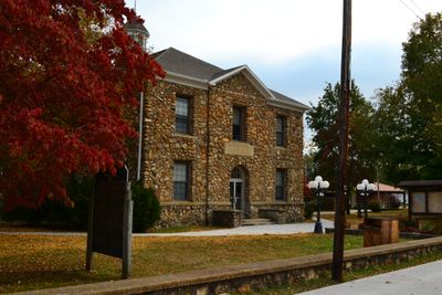
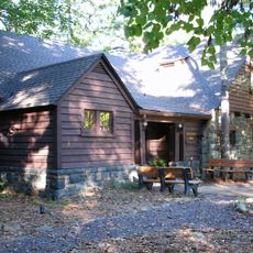
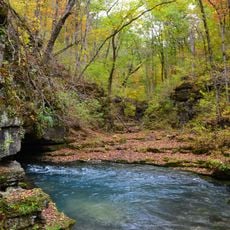
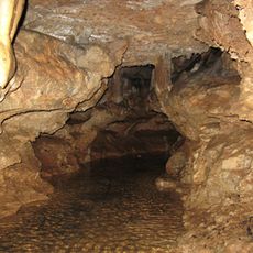
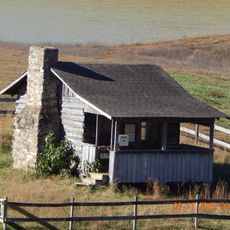
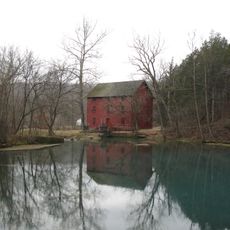
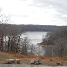
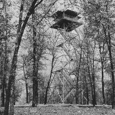
Carter County is an administrative division in southern Missouri with Van Buren as its county seat. The landscape consists mainly of rural areas with dense forests and the Current River winding through the region.

The Missouri legislature established this county in 1859, naming it after Zimri A. Carter, who had migrated from South Carolina decades earlier. The creation reflected growing settlement in the Ozark region during that period.

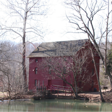
The Current River runs through the county, and locals use it for fishing, swimming, and boating, connecting daily life to the natural rhythms of the Ozark region.

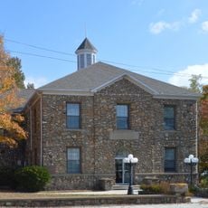
Van Buren serves as the administrative center with basic services and shops for visitors. Exploring the rural landscapes and river activities is best done by car.

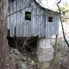
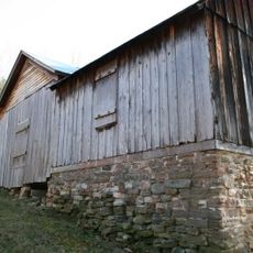
From 1887 to 1910, the Missouri Lumber and Mining Company shaped the local economy through timber harvesting and mining operations. These industries left marks on the land and influenced how settlements developed.

The community of curious travelers

AroundUs brings together thousands of curated places, local tips, and hidden gems, enriched daily by 60,000 contributors worldwide.

Start exploring
Location
Inception
May 10, 1859
Capital city
Van Buren
Shares border with
Reynolds County, Ripley County, Shannon County, Oregon County, Wayne County, Butler County
GPS coordinates
36.94000,-90.97000
Latest update
December 7, 2025 20:44
Around this place
Sam A. Baker State Park
United States of America

Sam A. Baker State Park

52.6 km
Greer Spring
United States of America

Greer Spring

37.7 km
Eleven Point State Park
United States of America

Eleven Point State Park

40.3 km
Current River Cavern
United States of America

Current River Cavern

7.1 km
Alley Spring Roller Mill
United States of America

Alley Spring Roller Mill

48.2 km
Williams-Gierth House
United States of America

Williams-Gierth House

54.6 km
North Main Street Historic District
United States of America

North Main Street Historic District

55 km
Mark Twain School
United States of America

Mark Twain School

54.2 km
Thomas Moore House
United States of America

Thomas Moore House

55.1 km
Walter Klepzig Mill and Farm
United States of America

Walter Klepzig Mill and Farm

29 km
Hillyard Cabin
United States of America

Hillyard Cabin

51.1 km
John Archibald Phillips House
United States of America

John Archibald Phillips House

55.1 km
Alfred W. Greer House
United States of America

Alfred W. Greer House

54.3 km
Moore-Dalton House
United States of America

Moore-Dalton House

55.1 km
Garfield Historic District
United States of America

Garfield Historic District

54.6 km
Ripley County Jail, Sheriff's Office and Sheriff's Residence
United States of America

Ripley County Jail, Sheriff's Office and Sheriff's Residence

38.1 km
Big Spring Historic District
United States of America

Big Spring Historic District

2.3 km
Randolph Columbus Barrett House
United States of America

Randolph Columbus Barrett House

37.8 km
Wheatley Public School
United States of America

Wheatley Public School

54.6 km
Ripley County Courthouse
United States of America

Ripley County Courthouse

38.1 km
Williamson-Kennedy School
United States of America

Williamson-Kennedy School

55.3 km
Reed Log House
United States of America

Reed Log House

29.5 km
Alley Spring
United States of America

Alley Spring

48.2 km
Lake Wappapello State Park
United States of America

Lake Wappapello State Park

55.9 km
Carter County Courthouse
United States of America

Carter County Courthouse

7.3 km
Sam A. Baker State Park Historic District
United States of America

Sam A. Baker State Park Historic District

54.5 km
Baldy Lookout Tower
United States of America

Baldy Lookout Tower

18.1 km
Possum Trot Lookout
United States of America

Possum Trot Lookout

32.4 km
Show the full map
Administrative divisions
« Carter County - County in Missouri, United States » is provided by Around Us (aroundus.com). Images and texts are derived from Wikimedia project under a Creative Commons license. You are allowed to copy, distribute, and modify copies of this page, under the conditions set by the license, as long as this note is clearly visible.

Discover hidden gems everywhere you go!

From secret cafés to breathtaking viewpoints, skip the crowded tourist spots and find places that match your style. Our app makes it easy with voice search, smart filtering, route optimization, and insider tips from travelers worldwide. Download now for the complete mobile experience.

Around Us App Screenshot

A unique approach to discovering new places

Le Figaro

All the places worth exploring

France Info

A tailor-made excursion in just a few clicks

20 Minutes

Around Us
Travel Guide & Maps
Download

Send to your phone

QR Code
1

Open the camera app on your mobile.

2

Point at the QR code with your camera. A notification will appear.

3

Tap the notification to open the link.