Enable Location

We need your location to show you interesting places around you

Discover nearby places

Find interesting locations and hidden gems around you

Precise directions

Get accurate directions and distances to places

Your location is never shared with other users. It's only used when you tap the location button.

Sam A. Baker State Park

Log in to your account

Start exploring — it's free

Trusted by 61,352 travelers worldwide

Continue with Google
Continue with Apple
or

We will send you a code to connect

By continuing, you accept our Terms and Conditions and our Privacy Policy

Check your inbox

We've sent a pincode in your inbox. Please enter the code below.

Sam A. Baker State Park, State park in Wayne County, Missouri, US.

Description

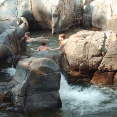
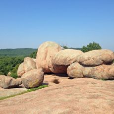
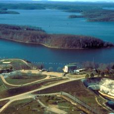
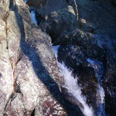
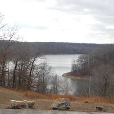
Sam A. Baker State Park is a protected landscape in the Saint Francois Mountains region, covering thousands of acres with rivers and creeks flowing through forested terrain. The park provides campsites, cabins, and water access for boating, along with hiking trails that connect different sections of the property.

History

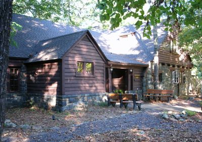
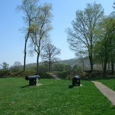
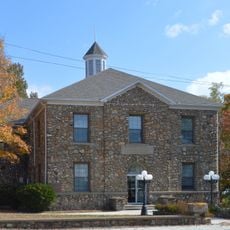
The site was established as a state park in the 1920s and expanded during the 1930s with numerous structures built through a major federal work program. These buildings represent how the park developed during an important period of American history.

Culture

The park is named after a former Missouri governor and reflects a region deeply connected to river landscapes and outdoor traditions. The historic stone buildings here serve as reminders of how communities have long gathered in these natural settings for recreation and shelter.

Practical

The park is easy to access and offers accommodation for different preferences and budgets. The best time to visit is spring and fall, when temperatures are mild and trails are easy to navigate.

Did you know?

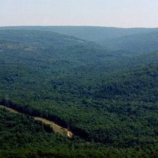
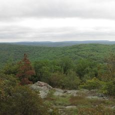
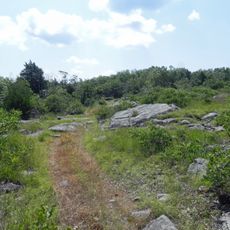
A long hiking trail crosses the park with stone shelters positioned along the way to protect backpackers on multi-day journeys. This route also reaches less-visited nature preserves with views of mountainous terrain.

Location
Inception
1926
Operator
Missouri Department of Natural Resources
GPS coordinates
37.25330,-90.52610
Latest update
December 8, 2025 19:53

AroundUs brings together thousands of curated places, local tips, and hidden gems, enriched daily by 60,000 contributors worldwide. Discover all places nearby (Wayne County).

Around this place
Taum Sauk Mountain
United States of America

Taum Sauk Mountain

39.5 km
Johnson's Shut-Ins State Park
United States of America

Johnson's Shut-Ins State Park

42.6 km
Elephant Rocks State Park
United States of America

Elephant Rocks State Park

46.9 km
Lake Wappapello
United States of America

Lake Wappapello

41.5 km
Taum Sauk Mountain State Park
United States of America

Taum Sauk Mountain State Park

39.5 km
Bell Mountain Wilderness
United States of America

Bell Mountain Wilderness

52.3 km
Mingo National Wildlife Refuge
United States of America

Mingo National Wildlife Refuge

46.3 km
Fort Davidson
United States of America

Fort Davidson

43 km
Arcadia College
United States of America

Arcadia College

37.8 km
Jay Nixon State Park
United States of America

Jay Nixon State Park

43.7 km
Buford Mountain Conservation Area
United States of America

Buford Mountain Conservation Area

53.6 km
Current River Cavern
United States of America

Current River Cavern

54.6 km
North Main Street Historic District
United States of America

North Main Street Historic District

56.1 km
Mark Twain School
United States of America

Mark Twain School

55.4 km
Immanuel Evangelical Lutheran Church
United States of America

Immanuel Evangelical Lutheran Church

42.7 km
St. Paul's Episcopal Church
United States of America

St. Paul's Episcopal Church

39.6 km
Alfred W. Greer House
United States of America

Alfred W. Greer House

55.9 km
Garfield Historic District
United States of America

Garfield Historic District

55.6 km
Big Spring Historic District
United States of America

Big Spring Historic District

53.6 km
Fredericktown Courthouse Square Historic District
United States of America

Fredericktown Courthouse Square Historic District

39.9 km
Wheatley Public School
United States of America

Wheatley Public School

55.6 km
Madison County Courthouse
United States of America

Madison County Courthouse

39.8 km
Iron County Courthouse
United States of America

Iron County Courthouse

39.4 km
Williamson-Kennedy School
United States of America

Williamson-Kennedy School

56.1 km
United States Post Office
United States of America

United States Post Office

39.6 km
Ironton Lodge Hall
United States of America

Ironton Lodge Hall

39.6 km
Lake Wappapello State Park
United States of America

Lake Wappapello State Park

37.1 km
Carter County Courthouse
United States of America

Carter County Courthouse

52 km
Show the full map
« Sam A. Baker State Park - State park in Wayne County, Missouri, US » is provided by Around Us (aroundus.com). Images and texts are derived from Wikimedia project under a Creative Commons license. You are allowed to copy, distribute, and modify copies of this page, under the conditions set by the license, as long as this note is clearly visible.

Discover hidden gems everywhere you go!

From secret cafés to breathtaking viewpoints, skip the crowded tourist spots and find places that match your style. Our app makes it easy with voice search, smart filtering, route optimization, and insider tips from travelers worldwide. Download now for the complete mobile experience.

Around Us App Screenshot

A unique approach to discovering new places

Le Figaro

All the places worth exploring

France Info

A tailor-made excursion in just a few clicks

20 Minutes

Around Us
Travel Guide & Maps
Download

Send to your phone

QR Code
1

Open the camera app on your mobile.

2

Point at the QR code with your camera. A notification will appear.

3

Tap the notification to open the link.