Johnson's Shut-Ins State Park

Log in to your account

AroundUs is a community-driven map of interesting places, built by curious explorers like you. It grows with every review, story, and photo you share.
Connect to save your favorite spots, contribute locations, and create personalized routes.
By continuing, you accept our Terms and Conditions and our Privacy Policy
Add to collection
Map
Suggest a change
Share

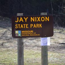
Johnson's Shut-Ins State Park, State park in Reynolds County, Missouri

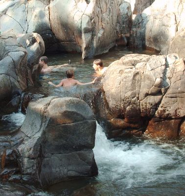
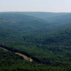
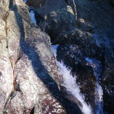
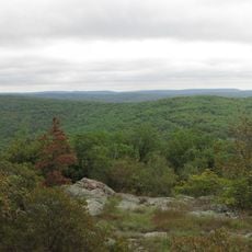
Johnson's Shut-Ins is a state park in Reynolds County in southern Missouri where the East Fork Black River flows through narrow channels of hard rhyolite rock. The water shapes natural pools, slides and rapids across an area of more than 3,550 hectares (8,781 acres) of forested hills.

Joseph Desloge, an industrialist from St. Louis, bought the land in several steps starting in 1918 and donated it to the state of Missouri in 1955. The area had previously been farmland of the Johnston family and other pioneers who settled here from the 1840s onward.

The name comes from John Johnson, a 19th-century Scotch-Irish settler whose family lived and worked in this area. Visitors can walk to the small Johnston family cemetery, where simple headstones tell stories of early frontier life.

Swimming and playing in the shallow rock channels is possible in warm weather, but the current can become strong. The park offers several campgrounds with different levels of facilities, hiking trails of varying lengths, and a small store for food and gear.

A severe flood in 2005 destroyed nearly all facilities when a nearby dam broke and a mudslide swept through the park. The rebuilding brought modern buildings and improved trails, while the natural rock formations remained largely unchanged.

Location: Missouri

Inception: 1955

Operator: Missouri Department of Natural Resources

Website: https://mostateparks.com/park/johnsons-shut-ins-state-park

GPS coordinates: 37.54190,-90.84190

Latest update: December 5, 2025 22:26

Photos
Around this place
Taum Sauk Mountain
United States of America

Taum Sauk Mountain

10.5 km
Elephant Rocks State Park
United States of America

Elephant Rocks State Park

18.4 km
Sam A. Baker State Park
United States of America

Sam A. Baker State Park

42.6 km
Taum Sauk Mountain State Park
United States of America

Taum Sauk Mountain State Park

10.6 km
Bell Mountain Wilderness
United States of America

Bell Mountain Wilderness

10.4 km
St. Joe State Park
United States of America

St. Joe State Park

41.5 km
Missouri Mines State Historic Site
United States of America

Missouri Mines State Historic Site

44.1 km
Dillard Mill State Historic Site
United States of America

Dillard Mill State Historic Site

37.6 km
Fort Davidson
United States of America

Fort Davidson

20.3 km
Arcadia College
United States of America

Arcadia College

19.3 km
Jay Nixon State Park
United States of America

Jay Nixon State Park

7.9 km
Buford Mountain Conservation Area
United States of America

Buford Mountain Conservation Area

22.8 km
Presbyterian Orphanage of Missouri
United States of America

Presbyterian Orphanage of Missouri

45.3 km
Bootleg Access
United States of America

Bootleg Access

31.3 km
Bonne Terre Depot
United States of America

Bonne Terre Depot

49.2 km
Immanuel Evangelical Lutheran Church
United States of America

Immanuel Evangelical Lutheran Church

20 km
St. Paul's Episcopal Church
United States of America

St. Paul's Episcopal Church

20.1 km
Madison County Courthouse
United States of America

Madison County Courthouse

48.4 km
Washington County Courthouse
United States of America

Washington County Courthouse

44.2 km
Iron County Courthouse
United States of America

Iron County Courthouse

19.9 km
St. Francois County Jail and Sheriff's Residence
United States of America

St. Francois County Jail and Sheriff's Residence

45.5 km
Courthouse Square Historic District
United States of America

Courthouse Square Historic District

45.7 km
East Columbia Historic District
United States of America

East Columbia Historic District

45.7 km
James Robinson McCormick House
United States of America

James Robinson McCormick House

45.3 km
Caledonia Historic District
United States of America

Caledonia Historic District

25.4 km
Harrison Queen House
United States of America

Harrison Queen House

26.8 km
Ironton Lodge Hall
United States of America

Ironton Lodge Hall

19.8 km
Space Museum
United States of America

Space Museum

49.4 km
Show the full map
Reviews

Visited this place? Tap the stars to rate it and share your experience / photos with the community! Try now! You can cancel it anytime.

« Johnson's Shut-Ins State Park - State park in Reynolds County, Missouri » is provided by Around Us (aroundus.com). Images and texts are derived from Wikimedia project under a Creative Commons license. You are allowed to copy, distribute, and modify copies of this page, under the conditions set by the license, as long as this note is clearly visible.

Discover hidden gems everywhere you go!

From secret cafés to breathtaking viewpoints, skip the crowded tourist spots and find places that match your style. Our app makes it easy with voice search, smart filtering, route optimization, and insider tips from travelers worldwide. Download now for the complete mobile experience.

Around Us App Screenshot

A unique approach to discovering new places

Le Figaro

All the places worth exploring

France Info

A tailor-made excursion in just a few clicks

20 Minutes