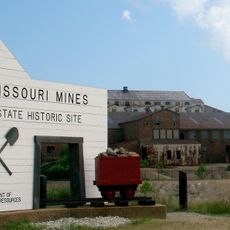
Enable Location

We need your location to show you interesting places around you

Discover nearby places

Find interesting locations and hidden gems around you

Precise directions

Get accurate directions and distances to places

Your location is never shared with other users. It's only used when you tap the location button.

Log in to your account

Start exploring — it's free

Trusted by 63,490 travelers worldwide

Continue with Google
Continue with Apple
or

We will send you a code to connect

By continuing, you accept our Terms and Conditions and our Privacy Policy

Check your inbox

We've sent a pincode in your inbox. Please enter the code below.

Fort Hovey
Discussion Reviews Photo
1.1k Popularity

Fort Hovey

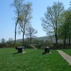
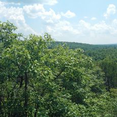
Fort Hovey was a small earth-and-wood fort built during the Civil War on a hill overlooking the road junction between Ironton and Fredericktown. It was constructed to protect the Arcadia Valley and the iron mines on Pilot Knob Mountain.

The fort was built in winter 1861-1862 by the 33rd Illinois Volunteer Infantry under Colonel Charles E. Hovey, from whom it took its name. After the Union victory at Pea Ridge in March 1862, it was renamed Fort Curtis to honor Brigadier General Samuel R. Curtis, and was abandoned in 1864 when Confederate forces advanced into Missouri.

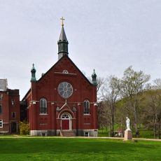
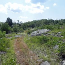
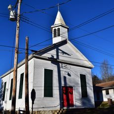
The fort site is located today next to the Arcadia Valley United Presbyterian Church at the corner of Church and Spring Streets in Arcadia and is easy to access. A historical marker indicates the location since no remnants of the original structure remain visible.

The fort was briefly used by Confederate soldiers as an observation post during and after the Battle of Pilot Knob. This secondary use shows how both sides recognized the strategic value of the hilltop location.

The community of curious travelers

AroundUs brings together thousands of curated places, local tips, and hidden gems, enriched daily by 60,000 contributors worldwide.

Start exploring
Location
GPS coordinates
37.59030,-90.62640
Latest update
February 9, 2026 07:40
Around this place
Taum Sauk Mountain
United States of America

Taum Sauk Mountain

9.2 km
Johnson's Shut-Ins State Park
United States of America

Johnson's Shut-Ins State Park

19.8 km
Elephant Rocks State Park
United States of America

Elephant Rocks State Park

9 km
Taum Sauk Mountain State Park
United States of America

Taum Sauk Mountain State Park

9.2 km
Bell Mountain Wilderness
United States of America

Bell Mountain Wilderness

22.6 km
St. Joe State Park
United States of America

St. Joe State Park

26.4 km
Missouri Mines State Historic Site
United States of America

Missouri Mines State Historic Site

29.5 km
Fort Davidson
United States of America

Fort Davidson

4.5 km
Arcadia College
United States of America

Arcadia College

866 m
Jay Nixon State Park
United States of America

Jay Nixon State Park

13.3 km
Buford Mountain Conservation Area
United States of America

Buford Mountain Conservation Area

15.4 km
Presbyterian Orphanage of Missouri
United States of America

Presbyterian Orphanage of Missouri

27.7 km
Bootleg Access
United States of America

Bootleg Access

27.9 km
Bonne Terre Depot
United States of America

Bonne Terre Depot

37.2 km
Immanuel Evangelical Lutheran Church
United States of America

Immanuel Evangelical Lutheran Church

4.2 km
St. Paul's Episcopal Church
United States of America

St. Paul's Episcopal Church

1 km
Pickle Springs
United States of America

Pickle Springs

37 km
Fredericktown Courthouse Square Historic District
United States of America

Fredericktown Courthouse Square Historic District

29.7 km
Madison County Courthouse
United States of America

Madison County Courthouse

29.5 km
Iron County Courthouse
United States of America

Iron County Courthouse

845 m
St. Francois County Jail and Sheriff's Residence
United States of America

St. Francois County Jail and Sheriff's Residence

27.8 km
Courthouse Square Historic District
United States of America

Courthouse Square Historic District

27.9 km
East Columbia Historic District
United States of America

East Columbia Historic District

27.9 km
James Robinson McCormick House
United States of America

James Robinson McCormick House

27.6 km
Caledonia Historic District
United States of America

Caledonia Historic District

23.1 km
Harrison Queen House
United States of America

Harrison Queen House

26 km
United States Post Office
United States of America

United States Post Office

29.5 km
Ironton Lodge Hall
United States of America

Ironton Lodge Hall

1.1 km
Show the full map
Reviews
Share your experience

No review yet

Discussions
Start a discussion...

No discussion yet

« Fort Hovey » is provided by Around Us (aroundus.com). Images and texts are derived from Wikimedia project under a Creative Commons license. You are allowed to copy, distribute, and modify copies of this page, under the conditions set by the license, as long as this note is clearly visible.

Discover hidden gems everywhere you go!

From secret cafés to breathtaking viewpoints, skip the crowded tourist spots and find places that match your style. Our app makes it easy with voice search, smart filtering, route optimization, and insider tips from travelers worldwide. Download now for the complete mobile experience.

Around Us App Screenshot

A unique approach to discovering new places

Le Figaro

All the places worth exploring

France Info

A tailor-made excursion in just a few clicks

20 Minutes

Around Us
Travel Guide & Maps
Download

Send to your phone

QR Code
1

Open the camera app on your mobile.

2

Point at the QR code with your camera. A notification will appear.

3

Tap the notification to open the link.