Chest opened
+${chestReward.xp} XP
Explorer
NOUVEAU ×${chestReward.collectible.quantity}
tapez pour fermer
Chest locked

Open chests in the app

Around Us is built for your phone — chests unlock when you walk, explore and capture nearby places.

Enable Location

We need your location to show you interesting places around you

Discover nearby places

Find interesting locations and hidden gems around you

Precise directions

Get accurate directions and distances to places

Your location is never shared with other users. It's only used when you tap the location button.

Log in to your account

Start exploring — it's free

Trusted by 72,888 travelers worldwide

Continue with Google
Continue with Apple
or

We will send you a code to connect

By continuing, you accept our Terms and Conditions and our Privacy Policy

Check your inbox

We've sent a pincode in your inbox. Please enter the code below.

M-185
Discussion Reviews Photo
25.9k Popularity

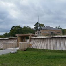
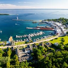
M-185, State highway on Mackinac Island, Michigan, United States.

M-185 is an 8-mile circular road around Mackinac Island in Michigan that links parks, historic sites, and natural features while offering views of Lake Huron. The route serves as the main way to reach attractions across the island.

The road was built in the early 1900s and officially became a state highway in 1933, with the asphalt surface completed in 1960. This timeline shows how the route grew into a formal transportation system while the island maintained its car-free approach.

The road reflects how islanders have chosen to live without cars, keeping horse-drawn carriages, bicycles, and walking as the main ways to get around. This choice shapes daily life here and creates a pace that feels different from mainland towns.

You reach this road by taking a passenger ferry to the island, with the starting point marked at the visitor center on Main Street. Plan for slower travel since only bicycles, horse-drawn carriages, and walkers are allowed here.

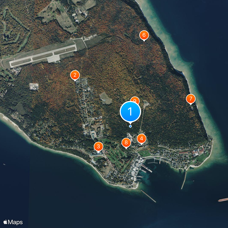
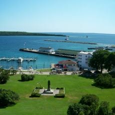
This is the only motorless state highway in the entire United States and uses wooden mile markers instead of standard metal signs. These unusual features make it a one-of-a-kind road system found nowhere else in the country.

The community of curious travelers

AroundUs brings together thousands of curated places, local tips, and hidden gems, enriched daily by 60,000 contributors worldwide.

Start exploring
Location
GPS coordinates
45.85472,-84.61944
Latest update
December 20, 2025 15:50
Reviews
Share your experience

No review yet

Discussions
Start a discussion...

No discussion yet

« M-185 - State highway on Mackinac Island, Michigan, United States » is provided by Around Us (aroundus.com). Images and texts are derived from Wikimedia project under a Creative Commons license. You are allowed to copy, distribute, and modify copies of this page, under the conditions set by the license, as long as this note is clearly visible.

Discover hidden gems everywhere you go!

From secret cafés to breathtaking viewpoints, skip the crowded tourist spots and find places that match your style. Our app makes it easy with voice search, smart filtering, route optimization, and insider tips from travelers worldwide. Download now for the complete mobile experience.

Around Us App Screenshot

A unique approach to discovering new places

Le Figaro

All the places worth exploring

France Info

A tailor-made excursion in just a few clicks

20 Minutes

Around Us
Travel Guide & Maps
Download

Send to your phone

QR Code
1

Open the camera app on your mobile.

2

Point at the QR code with your camera. A notification will appear.

3

Tap the notification to open the link.