Franklin County

Log in to your account

AroundUs is a community-driven map of interesting places, built by curious explorers like you. It grows with every review, story, and photo you share.
Connect to save your favorite spots, contribute locations, and create personalized routes.
Continue with Google
Continue with Apple
Continue with X
Continue with Facebook
Continue with email
By continuing, you accept our Terms and Conditions and our Privacy Policy
Create an account
Add to collection
Map
Suggest a change
Share

Franklin County, Administrative county in southern Nebraska, United States.

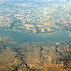
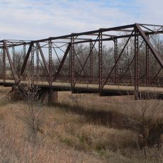
Franklin County is an administrative region in southern Nebraska comprised of farmland and small towns spread across its territory. The Republican River runs through its southern portion near the Kansas state line and defines part of the landscape.

The region was established in 1871 and named in honor of Benjamin Franklin as settlers organized a new administrative area in southern Nebraska. It grew from sparsely settled frontier land into an established county with permanent communities.

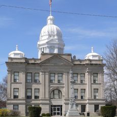
The Franklin County Board holds regular public meetings at the courthouse to discuss local matters and maintain connections with the community.

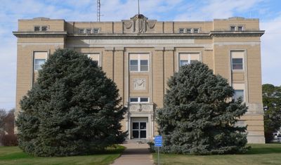
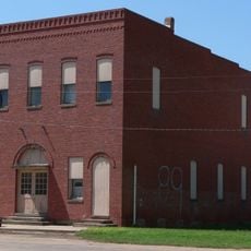
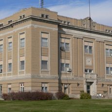
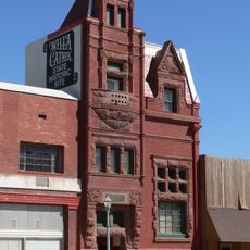
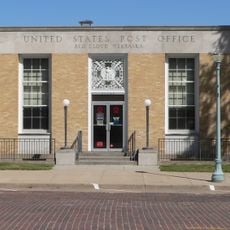
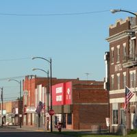
The county courthouse in Franklin provides administrative services such as property records and document notarization during standard business hours. Visitors should expect rural roads and limited urban services as this is a farming region with small towns as its main population centers.

The region received vehicle registration prefix 50 in 1922 based on its vehicle count ranking at that time. This numbering system, assigned by state rankings, remains visible on license plates from registered vehicles in the area.

Location: Nebraska

Inception: 1871

Capital city: Franklin

Shares border with: Kearney County, Smith County, Phelps County, Harlan County, Webster County, Phillips County

Website: http://co.franklin.ne.us

GPS coordinates: 40.18000,-98.95000

Latest update: December 10, 2025 15:49

Photos
Around this place
Harlan County Reservoir
United States of America

Harlan County Reservoir

30.2 km
Pioneer Village
United States of America

Pioneer Village

36.1 km
Willa Cather House
United States of America

Willa Cather House

37.9 km
Home on the Range Cabin
United States of America

Home on the Range Cabin

32.4 km
William Ducker House
United States of America

William Ducker House

37.2 km
Starke Round Barn
United States of America

Starke Round Barn

44.9 km
Franklin Bridge
United States of America

Franklin Bridge

11.6 km
Salem Swedish Methodist Episcopal Church
United States of America

Salem Swedish Methodist Episcopal Church

36 km
First Congregational Church, U.C.C.
United States of America

First Congregational Church, U.C.C.

19.9 km
Pleasant Ridge Church
United States of America

Pleasant Ridge Church

33.8 km
Kearney County Courthouse
United States of America

Kearney County Courthouse

35.5 km
IOOF Hall and Opera House
United States of America

IOOF Hall and Opera House

34.1 km
United States of America

Minden United States Post Office

35.5 km
Alma City Auditorium and Sale Barn
United States of America

Alma City Auditorium and Sale Barn

36.4 km
Franklin County Courthouse
United States of America

Franklin County Courthouse

9.2 km
Farmer's and Merchant's Bank Building
United States of America

Farmer's and Merchant's Bank Building

38.1 km
Auld Public Library
United States of America

Auld Public Library

38 km
W. T. Thorne Building
United States of America

W. T. Thorne Building

35.6 km
Matthew R. Bentley House
United States of America

Matthew R. Bentley House

37.8 km
Miner House
United States of America

Miner House

37.9 km
Red Cloud United States Post Office
United States of America

Red Cloud United States Post Office

38.1 km
United States of America

William Cather Homestead Site

25.1 km
Warner-Cather House
United States of America

Warner-Cather House

37.8 km
Dr. Gilbert McKeeby House
United States of America

Dr. Gilbert McKeeby House

37.4 km
Cather Childhood Home
United States of America

Cather Childhood Home

37.9 km
Farmer's Bridge
United States of America

Farmer's Bridge

21.4 km
Red Cloud Bridge
United States of America

Red Cloud Bridge

38.9 km
Turkey Creek Bridge
United States of America

Turkey Creek Bridge

34.9 km
Show the full map
Reviews

Visited this place? Tap the stars to rate it and share your experience / photos with the community! Try now! You can cancel it anytime.

Administrative divisions
« Franklin County - Administrative county in southern Nebraska, United States » is provided by Around Us (aroundus.com). Images and texts are derived from Wikimedia project under a Creative Commons license. You are allowed to copy, distribute, and modify copies of this page, under the conditions set by the license, as long as this note is clearly visible.

Discover hidden gems everywhere you go!

From secret cafés to breathtaking viewpoints, skip the crowded tourist spots and find places that match your style. Our app makes it easy with voice search, smart filtering, route optimization, and insider tips from travelers worldwide. Download now for the complete mobile experience.

Around Us App Screenshot

A unique approach to discovering new places

Le Figaro

All the places worth exploring

France Info

A tailor-made excursion in just a few clicks

20 Minutes