Enable Location

We need your location to show you interesting places around you

Discover nearby places

Find interesting locations and hidden gems around you

Precise directions

Get accurate directions and distances to places

Your location is never shared with other users. It's only used when you tap the location button.

Norman County

Log in to your account

Start exploring — it's free

Trusted by 61,902 travelers worldwide

Continue with Google
Continue with Apple
or

We will send you a code to connect

By continuing, you accept our Terms and Conditions and our Privacy Policy

Check your inbox

We've sent a pincode in your inbox. Please enter the code below.

Norman County, Administrative county in northwestern Minnesota, United States

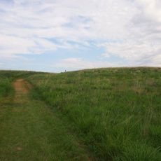
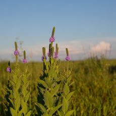
Norman County is an administrative area in northwestern Minnesota featuring rolling hills, lakes, and wetland regions that define its terrain. Rivers and waterways flow through the landscape, shaping both its geography and how the land is used.

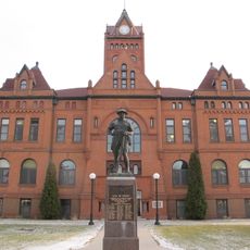
The Minnesota legislature established this county in 1881 and chose Ada as its administrative center, even though the location lay outside the geographic middle. This decision shaped how the county developed and organized itself.

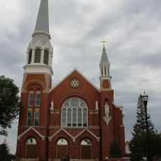
People here trace their roots back to Norwegian families, a heritage visible in local names and community traditions. This connection shapes how neighbors interact and celebrate together throughout the year.

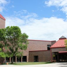
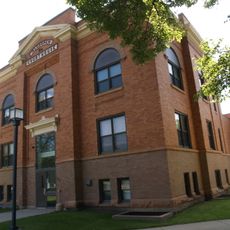
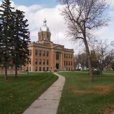
The county seat in Ada handles core services like property taxes, elections, and public health support for residents. Most administrative offices are located there, making it the main hub for official matters.

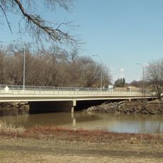
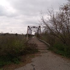
Two rivers, the Wild Rice and the Marsh, flow through the landscape and create a natural drainage system that has long supported farming. These waterways remain central to how the land functions today.

The community of curious travelers

AroundUs brings together thousands of curated places, local tips, and hidden gems, enriched daily by 60,000 contributors worldwide.

Start exploring
Location
Inception
November 8, 1881
Capital city
Ada
Shares border with
Polk County, Clay County, Mahnomen County, Becker County, Cass County, Traill County
GPS coordinates
47.33000,-96.46000
Latest update
December 8, 2025 13:43
Around this place
Fargodome
United States of America

Fargodome

54.1 km
Fargo Theatre
United States of America

Fargo Theatre

56 km
Buffalo River State Park
United States of America

Buffalo River State Park

51.8 km
Fargo Air Museum
United States of America

Fargo Air Museum

53.9 km
Fargo-Moorhead Toll Bridge
United States of America

Fargo-Moorhead Toll Bridge

54.5 km
Cathedral of St. Mary
United States of America

Cathedral of St. Mary

55.7 km
Glacial Ridge National Wildlife Refuge
United States of America

Glacial Ridge National Wildlife Refuge

42 km
Cathedral of the Immaculate Conception
United States of America

Cathedral of the Immaculate Conception

50.5 km
Rourke Art Museum
United States of America

Rourke Art Museum

56 km
North Dakota State University District
United States of America

North Dakota State University District

55.1 km
St. John the Divine Episcopal Church
United States of America

St. John the Divine Episcopal Church

56 km
Church of St. Peter-Catholic
United States of America

Church of St. Peter-Catholic

51.5 km
Zion Lutheran Church
United States of America

Zion Lutheran Church

28.5 km
James Holes House
United States of America

James Holes House

54.7 km
Great Northern Freight Warehouse
United States of America

Great Northern Freight Warehouse

55.9 km
Congregational Church of Ada
United States of America

Congregational Church of Ada

5.3 km
Mahnomen County Courthouse
United States of America

Mahnomen County Courthouse

37 km
Norman County Courthouse
United States of America

Norman County Courthouse

5.3 km
Caledonia Bridge
United States of America

Caledonia Bridge

35 km
Traill County Courthouse
United States of America

Traill County Courthouse

46.2 km
Sunset Lanes
United States of America

Sunset Lanes

54.3 km
Amos and Lillie Plummer House
United States of America

Amos and Lillie Plummer House

46.4 km
Fargo Oak Grove Residential Historic District
United States of America

Fargo Oak Grove Residential Historic District

55.2 km
Red River Lanes
United States of America

Red River Lanes

52.7 km
Buffalo River State Park WPA/Rustic Style Historic Resources
United States of America

Buffalo River State Park WPA/Rustic Style Historic Resources

51.9 km
The Rourke Art Gallery + Museum
United States of America

The Rourke Art Gallery + Museum

56 km
Riverfront Park
United States of America

Riverfront Park

55.5 km
John Olness House
United States of America

John Olness House

43.7 km
Show the full map
« Norman County - Administrative county in northwestern Minnesota, United States » is provided by Around Us (aroundus.com). Images and texts are derived from Wikimedia project under a Creative Commons license. You are allowed to copy, distribute, and modify copies of this page, under the conditions set by the license, as long as this note is clearly visible.

Discover hidden gems everywhere you go!

From secret cafés to breathtaking viewpoints, skip the crowded tourist spots and find places that match your style. Our app makes it easy with voice search, smart filtering, route optimization, and insider tips from travelers worldwide. Download now for the complete mobile experience.

Around Us App Screenshot

A unique approach to discovering new places

Le Figaro

All the places worth exploring

France Info

A tailor-made excursion in just a few clicks

20 Minutes

Around Us
Travel Guide & Maps
Download

Send to your phone

QR Code
1

Open the camera app on your mobile.

2

Point at the QR code with your camera. A notification will appear.

3

Tap the notification to open the link.