Texas County, County in southern Missouri, United States.
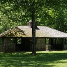
Texas County is an administrative unit in southern Missouri, covering much of the Ozark Highland region. The territory includes forested hills, winding rivers and scattered small towns that sit among the woodlands.
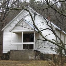
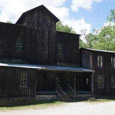
The territory was organized in 1843 as Ashley County, then renamed two years later to honor the Republic of Texas. Settlement by farmers and loggers shaped the region throughout the second half of the nineteenth century.
The area southwest of Houston remains rural farmland and forest, as settlers have worked the land for generations. Ranching families and timber operations still shape the local way of life in this corner of the Ozarks.
The main administrative office is in Houston, where visitors can reach public services during weekdays. Much of the territory is rural and spread out, so having a vehicle is useful for exploring the wider region.
This county covers more land than the entire state of Rhode Island. Despite its size, fewer people live here than in many single neighborhoods of larger American cities.
Location: Missouri
Inception: 1845
Capital city: Houston
Shares border with: Pulaski County, Phelps County, Dent County, Shannon County, Howell County, Douglas County, Wright County, Laclede County
Website: http://texascountymissouri.org
GPS coordinates: 37.32000,-91.96000
Latest update: December 15, 2025 05:31
Paddy Creek Wilderness
24.5 kmBates-Geers House
28.7 kmHouston High School
959 mAdministration Building, Missouri State Fruit Experiment Station
32.6 kmMountain Grove City Hall
34.1 kmArthur W. and Chloe B. Cole House
9.1 kmHouston Ranger Station Historic District
377 mMountain Grove Bandstand
34.2 km
Pulltite
42.9 km
Montauk State Park
28.8 km
Montauk State Park Open Shelter
28.1 km
Lower Parker School
32.6 kmBell Bluff
10 kmChimney Rock
34.4 km
Old Mill at Montauk State Park
28.4 kmRed Bluff
44 kmWhite Rock Bluff
4.2 kmNarrow Gap Bluff
18.3 kmBee Bluff
45.3 kmRandel-Hinkle Municipal Golf Course
35.9 kmOakwood Golf Club
3.8 kmDevil's Backbone
36.1 kmScenic viewpoint
26.3 kmScenic viewpoint
41.8 kmScenic viewpoint
27.3 kmScenic viewpoint
27.4 kmWaterfall
27.6 kmWaterfall
27.5 kmVisited this place? Tap the stars to rate it and share your experience / photos with the community! Try now! You can cancel it anytime.
Discover hidden gems everywhere you go!
From secret cafés to breathtaking viewpoints, skip the crowded tourist spots and find places that match your style. Our app makes it easy with voice search, smart filtering, route optimization, and insider tips from travelers worldwide. Download now for the complete mobile experience.
A unique approach to discovering new places❞
— Le Figaro
All the places worth exploring❞
— France Info
A tailor-made excursion in just a few clicks❞
— 20 Minutes