Enable Location

We need your location to show you interesting places around you

Discover nearby places

Find interesting locations and hidden gems around you

Precise directions

Get accurate directions and distances to places

Your location is never shared with other users. It's only used when you tap the location button.

Montauk State Park

Log in to your account

Start exploring — it's free

Trusted by 61,324 travelers worldwide

Continue with Google
Continue with Apple
or

We will send you a code to connect

By continuing, you accept our Terms and Conditions and our Privacy Policy

Check your inbox

We've sent a pincode in your inbox. Please enter the code below.

Montauk State Park

Montauk State Park, State park at Current River headwaters, Missouri, US.

Description

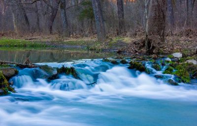
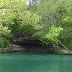
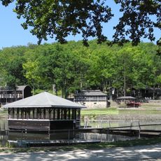
Montauk State Park is a large protected area at the headwaters of the Current River in Missouri. The park covers about 3,000 acres and is fed by several natural springs that pour water into the river daily.

History

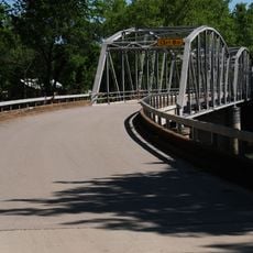
The area became a protected state park in 1926 to preserve its natural springs and river. During the 1930s, the Civilian Conservation Corps built a dam, spillway, and other structures to manage the water and support the park.

Culture

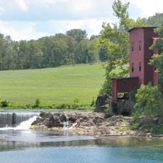
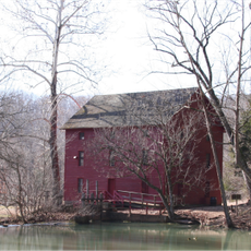
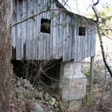
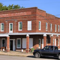
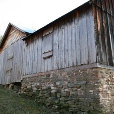
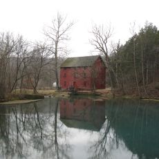
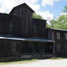
The old mill from 1896 shows how people once ground grain using spring water from this area. You can observe the traditional milling techniques that were part of daily life in the Ozarks.

Practical

The park has fishing areas along the Current River where you can catch rainbow and brown trout. There are designated zones with good trails and riverside access that are easiest to visit during warmer months.

Did you know?

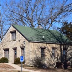
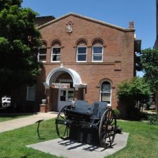
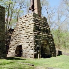
Three historic buildings at the park, including the old dam and spillway, were added to the National Register in 1985. These early structures remain visible today and show how water was managed decades ago.

Location
Inception
1926
GPS coordinates
37.45310,-91.68030
Latest update
December 6, 2025 19:03

AroundUs brings together thousands of curated places, local tips, and hidden gems, enriched daily by 60,000 contributors worldwide. Discover all places nearby (Dent County).

Natural wonders and historic sites of Missouri

Missouri offers a mix of geological formations and historic sites that show the natural resources and industrial past of the state. The landscape includes massive granite boulders, deep limestone caves, and clear springs that bubble up from the ground. Parks and conservation areas preserve forests,...

Around this place
Uranus Missouri
United States of America

Uranus Missouri

56.1 km
United States of America

Echo Bluff State Park

28.9 km
Maramec Spring
United States of America

Maramec Spring

57.4 km
United States of America

Marine Corps Detachment, Fort Leonard Wood

50.7 km
Dillard Mill State Historic Site
United States of America

Dillard Mill State Historic Site

51.1 km
Current River State Park
United States of America

Current River State Park

26 km
Roger Pryor Pioneer Backcountry
United States of America

Roger Pryor Pioneer Backcountry

25.9 km
Allgood–Bailey Stadium
United States of America

Allgood–Bailey Stadium

56 km
Fort Wyman
United States of America

Fort Wyman

54.5 km
Old Stagecoach Stop
United States of America

Old Stagecoach Stop

62.1 km
Alley Spring Roller Mill
United States of America

Alley Spring Roller Mill

39.4 km
Rolla Ranger Station Historic District
United States of America

Rolla Ranger Station Historic District

55.4 km
Walter Klepzig Mill and Farm
United States of America

Walter Klepzig Mill and Farm

56.1 km
Dent County Courthouse
United States of America

Dent County Courthouse

24.9 km
Phelps County Courthouse
United States of America

Phelps County Courthouse

55.5 km
Alton Club
United States of America

Alton Club

25.9 km
Hotel Cuba
United States of America

Hotel Cuba

71.8 km
Pulaski County Courthouse
United States of America

Pulaski County Courthouse

62.1 km
St. James Chapel
United States of America

St. James Chapel

60.5 km
Reed Log House
United States of America

Reed Log House

56.3 km
Uptown Cuba Historic District
United States of America

Uptown Cuba Historic District

71.8 km
Alley Spring
United States of America

Alley Spring

39.4 km
Montauk State Park Open Shelter
United States of America

Montauk State Park Open Shelter

739 m
Uranus
United States of America

Uranus

56.2 km
Lower Parker School
United States of America

Lower Parker School

5.3 km
Maramec Iron Works
United States of America

Maramec Iron Works

57.3 km
Old Mill at Montauk State Park
United States of America

Old Mill at Montauk State Park

455 m
Devils Elbow Bridge
United States of America

Devils Elbow Bridge

55.4 km
Show the full map
« Montauk State Park - State park at Current River headwaters, Missouri, US » is provided by Around Us (aroundus.com). Images and texts are derived from Wikimedia project under a Creative Commons license. You are allowed to copy, distribute, and modify copies of this page, under the conditions set by the license, as long as this note is clearly visible.

Discover hidden gems everywhere you go!

From secret cafés to breathtaking viewpoints, skip the crowded tourist spots and find places that match your style. Our app makes it easy with voice search, smart filtering, route optimization, and insider tips from travelers worldwide. Download now for the complete mobile experience.

Around Us App Screenshot

A unique approach to discovering new places

Le Figaro

All the places worth exploring

France Info

A tailor-made excursion in just a few clicks

20 Minutes

Around Us
Travel Guide & Maps
Download

Send to your phone

QR Code
1

Open the camera app on your mobile.

2

Point at the QR code with your camera. A notification will appear.

3

Tap the notification to open the link.