Enable Location

We need your location to show you interesting places around you

Discover nearby places

Find interesting locations and hidden gems around you

Precise directions

Get accurate directions and distances to places

Your location is never shared with other users. It's only used when you tap the location button.

Nobles County

Log in to your account

Start exploring — it's free

Trusted by 61,901 travelers worldwide

Continue with Google
Continue with Apple
or

We will send you a code to connect

By continuing, you accept our Terms and Conditions and our Privacy Policy

Check your inbox

We've sent a pincode in your inbox. Please enter the code below.

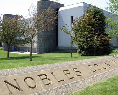
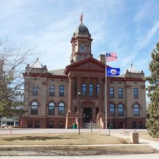
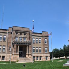
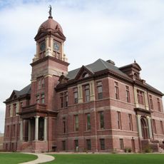
Nobles County, Administrative county in southwestern Minnesota, United States.

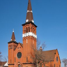
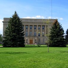
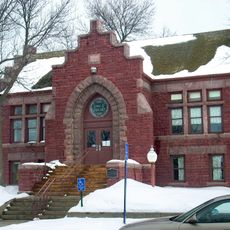
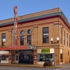
Nobles County is an administrative county in southwestern Minnesota with rolling hills, lakes, and broad agricultural fields. Worthington serves as its county seat and main population center.

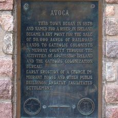
The Minnesota Legislature established this county in 1857, naming it after William H. Nobles, a territorial representative. European settlement transformed the region from native hunting grounds into farmland.

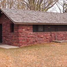
The Sisseton Dakota people originally lived here before European farmers arrived and shaped the land with agriculture. Today, farming communities and small towns define how the landscape looks and feels.

Interstate 90 and U.S. Highway 59 provide main routes through the area. Weather conditions, especially in winter, can affect travel, so plan accordingly when visiting.

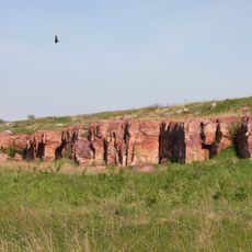
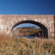
The county sits atop Buffalo Ridge, a natural divide that separates water flowing toward the Mississippi River from water flowing toward the Missouri River. This geological feature still shapes how rainfall moves through the landscape today.

The community of curious travelers

AroundUs brings together thousands of curated places, local tips, and hidden gems, enriched daily by 60,000 contributors worldwide.

Start exploring
Location
Inception
May 23, 1857
Capital city
Worthington
Shares border with
Murray County, Osceola County, Rock County, Lyon County, Jackson County, Cottonwood County
GPS coordinates
43.67000,-95.76000
Latest update
December 7, 2025 20:44
Around this place
West Okoboji Lake
United States of America

West Okoboji Lake

58 km
Blue Mounds State Park
United States of America

Blue Mounds State Park

34.9 km
Lake Shetek State Park
United States of America

Lake Shetek State Park

48.6 km
Split Rock Creek State Park
United States of America

Split Rock Creek State Park

54.8 km
Kilen Woods State Park
United States of America

Kilen Woods State Park

56.5 km
United States of America

Gull Point State Park

58.4 km
George D. Dayton House
United States of America

George D. Dayton House

14.4 km
Carnegie Library
United States of America

Carnegie Library

55.1 km
Church of St. Kilian
United States of America

Church of St. Kilian

15.8 km
Pipestone Water Tower
United States of America

Pipestone Water Tower

57.6 km
Melan Bridge
United States of America

Melan Bridge

41.4 km
Cottonwood County Courthouse
United States of America

Cottonwood County Courthouse

56.1 km
Osceola County Courthouse
United States of America

Osceola County Courthouse

29.9 km
Church of St. Adrian-Catholic
United States of America

Church of St. Adrian-Catholic

14.5 km
Pipestone County Courthouse
United States of America

Pipestone County Courthouse

57.7 km
Lyon County Courthouse
United States of America

Lyon County Courthouse

42.3 km
Holy Trinity Church-Episcopal
United States of America

Holy Trinity Church-Episcopal

36.4 km
John Rowe House
United States of America

John Rowe House

54.9 km
Sacred Heart Catholic Church
United States of America

Sacred Heart Catholic Church

38.2 km
Pipestone Public Library
United States of America

Pipestone Public Library

57.8 km
Blue Mounds State Park WPA/Rustic Style Historic Resources
United States of America

Blue Mounds State Park WPA/Rustic Style Historic Resources

34.7 km
Pearson Lakes Art Center
United States of America

Pearson Lakes Art Center

59.4 km
Winnewissa Falls
United States of America

Winnewissa Falls

59.2 km
Avoca Historical Marker
United States of America

Avoca Historical Marker

32.3 km
Palace Theatre
United States of America

Palace Theatre

36.2 km
Split Rock Bridge
United States of America

Split Rock Bridge

54.7 km
Lake Shetek State Park WPA/Rustic Style Group Camp
United States of America

Lake Shetek State Park WPA/Rustic Style Group Camp

49.1 km
Lake Shetek State Park WPA/Rustic Style Historic District
United States of America

Lake Shetek State Park WPA/Rustic Style Historic District

48.6 km
Show the full map
« Nobles County - Administrative county in southwestern Minnesota, United States » is provided by Around Us (aroundus.com). Images and texts are derived from Wikimedia project under a Creative Commons license. You are allowed to copy, distribute, and modify copies of this page, under the conditions set by the license, as long as this note is clearly visible.

Discover hidden gems everywhere you go!

From secret cafés to breathtaking viewpoints, skip the crowded tourist spots and find places that match your style. Our app makes it easy with voice search, smart filtering, route optimization, and insider tips from travelers worldwide. Download now for the complete mobile experience.

Around Us App Screenshot

A unique approach to discovering new places

Le Figaro

All the places worth exploring

France Info

A tailor-made excursion in just a few clicks

20 Minutes

Around Us
Travel Guide & Maps
Download

Send to your phone

QR Code
1

Open the camera app on your mobile.

2

Point at the QR code with your camera. A notification will appear.

3

Tap the notification to open the link.