Enable Location

We need your location to show you interesting places around you

Discover nearby places

Find interesting locations and hidden gems around you

Precise directions

Get accurate directions and distances to places

Your location is never shared with other users. It's only used when you tap the location button.

Putnam County

Log in to your account

Start exploring — it's free

Trusted by 62,504 travelers worldwide

Continue with Google
Continue with Apple
or

We will send you a code to connect

By continuing, you accept our Terms and Conditions and our Privacy Policy

Check your inbox

We've sent a pincode in your inbox. Please enter the code below.

Putnam County, County division in West Virginia, United States

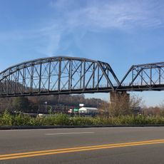
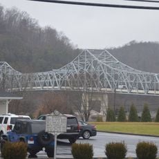
Putnam County is an administrative division in West Virginia centered on Winfield, which sits along the Kanawha River. The county encompasses a varied landscape with communities spread across its territory.

The county was founded on March 11, 1818, and was originally part of Virginia. During the Civil War, the region became part of the newly formed state of West Virginia in 1863.

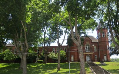
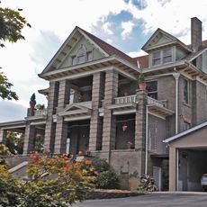
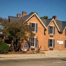
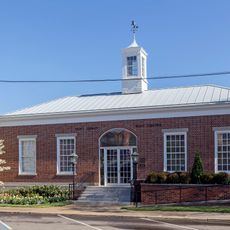
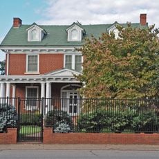
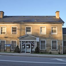
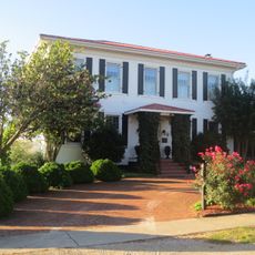
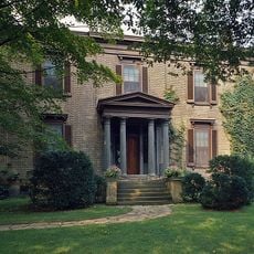
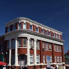
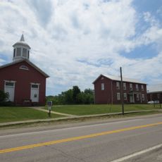
The Putnam County Courthouse and James W. Hoge House reflect local building traditions from earlier periods. These structures still shape the appearance of the county seat today.

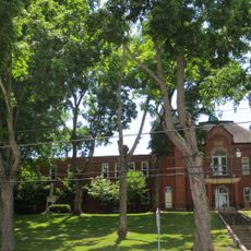
The county operates a public school system with facilities at different levels, mainly located in Winfield and surrounding areas. Visitors will find typical services of a rural region, with road access along the Kanawha River corridor.

Winfield, the county seat, was named after General Winfield Scott and began taking shape in 1818 with a ferry operation. The name honors a prominent military leader who played significant roles during multiple American conflicts.

The community of curious travelers

AroundUs brings together thousands of curated places, local tips, and hidden gems, enriched daily by 60,000 contributors worldwide.

Start exploring
Location
Inception
March 11, 1818
Capital city
Winfield
Elevation above the sea
269 m
Shares border with
Mason County, Lincoln County, Cabell County, Kanawha County, Jackson County
GPS coordinates
38.51000,-81.91000
Latest update
December 7, 2025 19:25
Around this place
Criel Mound
United States of America

Criel Mound

24.4 km
United States of America

Mardi Gras Casino and Resort

13.2 km
Gen. John McCausland House
United States of America

Gen. John McCausland House

17.2 km
Mud River Covered Bridge
United States of America

Mud River Covered Bridge

21.9 km
Edgewood Historic District
United States of America

Edgewood Historic District

28 km
Canty House
United States of America

Canty House

19.1 km
Chilton House
United States of America

Chilton House

15 km
Charleston Railroad Bridge‎
United States of America

Charleston Railroad Bridge‎

27.1 km
Fort Scammon
United States of America

Fort Scammon

28.3 km
William E. Mohler House
United States of America

William E. Mohler House

15.3 km
Dutch Hollow Wine Cellars
United States of America

Dutch Hollow Wine Cellars

21.3 km
Putnam County Courthouse
United States of America

Putnam County Courthouse

3.1 km
St. Albans Post Office
United States of America

St. Albans Post Office

15.2 km
The Beeches
United States of America

The Beeches

15.9 km
East Hall
United States of America

East Hall

19.1 km
Luna Park Historic District
United States of America

Luna Park Historic District

27.8 km
St. Albans Main Street Historic District
United States of America

St. Albans Main Street Historic District

15.2 km
Breezemont
United States of America

Breezemont

28.8 km
James W. Hoge House
United States of America

James W. Hoge House

3.1 km
Littlepage Stone Mansion
United States of America

Littlepage Stone Mansion

26 km
Asbury House
United States of America

Asbury House

12.7 km
Laidley-Summers-Quarrier House
United States of America

Laidley-Summers-Quarrier House

27.6 km
Bank of St. Albans Building
United States of America

Bank of St. Albans Building

15.1 km
Winfield Toll Bridge
United States of America

Winfield Toll Bridge

2.9 km
James Weimer House
United States of America

James Weimer House

15.5 km
Buffalo Town Square Historic District
United States of America

Buffalo Town Square Historic District

13.5 km
Shoney's Big Boy Museum
United States of America

Shoney's Big Boy Museum

26.6 km
Lee Street Bridge
United States of America

Lee Street Bridge

28.9 km
Show the full map
« Putnam County - County division in West Virginia, United States » is provided by Around Us (aroundus.com). Images and texts are derived from Wikimedia project under a Creative Commons license. You are allowed to copy, distribute, and modify copies of this page, under the conditions set by the license, as long as this note is clearly visible.

Discover hidden gems everywhere you go!

From secret cafés to breathtaking viewpoints, skip the crowded tourist spots and find places that match your style. Our app makes it easy with voice search, smart filtering, route optimization, and insider tips from travelers worldwide. Download now for the complete mobile experience.

Around Us App Screenshot

A unique approach to discovering new places

Le Figaro

All the places worth exploring

France Info

A tailor-made excursion in just a few clicks

20 Minutes

Around Us
Travel Guide & Maps
Download

Send to your phone

QR Code
1

Open the camera app on your mobile.

2

Point at the QR code with your camera. A notification will appear.

3

Tap the notification to open the link.