Grainger County

Log in to your account

AroundUs is a community-driven map of interesting places, built by curious explorers like you. It grows with every review, story, and photo you share.
Connect to save your favorite spots, contribute locations, and create personalized routes.
Continue with Google
Continue with Apple
Continue with X
Continue with Facebook
Continue with email
By continuing, you accept our Terms and Conditions and our Privacy Policy
Create an account
Add to collection
Map
Suggest a change
Share

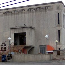
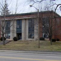
Grainger County, Administrative county in eastern Tennessee, United States

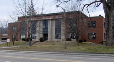
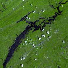
Grainger County is an administrative county in eastern Tennessee situated at the foothills of the Great Smoky Mountains. It contains three cities: Bean Station, Blaine, and Rutledge, while Cherokee Lake forms its natural boundary.

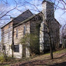
Formed in 1796, this county holds the singular distinction among Tennessee counties of being named after a woman, Mary Grainger Blount. She was the wife of William Blount, who helped shape the region's early development.

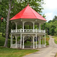
The tomato festival each summer brings together local farmers and residents to celebrate their agricultural roots. This event shows how farming remains central to how people here see themselves and their community.

Voting takes place across several polling locations throughout the county. Early voting is available during set periods and should be planned ahead of time.

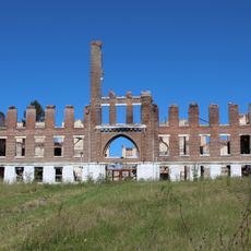
Cherokee Lake was created in the 1940s by the Tennessee Valley Authority, which required Bean Station and many families to relocate. This reshaping of the landscape became a defining moment in the county's modern history.

Location: Tennessee

Inception: April 22, 1796

Capital city: Rutledge

Shares border with: Hancock County, Hawkins County, Hamblen County, Jefferson County, Knox County, Union County, Claiborne County

Website: http://graingertn.com

GPS coordinates: 36.28000,-83.51000

Latest update: December 7, 2025 10:06

Photos
Around this place
Cherokee Lake
United States of America

Cherokee Lake

9.9 km
Morristown College
United States of America

Morristown College

20.6 km
Panther Creek State Park
United States of America

Panther Creek State Park

11.9 km
Crockett Tavern Museum
United States of America

Crockett Tavern Museum

22.7 km
United States of America

Morristown Main Street Historic District

20.8 km
Tate Springs Springhouse
United States of America

Tate Springs Springhouse

16.1 km
Rose Center
United States of America

Rose Center

20.4 km
Bethesda Presbyterian Church
United States of America

Bethesda Presbyterian Church

25.6 km
Burke–Tarr Stadium
United States of America

Burke–Tarr Stadium

17.7 km
Hamblen County Courthouse
United States of America

Hamblen County Courthouse

20.4 km
Henderson Chapel African Methodist Episcopal Zion Church
United States of America

Henderson Chapel African Methodist Episcopal Zion Church

594 m
Glenmore
United States of America

Glenmore

17.1 km
New Market Presbyterian Church
United States of America

New Market Presbyterian Church

20.4 km
Lawson D. Franklin House
United States of America

Lawson D. Franklin House

31 km
James Weir House
United States of America

James Weir House

20 km
Squirewood Hall
United States of America

Squirewood Hall

30.5 km
Richland
United States of America

Richland

19.8 km
Graham-Kivett House
United States of America

Graham-Kivett House

19.9 km
William Cocke House
United States of America

William Cocke House

5.4 km
Lea Springs
United States of America

Lea Springs

19.1 km
Branner-Hicks House
United States of America

Branner-Hicks House

17.3 km
St. Paul Presbyterian Church
United States of America

St. Paul Presbyterian Church

28.7 km
Fairvue
United States of America

Fairvue

16 km
Poplar Hill
United States of America

Poplar Hill

19.3 km
Kesterson-Watkins House
United States of America

Kesterson-Watkins House

23.8 km
Crockett Tavern Museum
United States of America

Crockett Tavern Museum

22.7 km
Glenmore Mansion
United States of America

Glenmore Mansion

17.1 km
Union County Courthouse
United States of America

Union County Courthouse

26.1 km
Show the full map
Reviews

Visited this place? Tap the stars to rate it and share your experience / photos with the community! Try now! You can cancel it anytime.

Administrative divisions
« Grainger County - Administrative county in eastern Tennessee, United States » is provided by Around Us (aroundus.com). Images and texts are derived from Wikimedia project under a Creative Commons license. You are allowed to copy, distribute, and modify copies of this page, under the conditions set by the license, as long as this note is clearly visible.

Discover hidden gems everywhere you go!

From secret cafés to breathtaking viewpoints, skip the crowded tourist spots and find places that match your style. Our app makes it easy with voice search, smart filtering, route optimization, and insider tips from travelers worldwide. Download now for the complete mobile experience.

Around Us App Screenshot

A unique approach to discovering new places

Le Figaro

All the places worth exploring

France Info

A tailor-made excursion in just a few clicks

20 Minutes