Enable Location

We need your location to show you interesting places around you

Discover nearby places

Find interesting locations and hidden gems around you

Precise directions

Get accurate directions and distances to places

Your location is never shared with other users. It's only used when you tap the location button.

Chesterfield County

Log in to your account

Start exploring — it's free

Trusted by travelers worldwide

Continue with Google
Continue with Apple
or

We will send you a code to connect

By continuing, you accept our Terms and Conditions and our Privacy Policy

Check your inbox

We've sent a pincode in your inbox. Please enter the code below.

Chesterfield County, Administrative county in South Carolina.

Description

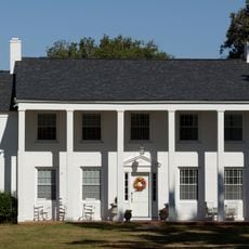
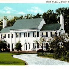
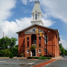
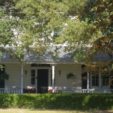
Chesterfield County is an administrative county in South Carolina, situated between Charlotte and Columbia. The area contains protected wildlife areas and several residential communities spread throughout the region.

History

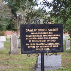
The county was established in 1798 and named after Philip Stanhope, 4th Earl of Chesterfield, a British figure who opposed the Stamp Act. This choice honored someone who had criticized American taxation policies.

Culture

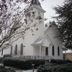
Early settlers from England, Wales, and Northern Ireland brought their Presbyterian traditions, which shaped how communities organized themselves and worshipped for generations.

Practical

The county offers residents online services for tax payments, vehicle registration, and access to geographic information systems. These resources help visitors and residents handle administrative tasks from home.

Did you know?

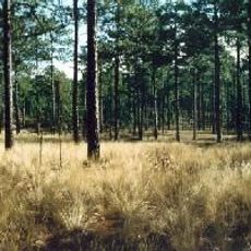
The Carolina Sandhills National Wildlife Refuge within the county protects local plant and animal species in their natural habitat. This area shelters many rare and native species adapted to the special conditions of sandhills ecosystems.

Location
Inception
1798
Capital city
Chesterfield
Shares border with
Anson County, Richmond County, Marlboro County, Darlington County, Lee County, Kershaw County, Lancaster County, Union County
GPS coordinates
34.64000,-80.16000
Latest update
December 7, 2025 19:25

AroundUs brings together thousands of curated places, local tips, and hidden gems, enriched daily by 60,000 contributors worldwide. Discover all places nearby (South Carolina).

Around this place
Carolina Sandhills National Wildlife Refuge
United States of America

Carolina Sandhills National Wildlife Refuge

9.2 km
St. David's Episcopal Church and Cemetery
United States of America

St. David's Episcopal Church and Cemetery

26.4 km
Coker Experimental Farms
United States of America

Coker Experimental Farms

32.2 km
Pegues Place
United States of America

Pegues Place

29 km
Center Theater
United States of America

Center Theater

30.5 km
United States of America

Jeffries Creek

38.8 km
Robert Smalls School
United States of America

Robert Smalls School

26.2 km
Hartsville Post Office
United States of America

Hartsville Post Office

30.4 km
A.M. McNair House
United States of America

A.M. McNair House

30.4 km
Robert R. Coker House
United States of America

Robert R. Coker House

30.8 km
Cheraw Historic District
United States of America

Cheraw Historic District

25.7 km
James L. Coker III House
United States of America

James L. Coker III House

30.6 km
Hartsville Armory
United States of America

Hartsville Armory

30.9 km
Memorial Hall
United States of America

Memorial Hall

30.4 km
East Main Street Historic District (Chesterfield, South Carolina)
United States of America

East Main Street Historic District (Chesterfield, South Carolina)

12.8 km
E. W. Cannon House and Store
United States of America

E. W. Cannon House and Store

30.6 km
J.B. Gilbert House
United States of America

J.B. Gilbert House

30 km
Thomas E. Hart House
United States of America

Thomas E. Hart House

30.7 km
Lawton Park and Pavilion
United States of America

Lawton Park and Pavilion

29.7 km
West Main Street Historic District (Chesterfield, South Carolina)
United States of America

West Main Street Historic District (Chesterfield, South Carolina)

12.3 km
Wade Hampton Hicks House
United States of America

Wade Hampton Hicks House

30.5 km
Paul H. Rogers House
United States of America

Paul H. Rogers House

30.6 km
John L. Hart House
United States of America

John L. Hart House

30.4 km
Davidson Hall, Coker College
United States of America

Davidson Hall, Coker College

30.4 km
Dr. Thomas E. Lucas House
United States of America

Dr. Thomas E. Lucas House

12.4 km
East Home Avenue Historic District
United States of America

East Home Avenue Historic District

30.2 km
Seaboard Air Line Railway Depot in McBee
United States of America

Seaboard Air Line Railway Depot in McBee

21 km
McBee Presbyterian Church
United States of America

McBee Presbyterian Church

21.1 km
Show the full map
Administrative divisions
« Chesterfield County - Administrative county in South Carolina » is provided by Around Us (aroundus.com). Images and texts are derived from Wikimedia project under a Creative Commons license. You are allowed to copy, distribute, and modify copies of this page, under the conditions set by the license, as long as this note is clearly visible.

Discover hidden gems everywhere you go!

From secret cafés to breathtaking viewpoints, skip the crowded tourist spots and find places that match your style. Our app makes it easy with voice search, smart filtering, route optimization, and insider tips from travelers worldwide. Download now for the complete mobile experience.

Around Us App Screenshot

A unique approach to discovering new places

Le Figaro

All the places worth exploring

France Info

A tailor-made excursion in just a few clicks

20 Minutes

Around Us
Travel Guide & Maps
Download

Send to your phone

QR Code
1

Open the camera app on your mobile.

2

Point at the QR code with your camera. A notification will appear.

3

Tap the notification to open the link.