Enable Location

We need your location to show you interesting places around you

Discover nearby places

Find interesting locations and hidden gems around you

Precise directions

Get accurate directions and distances to places

Your location is never shared with other users. It's only used when you tap the location button.

Fulton County

Log in to your account

Start exploring — it's free

Trusted by 61,688 travelers worldwide

Continue with Google
Continue with Apple
or

We will send you a code to connect

By continuing, you accept our Terms and Conditions and our Privacy Policy

Check your inbox

We've sent a pincode in your inbox. Please enter the code below.

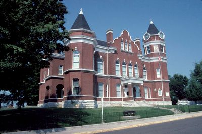
Fulton County, Administrative division in western Kentucky, United States.

Description

Fulton County is an administrative division in western Kentucky where the Mississippi River forms the western boundary and Hickman serves as the county seat. The land encompasses farmland and includes Kentucky Bend, a distinctive geographic formation that extends into a separate territory.

History

Established in 1845 from neighboring Hickman County, the area received its name from Robert Fulton, the inventor of commercial steamboat operations. This naming reflects the importance of river commerce in the region's early development.

Culture

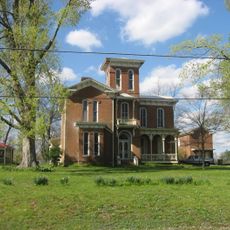
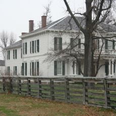
Agriculture shapes daily life here, with corn and soybean fields visible across the landscape and farming practices that have defined the community for generations.

Practical

Kentucky Bend can only be reached by traveling through Tennessee due to its geographic position and surveying history. Keep this in mind when planning routes through the area.

Did you know?

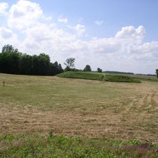
This area marks Kentucky's lowest elevation point and was shaped by early surveying mistakes into a geographic puzzle. The surveying errors created an unusual situation where one section is only accessible from outside the county.

Location
Inception
January 15, 1845
Capital city
Hickman
Shares border with
Lake County, Mississippi County, Hickman County, Obion County, New Madrid County
GPS coordinates
36.55000,-89.19000
Latest update
December 23, 2025 17:21

AroundUs brings together thousands of curated places, local tips, and hidden gems, enriched daily by 60,000 contributors worldwide. Discover all places nearby (Kentucky).

Around this place
United States of America

Discovery Park of America

16.4 km
Big Oak Tree State Park
United States of America

Big Oak Tree State Park

17 km
Towosahgy State Historic Site
United States of America

Towosahgy State Historic Site

16.5 km
United States of America

Reelfoot National Wildlife Refuge

14.8 km
Confederate Memorial in Fulton
United States of America

Confederate Memorial in Fulton

28 km
Confederate Memorial Gateway in Hickman
United States of America

Confederate Memorial Gateway in Hickman

1.4 km
Thomas Chapel C.M.E. Church
United States of America

Thomas Chapel C.M.E. Church

2.4 km
United States of America

White Site

10.6 km
Jesse Whitesell House and Farm
United States of America

Jesse Whitesell House and Farm

26.3 km
Carnegie Library
United States of America

Carnegie Library

2.4 km
W.W. Morris House
United States of America

W.W. Morris House

27.8 km
United States of America

Old Hickman Historic District

2.5 km
Hunter-Dawson State Historic Site
United States of America

Hunter-Dawson State Historic Site

30.3 km
United States of America

Orpheum Theatre

28.1 km
United States of America

Reelfoot National Wildlife Refuge

12.3 km
United States of America

Ritz Theatre

2.6 km
United States of America

Chalk Bluff

20.6 km
United States of America

Reelfoot Indian Creek Number Ten Lake

6.4 km
United States of America

Fulton Country Club

31 km
United States of America

Three Ponds Bluff

14.4 km
United States of America

Hickman Country Club

2.7 km
United States of America

Discovery Park of America

16.4 km
United States of America

The Settlement

16.3 km
United States of America

Mill Ridge

16.3 km
United States of America

S.T.E.M. Landing

16.4 km
United States of America

The Maze

16.4 km
United States of America

Davy Crockett

16.3 km
United States of America

Ronald Reagan

16.5 km
Show the full map
« Fulton County - Administrative division in western Kentucky, United States » is provided by Around Us (aroundus.com). Images and texts are derived from Wikimedia project under a Creative Commons license. You are allowed to copy, distribute, and modify copies of this page, under the conditions set by the license, as long as this note is clearly visible.

Discover hidden gems everywhere you go!

From secret cafés to breathtaking viewpoints, skip the crowded tourist spots and find places that match your style. Our app makes it easy with voice search, smart filtering, route optimization, and insider tips from travelers worldwide. Download now for the complete mobile experience.

Around Us App Screenshot

A unique approach to discovering new places

Le Figaro

All the places worth exploring

France Info

A tailor-made excursion in just a few clicks

20 Minutes

Around Us
Travel Guide & Maps
Download

Send to your phone

QR Code
1

Open the camera app on your mobile.

2

Point at the QR code with your camera. A notification will appear.

3

Tap the notification to open the link.