Enable Location

We need your location to show you interesting places around you

Discover nearby places

Find interesting locations and hidden gems around you

Precise directions

Get accurate directions and distances to places

Your location is never shared with other users. It's only used when you tap the location button.

Livingston County

Log in to your account

Start exploring — it's free

Trusted by 62,839 travelers worldwide

Continue with Google
Continue with Apple
or

We will send you a code to connect

By continuing, you accept our Terms and Conditions and our Privacy Policy

Check your inbox

We've sent a pincode in your inbox. Please enter the code below.

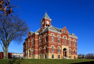
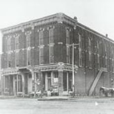
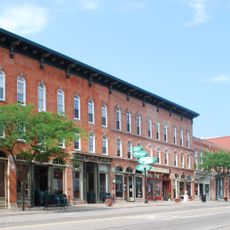
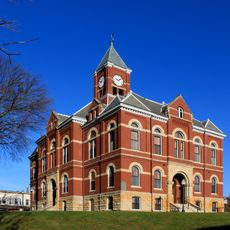
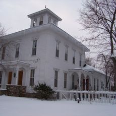
Livingston County, County administration center in Howell, Michigan, US

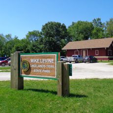
Livingston County is a county in southeastern Michigan that combines urban neighborhoods with rural farmland and natural areas. The region includes residential communities, forests, and water bodies that form the backbone of the local landscape.

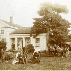
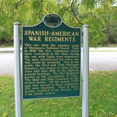
The area was established as a county in 1833 and named after Edward Livingston, who served in President Andrew Jackson's government. This early founding made it part of Michigan's development during the period of westward expansion.

Local residents participate in food drives and community support programs through the Livingston County Law Enforcement's annual collection initiatives.

The area is connected by three main highways – I-96, US 23, and M-59 – to nearby major cities. These routes make it easy for daily commuting and traveling to other regional centers.

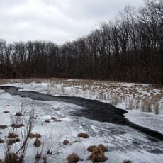
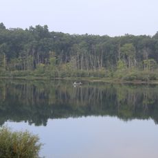
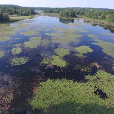
The Brighton Recreation Area within the county borders incorporates 4,947 acres of woods, lakes, and trails for outdoor activities.

The community of curious travelers

AroundUs brings together thousands of curated places, local tips, and hidden gems, enriched daily by 60,000 contributors worldwide.

Start exploring
Location
Inception
1833
Capital city
Howell
Shares border with
Genesee County, Washtenaw County, Oakland County, Jackson County, Ingham County, Shiawassee County
GPS coordinates
42.60000,-83.91000
Latest update
December 19, 2025 22:22
Around this place
Pinckney State Recreation Area
United States of America

Pinckney State Recreation Area

20 km
Brighton Recreation Area
United States of America

Brighton Recreation Area

11.3 km
Mike Levine Lakelands Trail State Park
United States of America

Mike Levine Lakelands Trail State Park

16.8 km
Huron Meadows Metropark
United States of America

Huron Meadows Metropark

17.1 km
Howell Opera House
United States of America

Howell Opera House

1.8 km
Howell Downtown Historic District
United States of America

Howell Downtown Historic District

1.9 km
St. Augustine Catholic Church and Cemetery
United States of America

St. Augustine Catholic Church and Cemetery

13.8 km
Livingston County Courthouse
United States of America

Livingston County Courthouse

1.7 km
Nathan B. Devereaux Octagon House
United States of America

Nathan B. Devereaux Octagon House

25.7 km
Western House
United States of America

Western House

12.9 km
Bingham House
United States of America

Bingham House

21.8 km
Timothy and Lucretia Jones Warner Homestead
United States of America

Timothy and Lucretia Jones Warner Homestead

17.1 km
Frank J. Hecox House
United States of America

Frank J. Hecox House

7.1 km
Alonzo W. Olds House
United States of America

Alonzo W. Olds House

23.6 km
William K. and Nellie Sexton House
United States of America

William K. and Nellie Sexton House

2.1 km
August Westphal Farmstead
United States of America

August Westphal Farmstead

10.7 km
John H. and Martha Durfee Galloway House
United States of America

John H. and Martha Durfee Galloway House

1.7 km
George Louk Farm
United States of America

George Louk Farm

2.2 km
United States of America

Island Lake Recreation Area

19.4 km
Chilson Impoundment
United States of America

Chilson Impoundment

10.3 km
United States of America

Southern Michigan State Forest Nursery

11.1 km
United States of America

Unadilla State Wildlife Area

24.9 km
Spanish American War Regiments Historical Marker
United States of America

Spanish American War Regiments Historical Marker

17.6 km
United States of America

The Bluffs

18.5 km
United States of America

Fausett Lake

11.4 km
Pine Creek Ridge Lodge Beach
United States of America

Pine Creek Ridge Lodge Beach

12.4 km
United States of America

Huron Meadows Golf Course

16.3 km
United States of America

MTB Jump

14.5 km
Show the full map
Administrative divisions
« Livingston County - County administration center in Howell, Michigan, US » is provided by Around Us (aroundus.com). Images and texts are derived from Wikimedia project under a Creative Commons license. You are allowed to copy, distribute, and modify copies of this page, under the conditions set by the license, as long as this note is clearly visible.

Discover hidden gems everywhere you go!

From secret cafés to breathtaking viewpoints, skip the crowded tourist spots and find places that match your style. Our app makes it easy with voice search, smart filtering, route optimization, and insider tips from travelers worldwide. Download now for the complete mobile experience.

Around Us App Screenshot

A unique approach to discovering new places

Le Figaro

All the places worth exploring

France Info

A tailor-made excursion in just a few clicks

20 Minutes

Around Us
Travel Guide & Maps
Download

Send to your phone

QR Code
1

Open the camera app on your mobile.

2

Point at the QR code with your camera. A notification will appear.

3

Tap the notification to open the link.