Simpson County

Log in to your account

AroundUs is a community-driven map of interesting places, built by curious explorers like you. It grows with every review, story, and photo you share.
Connect to save your favorite spots, contribute locations, and create personalized routes.
By continuing, you accept our Terms and Conditions and our Privacy Policy
Add to collection
Map
Suggest a change
Share

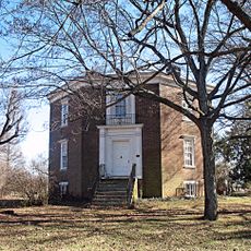
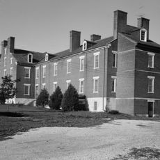
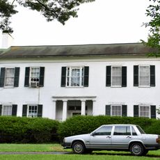
Simpson County, Administrative county in western Kentucky, United States

Simpson County is an administrative region in western Kentucky with Franklin serving as its county seat and main city. The area includes several smaller communities connected by rural roads and local infrastructure.

Kentucky legislators established Simpson County on January 28, 1819, naming it after Captain John Simpson who died during the War of 1812. This founding reflected the early expansion of administrative organization across Kentucky.

Franklin, the county seat, serves as a gathering place where residents meet throughout the year at public spaces and community events. The town gives the county its social and civic character.

The county website at simpsoncounty.us provides administrative services, local information, and practical details for residents and visitors. Franklin's government offices serve as the main point of contact for official information and guidance.

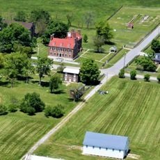
The county has a deep heritage in tobacco farming that shaped its economy and rural character for generations. This agricultural legacy remains visible in how the land is used and the communities are organized.

Location: Kentucky

Inception: January 28, 1819

Capital city: Franklin

Shares border with: Allen County, Logan County, Warren County, Sumner County, Robertson County

Website: http://simpsoncounty.us

GPS coordinates: 36.74000,-86.58000

Latest update: December 10, 2025 15:53

Photos
Around this place
Lost River Cave
United States of America

Lost River Cave

25.6 km
E. A. Diddle Arena
United States of America

E. A. Diddle Arena

29.5 km
Octagon Hall
United States of America

Octagon Hall

7.8 km
Red River Meeting House
United States of America

Red River Meeting House

21 km
Shaker Museum at South Union
United States of America

Shaker Museum at South Union

17.1 km
Henry Hardin Cherry Hall
United States of America

Henry Hardin Cherry Hall

29.8 km
Van Meter Hall
United States of America

Van Meter Hall

30 km
Western Kentucky University Heating Plant
United States of America

Western Kentucky University Heating Plant

29.7 km
South Union Shaker Center House and Preservatory
United States of America

South Union Shaker Center House and Preservatory

17.1 km
Simpson County Courthouse
United States of America

Simpson County Courthouse

2 km
Black Bottom Historic District
United States of America

Black Bottom Historic District

29.3 km
Cornsilk
United States of America

Cornsilk

12.6 km
McCutchen Meadows
United States of America

McCutchen Meadows

17.3 km
Sudley Place
United States of America

Sudley Place

23.6 km
Longview Farm House
United States of America

Longview Farm House

22.5 km
Goodnight House
United States of America

Goodnight House

2.1 km
Hargis House
United States of America

Hargis House

2.1 km
Pleasant Run Methodist Church
United States of America

Pleasant Run Methodist Church

19 km
Rock Jolly
United States of America

Rock Jolly

18.3 km
The Cedars
United States of America

The Cedars

3.1 km
Franklin Downtown Commercial District
United States of America

Franklin Downtown Commercial District

1.9 km
William Randolph House
United States of America

William Randolph House

23.8 km
Moye Boarding House
United States of America

Moye Boarding House

18.5 km
Bowling Green Organizational Maintenance Shop No. 10
United States of America

Bowling Green Organizational Maintenance Shop No. 10

29.4 km
Gordon Wilson Hall
United States of America

Gordon Wilson Hall

29.9 km
Baker Arboretum & Downing Museum
United States of America

Baker Arboretum & Downing Museum

28.8 km
South Union Shaker Village
United States of America

South Union Shaker Village

17 km
Lickskillet Bridge
United States of America

Lickskillet Bridge

17.6 km
Show the full map
Reviews

Visited this place? Tap the stars to rate it and share your experience / photos with the community! Try now! You can cancel it anytime.

Administrative divisions
« Simpson County - Administrative county in western Kentucky, United States » is provided by Around Us (aroundus.com). Images and texts are derived from Wikimedia project under a Creative Commons license. You are allowed to copy, distribute, and modify copies of this page, under the conditions set by the license, as long as this note is clearly visible.

Discover hidden gems everywhere you go!

From secret cafés to breathtaking viewpoints, skip the crowded tourist spots and find places that match your style. Our app makes it easy with voice search, smart filtering, route optimization, and insider tips from travelers worldwide. Download now for the complete mobile experience.

Around Us App Screenshot

A unique approach to discovering new places

Le Figaro

All the places worth exploring

France Info

A tailor-made excursion in just a few clicks

20 Minutes