Enable Location

We need your location to show you interesting places around you

Discover nearby places

Find interesting locations and hidden gems around you

Precise directions

Get accurate directions and distances to places

Your location is never shared with other users. It's only used when you tap the location button.

Wyandot County

Log in to your account

Start exploring — it's free

Trusted by 61,864 travelers worldwide

Continue with Google
Continue with Apple
or

We will send you a code to connect

By continuing, you accept our Terms and Conditions and our Privacy Policy

Check your inbox

We've sent a pincode in your inbox. Please enter the code below.

Wyandot County, Administrative county in northwestern Ohio, United States.

Description

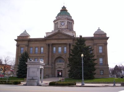
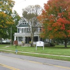
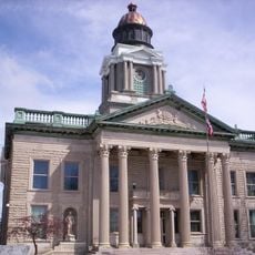
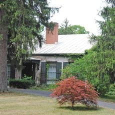
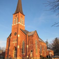
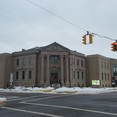
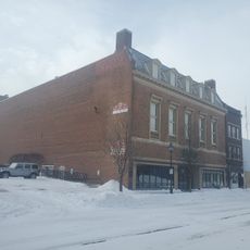
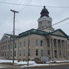
Wyandot County is an administrative county in northwestern Ohio that includes several communities and towns spread across the landscape. Upper Sandusky serves as the county seat and main hub.

History

The county was established in 1845 from portions of neighboring counties to organize the region administratively. This formation shaped how the area developed over the following decades.

Culture

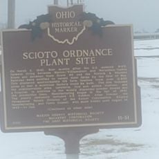
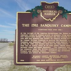
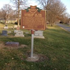
The area takes its name from the Wyandot people who lived here long ago. Their heritage remains part of the region's identity through place names and local stories.

Practical

The county is accessible by car through several state highways that connect its various communities. Visitors can find lodging and basic services in Upper Sandusky and smaller towns throughout the area.

Did you know?

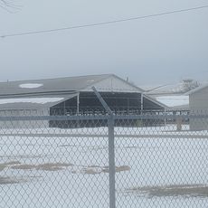
The county is home to a significant solar power installation that supplies renewable energy to the region. This facility demonstrates how the area is adopting cleaner energy solutions.

Location
Inception
February 3, 1845
Capital city
Upper Sandusky
Shares border with
Seneca County, Crawford County, Marion County, Hardin County, Hancock County
GPS coordinates
40.85000,-83.30000
Latest update
December 7, 2025 20:23

AroundUs brings together thousands of curated places, local tips, and hidden gems, enriched daily by 60,000 contributors worldwide. Discover all places nearby (Ohio).

Around this place
Basilica and National Shrine of Our Lady of Consolation
United States of America

Basilica and National Shrine of Our Lady of Consolation

13.4 km
Harding Home
United States of America

Harding Home

33 km
Col. Crawford Burn Site Monument
United States of America

Col. Crawford Burn Site Monument

8.6 km
Palace Theatre
United States of America

Palace Theatre

32.3 km
Old U.S. Post Office
United States of America

Old U.S. Post Office

32.7 km
Veterans Memorial Coliseum
United States of America

Veterans Memorial Coliseum

31.1 km
Crawford County Courthouse
United States of America

Crawford County Courthouse

27.8 km
Parker Covered Bridge
United States of America

Parker Covered Bridge

7.5 km
Swartz Covered Bridge
United States of America

Swartz Covered Bridge

14.1 km
Marion Public Library (Marion, Ohio)
United States of America

Marion Public Library (Marion, Ohio)

33 km
Monnett Memorial M. E. Chapel
United States of America

Monnett Memorial M. E. Chapel

28.5 km
Wyandot County Courthouse and Jail
United States of America

Wyandot County Courthouse and Jail

3 km
Bagby-Hossler House
United States of America

Bagby-Hossler House

29.8 km
North Main-North Detroit Street Historic District
United States of America

North Main-North Detroit Street Historic District

34.2 km
Marion Union Station
United States of America

Marion Union Station

32 km
Marion County Courthouse
United States of America

Marion County Courthouse

32.5 km
Princess Theatre
United States of America

Princess Theatre

32.1 km
The Lincoln Highway
United States of America

The Lincoln Highway

3.7 km
Ohio Theatre
United States of America

Ohio Theatre

32.6 km
Bucyrus Public Library
United States of America

Bucyrus Public Library

27.8 km
Old Sandusky Trail and Shawnee Ford
United States of America

Old Sandusky Trail and Shawnee Ford

30.7 km
State Theatre
United States of America

State Theatre

32.4 km
Scioto Ordnance Plant Site
United States of America

Scioto Ordnance Plant Site

30.2 km
Home of Warren G. Harding
United States of America

Home of Warren G. Harding

33 km
Early Electric Illumination, 1884
United States of America

Early Electric Illumination, 1884

31.1 km
Colonel William Crawford - The 1782 Sandusky Campaign
United States of America

Colonel William Crawford - The 1782 Sandusky Campaign

8.2 km
Bucyrus Commercial Historic District
United States of America

Bucyrus Commercial Historic District

27.7 km
Departure of the Wyandot Indians
United States of America

Departure of the Wyandot Indians

2.4 km
Show the full map
Administrative divisions
« Wyandot County - Administrative county in northwestern Ohio, United States » is provided by Around Us (aroundus.com). Images and texts are derived from Wikimedia project under a Creative Commons license. You are allowed to copy, distribute, and modify copies of this page, under the conditions set by the license, as long as this note is clearly visible.

Discover hidden gems everywhere you go!

From secret cafés to breathtaking viewpoints, skip the crowded tourist spots and find places that match your style. Our app makes it easy with voice search, smart filtering, route optimization, and insider tips from travelers worldwide. Download now for the complete mobile experience.

Around Us App Screenshot

A unique approach to discovering new places

Le Figaro

All the places worth exploring

France Info

A tailor-made excursion in just a few clicks

20 Minutes

Around Us
Travel Guide & Maps
Download

Send to your phone

QR Code
1

Open the camera app on your mobile.

2

Point at the QR code with your camera. A notification will appear.

3

Tap the notification to open the link.