Enable Location

We need your location to show you interesting places around you

Discover nearby places

Find interesting locations and hidden gems around you

Precise directions

Get accurate directions and distances to places

Your location is never shared with other users. It's only used when you tap the location button.

Crawford County

Log in to your account

Start exploring — it's free

Trusted by 61,559 travelers worldwide

Continue with Google
Continue with Apple
or

We will send you a code to connect

By continuing, you accept our Terms and Conditions and our Privacy Policy

Check your inbox

We've sent a pincode in your inbox. Please enter the code below.

Crawford County, Administrative county in north central Ohio, United States.

Description

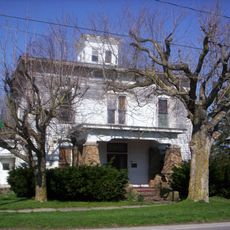
Crawford County is an administrative county in north central Ohio covering about 403 square miles (1,043 square kilometers). The area contains farmland, residential communities, and the county seat of Bucyrus at its center.

History

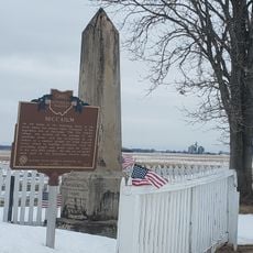
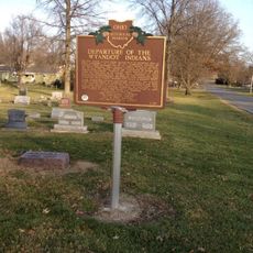
The county was officially established on April 1, 1826, and named after Colonel William Crawford, who served during the American Revolution. This naming honors his important role in the nation's early history.

Culture

The Crawford Park District runs nature programs throughout the year, helping visitors learn about the local environment and outdoor life. These activities connect people with the land and give them chances to explore the area's natural side.

Practical

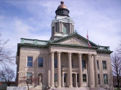
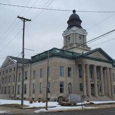
The Crawford County Courthouse is located in Bucyrus and houses multiple courts and administrative offices serving the public. Visitors can access the building during regular business hours to conduct official business or inquire about services.

Did you know?

The courthouse features a remarkable stained glass dome in its main courtroom, which received extra protection through a specially designed skylight in 1979. This restoration effort preserved a rare architectural element for future generations.

Location
Inception
April 1, 1826
Capital city
Bucyrus
Shares border with
Seneca County, Morrow County, Marion County, Wyandot County, Richland County, Huron County
GPS coordinates
40.85000,-82.92000
Latest update
December 7, 2025 19:29

AroundUs brings together thousands of curated places, local tips, and hidden gems, enriched daily by 60,000 contributors worldwide. Discover all places nearby (Ohio).

Around this place
Mid-Ohio Sports Car Course
United States of America

Mid-Ohio Sports Car Course

29.9 km
Formula F at the SCCA National Championship Runoffs
United States of America

Formula F at the SCCA National Championship Runoffs

29.9 km
Caledonia Bowstring Bridge
United States of America

Caledonia Bowstring Bridge

23.4 km
Most Pure Heart Of Mary Church
United States of America

Most Pure Heart Of Mary Church

21.6 km
Crawford County Courthouse
United States of America

Crawford County Courthouse

6.5 km
Sacred Heart of Jesus Churches
United States of America

Sacred Heart of Jesus Churches

16.7 km
Parker Covered Bridge
United States of America

Parker Covered Bridge

28 km
Brownella Cottage and Grace Episcopal Church and Rectory
United States of America

Brownella Cottage and Grace Episcopal Church and Rectory

17 km
Swartz Covered Bridge
United States of America

Swartz Covered Bridge

22.8 km
Monnett Memorial M. E. Chapel
United States of America

Monnett Memorial M. E. Chapel

13.7 km
Silas Ferrell House
United States of America

Silas Ferrell House

30 km
Richland Mall Cinema I-II-III
United States of America

Richland Mall Cinema I-II-III

28.7 km
Cinemark 14 Mansfield Town Center
United States of America

Cinemark 14 Mansfield Town Center

28 km
Galion Theatre
United States of America

Galion Theatre

16.9 km
Olentangy Battle Monument
United States of America

Olentangy Battle Monument

9.1 km
Springfield Square Cinema 10
United States of America

Springfield Square Cinema 10

29.3 km
The Lincoln Highway
United States of America

The Lincoln Highway

29.4 km
Crest Theater
United States of America

Crest Theater

16.6 km
W32AR
United States of America

W32AR

27.2 km
Plymouth Theater
United States of America

Plymouth Theater

26.9 km
Bucyrus Public Library
United States of America

Bucyrus Public Library

6.5 km
New Washington Branch Library
United States of America

New Washington Branch Library

13.7 km
Sunset Drive-In
United States of America

Sunset Drive-In

24 km
Bucyrus Commercial Historic District
United States of America

Bucyrus Commercial Historic District

6.6 km
Galion Public Library Association
United States of America

Galion Public Library Association

16.9 km
Caledonia Branch
United States of America

Caledonia Branch

24.1 km
Scioto Ordnance Plant Site
United States of America

Scioto Ordnance Plant Site

26.7 km
Departure of the Wyandot Indians
United States of America

Departure of the Wyandot Indians

30.2 km
Show the full map
Administrative divisions
« Crawford County - Administrative county in north central Ohio, United States » is provided by Around Us (aroundus.com). Images and texts are derived from Wikimedia project under a Creative Commons license. You are allowed to copy, distribute, and modify copies of this page, under the conditions set by the license, as long as this note is clearly visible.

Discover hidden gems everywhere you go!

From secret cafés to breathtaking viewpoints, skip the crowded tourist spots and find places that match your style. Our app makes it easy with voice search, smart filtering, route optimization, and insider tips from travelers worldwide. Download now for the complete mobile experience.

Around Us App Screenshot

A unique approach to discovering new places

Le Figaro

All the places worth exploring

France Info

A tailor-made excursion in just a few clicks

20 Minutes

Around Us
Travel Guide & Maps
Download

Send to your phone

QR Code
1

Open the camera app on your mobile.

2

Point at the QR code with your camera. A notification will appear.

3

Tap the notification to open the link.