Chest opened
+${chestReward.xp} XP
Explorer
NOUVEAU ×${chestReward.collectible.quantity}
tapez pour fermer

See the monuments around you in AR Open chests in the app

Around Us is built for your phone — point your camera at the streets and discover the monuments and places around you in augmented reality. Around Us is built for your phone — chests unlock when you walk, explore and capture nearby places.

Enable Location

We need your location to show you interesting places around you

Discover nearby places

Find interesting locations and hidden gems around you

Precise directions

Get accurate directions and distances to places

Your location is never shared with other users. It's only used when you tap the location button.

Tuscarawas County

Log in to your account

Start exploring — it's free

Trusted by 86,819 travelers worldwide

Continue with Google
Continue with Apple
or

We will send you a code to connect

By continuing, you accept our Terms and Conditions and our Privacy Policy

Check your inbox

We've sent a pincode in your inbox. Please enter the code below.

Discussion Reviews 1 Photos
29.1k Popularity

Tuscarawas County, Administrative county in northeastern Ohio, United States

Tuscarawas County is an administrative county in northeastern Ohio cut through by a river running through fertile valleys with coal and stone deposits. New Philadelphia serves as the county seat and primary community hub.

A peace agreement negotiated in the 1760s between colonial forces and Native American tribes opened the region to European settlement. Moravian missionaries arrived afterward and founded Christian communities starting in the early 1770s.

The area reflects its heritage from Moravian missionary settlements established with Delaware Indians, where religious faith shaped daily community life. Visitors can still sense this spiritual foundation in the character of older neighborhoods and local traditions.

The county is accessible by car with main services concentrated in New Philadelphia and nearby towns offering shops and dining options. The river valley provides access to outdoor activities and trails for exploring the local landscape.

An old canal system once connected the region to major trade networks before railroads became the dominant form of transportation. This waterway was crucial to the area's early economic growth and shaped where communities developed.

The community of curious travelers

AroundUs brings together thousands of curated places, local tips, and hidden gems, enriched daily by 60,000 contributors worldwide.
Start exploring
Location
Inception
March 15, 1808
Capital city
New Philadelphia
Reference
TUS
Shares border with
Stark County, Carroll County, Guernsey County, Harrison County, Holmes County, Coshocton County
GPS coordinates
40.44065,-81.48830
Latest update
September 12, 2026 03:55
Around this place
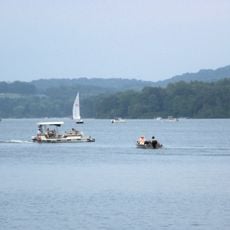
Atwood Lake
United States of America

Atwood Lake

12.3 mi
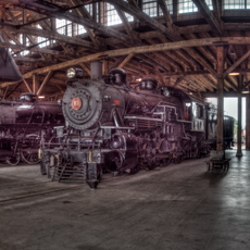
Age of Steam Roundhouse
United States of America

Age of Steam Roundhouse

9.7 mi
Fort Laurens
United States of America

Fort Laurens

13.8 mi
Seven Ranges Terminus
United States of America

Seven Ranges Terminus

17.1 mi
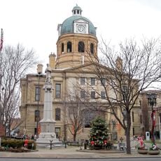
Tuscarawas County Courthouse
United States of America

Tuscarawas County Courthouse

4.1 mi
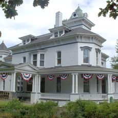
Jeremiah Reeves House and Carriage House
United States of America

Jeremiah Reeves House and Carriage House

5.4 mi
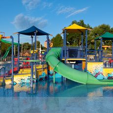
Uhrichsville Water Park
United States of America

Uhrichsville Water Park

8 mi
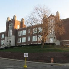
Dennison High School
United States of America

Dennison High School

8.8 mi
Fort Laurens Museum
United States of America

Fort Laurens Museum

13.9 mi
David Warther Carvings & Gift Shop
United States of America

David Warther Carvings & Gift Shop

11.8 mi
Historic Zoar Village
United States of America

Historic Zoar Village

12.4 mi
Ernest Warther Museum and Gardens
United States of America

Ernest Warther Museum and Gardens

5.9 mi
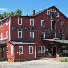
Elson-Magnolia Flour Mill
United States of America

Elson-Magnolia Flour Mill

17.7 mi
Atwood Lake Beach
United States of America

Atwood Lake Beach

13.5 mi
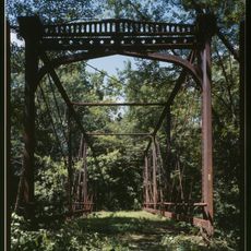
Zoarville Bridge
United States of America

Zoarville Bridge

10.7 mi
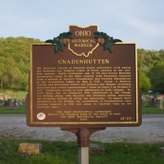
Gnadenhutten
United States of America

Gnadenhutten

6.6 mi
United States of America

Oak Shadows Golf Club

5.6 mi
United States of America

Willandale Golf Club

9.4 mi
United States of America

Green Valley

6.8 mi
United States of America

Union Country Club

5.6 mi
United States of America

Wilkshire Golf Course

13.8 mi
United States of America

Big Bend Golf Course

7.8 mi
United States of America

Norma Johnson Center

5.7 mi
United States of America

World's Largest Cuckoo Clock

9.1 mi
United States of America

Schoenbrunn Amphitheatre

5.2 mi
United States of America

Big Bend Golf Course

7.7 mi
United States of America

Statue

9.1 mi
United States of America

Adrian&Sarann’s house

13.3 mi
Show the full map
Reviews
Share your experience

No review yet

Discussions
Start a discussion...

No discussion yet

Administrative divisions
« Tuscarawas County - Administrative county in northeastern Ohio, United States » is provided by Around Us (aroundus.com). Images and texts are derived from Wikimedia project under a Creative Commons license. You are allowed to copy, distribute, and modify copies of this page, under the conditions set by the license, as long as this note is clearly visible.

Discover hidden gems everywhere you go!

From secret cafés to breathtaking viewpoints, skip the crowded tourist spots and find places that match your style. Our app makes it easy with voice search, smart filtering, route optimization, and insider tips from travelers worldwide. Download now for the complete mobile experience.

Around Us App Screenshot

A unique approach to discovering new places

Le Figaro

All the places worth exploring

France Info

A tailor-made excursion in just a few clicks

20 Minutes

Around Us
Travel Guide & Maps
Download

Send to your phone

QR Code
1

Open the camera app on your mobile.

2

Point at the QR code with your camera. A notification will appear.

3

Tap the notification to open the link.