Blackford County

Log in to your account

AroundUs is a community-driven map of interesting places, built by curious explorers like you. It grows with every review, story, and photo you share.
Connect to save your favorite spots, contribute locations, and create personalized routes.
Continue with Google
Continue with Apple
Continue with X
Continue with Facebook
Continue with email
By continuing, you accept our Terms and Conditions and our Privacy Policy
Create an account
Add to collection
Map
Suggest a change
Share

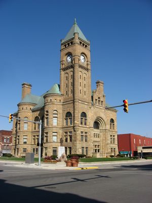
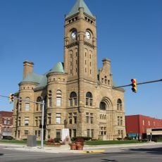
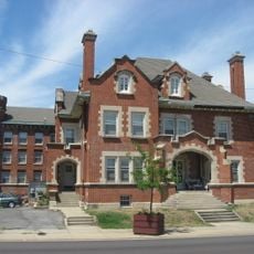
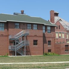
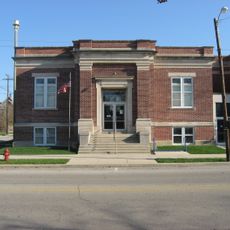
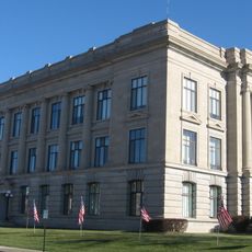
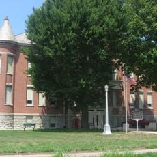
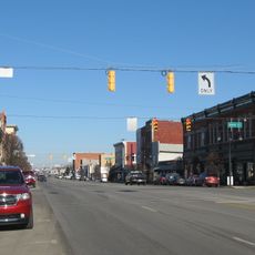
Blackford County, County administration center in Hartford City, Indiana

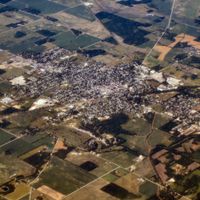
Blackford County is an administrative division in east central Indiana. The region spans farmland and open spaces, with Hartford City serving as the main administrative hub.

Established in 1838, the county was named after Judge Isaac Blackford, an early speaker of the Indiana General Assembly. Natural gas discoveries in the late 1800s sparked rapid growth that brought factories and workers to the area.

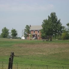
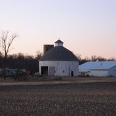
The region is shaped by farming and rural living, with cornfields and soybean crops defining the landscape. This agricultural tradition continues to influence how people live and work in the area today.

Hartford City sits at the administrative center and is easily reached from all directions. Visitors can navigate the county through roadways that connect the main town with surrounding communities.

The county experienced explosive growth during the natural gas boom of the late 1800s, becoming an industrial hotspot in the region. By 1900, it had reached its peak population before gas supplies began to decline.

Location: Indiana

Inception: April 2, 1838

Capital city: Hartford City

Shares border with: Wells County, Jay County, Delaware County, Grant County

Website: http://blackfordcounty.com

GPS coordinates: 40.47000,-85.32000

Latest update: December 7, 2025 20:40

Photos
Around this place
Scheumann Stadium
United States of America

Scheumann Stadium

29.4 km
Marie Webster House
United States of America

Marie Webster House

30.2 km
Gene Stratton-Porter Cabin
United States of America

Gene Stratton-Porter Cabin

2.7 km
Marion National Cemetery
United States of America

Marion National Cemetery

26.9 km
Blackford County Courthouse
United States of America

Blackford County Courthouse

4.6 km
First Presbyterian Church
United States of America

First Presbyterian Church

4.5 km
Hartford City Courthouse Square Historic District
United States of America

Hartford City Courthouse Square Historic District

4.6 km
Cumberland Covered Bridge
United States of America

Cumberland Covered Bridge

16.6 km
Grant County Jail and Sheriff's Residence
United States of America

Grant County Jail and Sheriff's Residence

30.3 km
Mount Zion Methodist Episcopal Church
United States of America

Mount Zion Methodist Episcopal Church

15.4 km
Miami Indian
United States of America

Miami Indian

10 km
Israel Jenkins House
United States of America

Israel Jenkins House

17.8 km
Gas City High School
United States of America

Gas City High School

24.4 km
Rebecca Rankin Round Barn
United States of America

Rebecca Rankin Round Barn

20 km
Montpelier Carnegie Library
United States of America

Montpelier Carnegie Library

9.9 km
Redkey Historic District
United States of America

Redkey Historic District

19.5 km
Jay County Courthouse
United States of America

Jay County Courthouse

29.2 km
West Ward School
United States of America

West Ward School

25.3 km
Baldwin Addition Historic District
United States of America

Baldwin Addition Historic District

28.5 km
Thompson-Ray House
United States of America

Thompson-Ray House

24.5 km
Felt's Farm
United States of America

Felt's Farm

15.3 km
J.W. Patterson House
United States of America

J.W. Patterson House

28.5 km
Abijah C. Jay House
United States of America

Abijah C. Jay House

30.3 km
Portland Commercial Historic District
United States of America

Portland Commercial Historic District

29.1 km
Bethel Methodist Episcopal Church
United States of America

Bethel Methodist Episcopal Church

29.9 km
Fairmount Commercial Historic District
United States of America

Fairmount Commercial Historic District

28.6 km
Hamilton Township Schoolhouse No. 4
United States of America

Hamilton Township Schoolhouse No. 4

24 km
Meridian Street Bridge
United States of America

Meridian Street Bridge

29.3 km
Show the full map
Reviews

Visited this place? Tap the stars to rate it and share your experience / photos with the community! Try now! You can cancel it anytime.

Administrative divisions
« Blackford County - County administration center in Hartford City, Indiana » is provided by Around Us (aroundus.com). Images and texts are derived from Wikimedia project under a Creative Commons license. You are allowed to copy, distribute, and modify copies of this page, under the conditions set by the license, as long as this note is clearly visible.

Discover hidden gems everywhere you go!

From secret cafés to breathtaking viewpoints, skip the crowded tourist spots and find places that match your style. Our app makes it easy with voice search, smart filtering, route optimization, and insider tips from travelers worldwide. Download now for the complete mobile experience.

Around Us App Screenshot

A unique approach to discovering new places

Le Figaro

All the places worth exploring

France Info

A tailor-made excursion in just a few clicks

20 Minutes