Enable Location

We need your location to show you interesting places around you

Discover nearby places

Find interesting locations and hidden gems around you

Precise directions

Get accurate directions and distances to places

Your location is never shared with other users. It's only used when you tap the location button.

Trimble County

Log in to your account

Start exploring — it's free

Trusted by 62,994 travelers worldwide

Continue with Google
Continue with Apple
or

We will send you a code to connect

By continuing, you accept our Terms and Conditions and our Privacy Policy

Check your inbox

We've sent a pincode in your inbox. Please enter the code below.

Discussion Reviews 1 Photos
10.2k Popularity

Trimble County, Administrative county in northern Kentucky, United States.

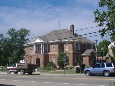
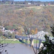
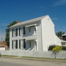
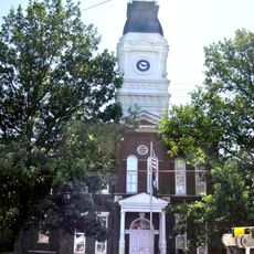
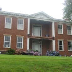
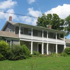
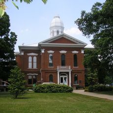
Trimble County is an administrative division in northern Kentucky along the Ohio River. The region includes settlements such as Bedford, which serves as the county seat, and several smaller communities.

The area was established in February 1837 and named after Robert Trimble, a United States Supreme Court justice. Its creation reflected Kentucky's administrative reorganization during the 1800s.

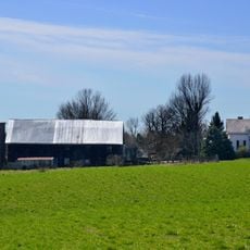
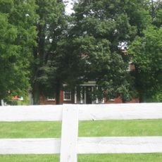
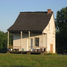
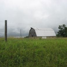
The county maintains strong agricultural traditions with local farmers contributing to Kentucky's agricultural production through crops and livestock operations.

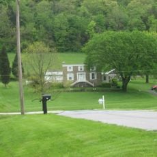
The area sits in a region well-connected by highways and local roads linking the main communities. Visitors should expect rural conditions, as some parts may have limited services and facilities.

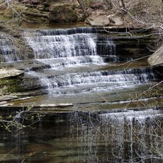
A central north-south ridge divides the region into two distinct landscapes. The Little Kentucky River flows through the eastern section and shapes the terrain.

The community of curious travelers

AroundUs brings together thousands of curated places, local tips, and hidden gems, enriched daily by 60,000 contributors worldwide.

Start exploring
Location
Inception
February 9, 1837
Capital city
Bedford
Shares border with
Carroll County, Henry County, Oldham County, Jefferson County, Clark County
GPS coordinates
38.60000,-85.34000
Latest update
December 10, 2025 15:55
Around this place
Clifty Falls State Park
United States of America

Clifty Falls State Park

17.7 km
General Butler State Resort Park
United States of America

General Butler State Resort Park

18 km
Lanier Mansion
United States of America

Lanier Mansion

15.6 km
Milton-Madison Bridge
United States of America

Milton-Madison Bridge

14.5 km
Benjamin Schenck Mansion
United States of America

Benjamin Schenck Mansion

28.6 km
Madison Historic District
United States of America

Madison Historic District

16.2 km
D. W. Griffith House
United States of America

D. W. Griffith House

21.7 km
Charles L. Shrewsbury House
United States of America

Charles L. Shrewsbury House

15.5 km
Schofield House
United States of America

Schofield House

15.5 km
Rob Morris Home
United States of America

Rob Morris Home

21.7 km
Edward and George Cary Eggleston House
United States of America

Edward and George Cary Eggleston House

28.5 km
Henry County Courthouse
United States of America

Henry County Courthouse

23.7 km
Mathias Wolf Farm
United States of America

Mathias Wolf Farm

18.3 km
Gen. William O. Butler House
United States of America

Gen. William O. Butler House

17 km
Hunter's Bottom Historic District
United States of America

Hunter's Bottom Historic District

14.3 km
Lemuel Allen Farm
United States of America

Lemuel Allen Farm

17.8 km
Crawford-Whitehead-Ross House
United States of America

Crawford-Whitehead-Ross House

15.8 km
Carrollton Historic District
United States of America

Carrollton Historic District

16.6 km
Crowe-Garritt House
United States of America

Crowe-Garritt House

17.1 km
Central La Grange Historic District
United States of America

Central La Grange Historic District

21.8 km
Coleman House
United States of America

Coleman House

2.1 km
Thomas T. Wright House
United States of America

Thomas T. Wright House

22.6 km
William L. Coleman House
United States of America

William L. Coleman House

7.1 km
Venoge Farmstead
United States of America

Venoge Farmstead

26.6 km
Bates House
United States of America

Bates House

5 km
McMahan House
United States of America

McMahan House

21.8 km
House on KY 1492
United States of America

House on KY 1492

9.9 km
Henry Ogburn House
United States of America

Henry Ogburn House

20.7 km
Show the full map
Reviews
Share your experience

No review yet

Discussions
Start a discussion...

No discussion yet

« Trimble County - Administrative county in northern Kentucky, United States » is provided by Around Us (aroundus.com). Images and texts are derived from Wikimedia project under a Creative Commons license. You are allowed to copy, distribute, and modify copies of this page, under the conditions set by the license, as long as this note is clearly visible.

Discover hidden gems everywhere you go!

From secret cafés to breathtaking viewpoints, skip the crowded tourist spots and find places that match your style. Our app makes it easy with voice search, smart filtering, route optimization, and insider tips from travelers worldwide. Download now for the complete mobile experience.

Around Us App Screenshot

A unique approach to discovering new places

Le Figaro

All the places worth exploring

France Info

A tailor-made excursion in just a few clicks

20 Minutes

Around Us
Travel Guide & Maps
Download

Send to your phone

QR Code
1

Open the camera app on your mobile.

2

Point at the QR code with your camera. A notification will appear.

3

Tap the notification to open the link.