Enable Location

We need your location to show you interesting places around you

Discover nearby places

Find interesting locations and hidden gems around you

Precise directions

Get accurate directions and distances to places

Your location is never shared with other users. It's only used when you tap the location button.

Oldham County

Log in to your account

Start exploring — it's free

Trusted by 61,694 travelers worldwide

Continue with Google
Continue with Apple
or

We will send you a code to connect

By continuing, you accept our Terms and Conditions and our Privacy Policy

Check your inbox

We've sent a pincode in your inbox. Please enter the code below.

Oldham County, Administrative county in northern Kentucky, United States.

Description

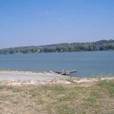
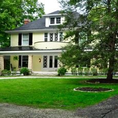
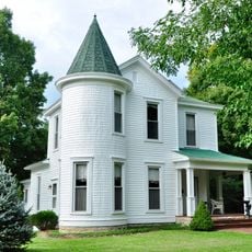
Oldham County is an administrative area in northern Kentucky that uses the Ohio River as a natural boundary with Indiana. The region contains small towns, open farmland, and wooded areas that spread across rolling hills and river valleys.

History

The administrative unit formed in December 1823 from parts of Henry, Jefferson, and Shelby counties. The name honors Colonel William Oldham, an officer from the Revolutionary War who served in the region.

Culture

The Kenwood Road Planning Study represents the county's commitment to infrastructure development, connecting major routes KY 329B and KY 146 for community benefit.

Practical

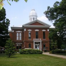
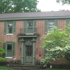
La Grange serves as the seat of local government and offers the main administrative services for residents. Visitors will find public offices and information for navigating the area there.

Did you know?

North Oldham High School maintains excellence in education, contributing to the county's status as Kentucky's most affluent region with superior academic standards.

Location
Inception
December 15, 1823
Capital city
La Grange
Shares border with
Clark County, Trimble County, Henry County, Shelby County, Jefferson County
GPS coordinates
38.40000,-85.44000
Latest update
December 13, 2025 18:55

AroundUs brings together thousands of curated places, local tips, and hidden gems, enriched daily by 60,000 contributors worldwide. Discover all places nearby (Kentucky).

Around this place
Rose Island
United States of America

Rose Island

15.8 km
Charlestown State Park
United States of America

Charlestown State Park

16.9 km
D. W. Griffith House
United States of America

D. W. Griffith House

5 km
John Work House and Mill Site
United States of America

John Work House and Mill Site

18.7 km
Pewee Valley Confederate Cemetery
United States of America

Pewee Valley Confederate Cemetery

11.2 km
Rob Morris Home
United States of America

Rob Morris Home

5.5 km
Von Allmen Dairy Farm House
United States of America

Von Allmen Dairy Farm House

15.2 km
Harrods Creek Baptist Church and Rev. William Kellar House
United States of America

Harrods Creek Baptist Church and Rev. William Kellar House

7.7 km
Saint James' Episcopal Church
United States of America

Saint James' Episcopal Church

10.4 km
United States of America

Wesley Methodist Church

11.3 km
Wooldridge-Rose House
United States of America

Wooldridge-Rose House

10.2 km
United States of America

Bradshaw-Duncan House

10.8 km
Bondurant-Hustin House
United States of America

Bondurant-Hustin House

11.6 km
Central La Grange Historic District
United States of America

Central La Grange Historic District

5.1 km
United States of America

Central Avenue Historic District

10.9 km
Albert E. Clore House
United States of America

Albert E. Clore House

9.2 km
United States of America

WAVE-Sendemast

6.4 km
United States of America

Carpenter-Smith House

8.5 km
McMahan House
United States of America

McMahan House

5.6 km
United States of America

Ashwood Avenue Historic District

11.2 km
United States of America

Reuben Sale House

7.7 km
United States of America

La Grange Railroad Museum & Learning Center

5.8 km
Confederate Memorial in Peewee Valley
United States of America

Confederate Memorial in Peewee Valley

11.2 km
United States of America

Crystal Lake

6.8 km
United States of America

Cedar Point

3.4 km
United States of America

Standard Country Club

18.2 km
United States of America

Harmony Landing

14.2 km
United States of America

Lovers Lane

16.6 km
Show the full map
« Oldham County - Administrative county in northern Kentucky, United States » is provided by Around Us (aroundus.com). Images and texts are derived from Wikimedia project under a Creative Commons license. You are allowed to copy, distribute, and modify copies of this page, under the conditions set by the license, as long as this note is clearly visible.

Discover hidden gems everywhere you go!

From secret cafés to breathtaking viewpoints, skip the crowded tourist spots and find places that match your style. Our app makes it easy with voice search, smart filtering, route optimization, and insider tips from travelers worldwide. Download now for the complete mobile experience.

Around Us App Screenshot

A unique approach to discovering new places

Le Figaro

All the places worth exploring

France Info

A tailor-made excursion in just a few clicks

20 Minutes

Around Us
Travel Guide & Maps
Download

Send to your phone

QR Code
1

Open the camera app on your mobile.

2

Point at the QR code with your camera. A notification will appear.

3

Tap the notification to open the link.