Enable Location

We need your location to show you interesting places around you

Discover nearby places

Find interesting locations and hidden gems around you

Precise directions

Get accurate directions and distances to places

Your location is never shared with other users. It's only used when you tap the location button.

John Work House and Mill Site

Log in to your account

Start exploring — it's free

Trusted by 61,663 travelers worldwide

Continue with Google
Continue with Apple
or

We will send you a code to connect

By continuing, you accept our Terms and Conditions and our Privacy Policy

Check your inbox

We've sent a pincode in your inbox. Please enter the code below.

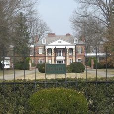
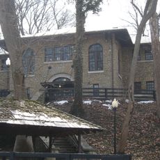
John Work House and Mill Site, Historic district in Clark County, Indiana

Description

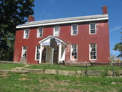
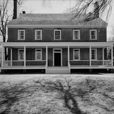
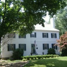
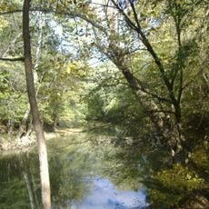
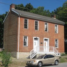
The John Work House is a Federal-style brick building constructed around 1811 with balanced proportions and individual chimneys serving its six rooms. The site also contains remnants of a gristmill that was powered by water channeled through an underground system.

History

The property was established around 1811 when John Work built a mill and residence at this location. It became an important center for early industrial activity and grain processing in the region during the 1800s.

Culture

The site is named for John Work, the pioneer who established the settlement and its economic center. Visitors can explore the old burial ground where members of the early community found their final resting place.

Practical

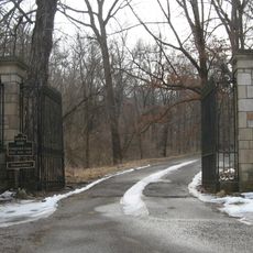
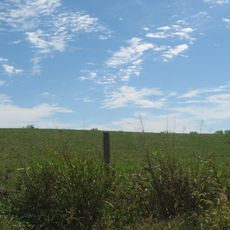
The site is located in a rural setting near Charlestown and can be reached by following local roads to Tunnel Mill Road. The property is now managed as part of a Scout Reservation, so visitors should check access conditions and appropriate visiting times in advance.

Did you know?

The most remarkable engineering feature is a limestone tunnel carved through a hillside to channel water to the mill, requiring careful excavation and controlled blasting. This ambitious underground system demonstrates the determination of early settlers to harness local resources for industrial purposes.

Location
GPS coordinates
38.48330,-85.62670
Latest update
December 12, 2025 17:47

AroundUs brings together thousands of curated places, local tips, and hidden gems, enriched daily by 60,000 contributors worldwide. Discover all places nearby (Indiana).

Around this place
Rose Island
United States of America

Rose Island

6 km
United States of America

Indiana Army Ammunition Plant

12.4 km
Zachary Taylor National Cemetery
United States of America

Zachary Taylor National Cemetery

22.9 km
Locust Grove
United States of America

Locust Grove

22.1 km
Pigeon Roost State Historic Site
United States of America

Pigeon Roost State Historic Site

19.6 km
E. P. "Tom" Sawyer State Park
United States of America

E. P. "Tom" Sawyer State Park

22.9 km
Zachary Taylor House
United States of America

Zachary Taylor House

22.8 km
Charlestown State Park
United States of America

Charlestown State Park

5.9 km
Lincliff
United States of America

Lincliff

21.1 km
Deam Lake State Recreation Area
United States of America

Deam Lake State Recreation Area

20.4 km
D. W. Griffith House
United States of America

D. W. Griffith House

22.8 km
Boxhill
United States of America

Boxhill

20.4 km
Prather Site
United States of America

Prather Site

13.1 km
Lapping Park
United States of America

Lapping Park

20.5 km
Von Allmen Dairy Farm House
United States of America

Von Allmen Dairy Farm House

19.5 km
Patriots Peace Memorial
United States of America

Patriots Peace Memorial

22.2 km
Midlands
United States of America

Midlands

21.5 km
Harrods Creek Baptist Church and Rev. William Kellar House
United States of America

Harrods Creek Baptist Church and Rev. William Kellar House

17.1 km
Thomas Downs House
United States of America

Thomas Downs House

5.2 km
Benjamin Ferguson House
United States of America

Benjamin Ferguson House

5.7 km
Saint James' Episcopal Church
United States of America

Saint James' Episcopal Church

22.7 km
Watson House
United States of America

Watson House

5.2 km
Rogers Clark Ballard Memorial School
United States of America

Rogers Clark Ballard Memorial School

19 km
Wooldridge-Rose House
United States of America

Wooldridge-Rose House

22 km
Bondurant-Hustin House
United States of America

Bondurant-Hustin House

22.8 km
Albert E. Clore House
United States of America

Albert E. Clore House

20 km
Wooded Glen Covered Bridge
United States of America

Wooded Glen Covered Bridge

13.6 km
Glenview Historic District
United States of America

Glenview Historic District

19.5 km
Show the full map
« John Work House and Mill Site - Historic district in Clark County, Indiana » is provided by Around Us (aroundus.com). Images and texts are derived from Wikimedia project under a Creative Commons license. You are allowed to copy, distribute, and modify copies of this page, under the conditions set by the license, as long as this note is clearly visible.

Discover hidden gems everywhere you go!

From secret cafés to breathtaking viewpoints, skip the crowded tourist spots and find places that match your style. Our app makes it easy with voice search, smart filtering, route optimization, and insider tips from travelers worldwide. Download now for the complete mobile experience.

Around Us App Screenshot

A unique approach to discovering new places

Le Figaro

All the places worth exploring

France Info

A tailor-made excursion in just a few clicks

20 Minutes

Around Us
Travel Guide & Maps
Download

Send to your phone

QR Code
1

Open the camera app on your mobile.

2

Point at the QR code with your camera. A notification will appear.

3

Tap the notification to open the link.