Enable Location

We need your location to show you interesting places around you

Discover nearby places

Find interesting locations and hidden gems around you

Precise directions

Get accurate directions and distances to places

Your location is never shared with other users. It's only used when you tap the location button.

Henderson County

Log in to your account

Start exploring — it's free

Trusted by 61,971 travelers worldwide

Continue with Google
Continue with Apple
or

We will send you a code to connect

By continuing, you accept our Terms and Conditions and our Privacy Policy

Check your inbox

We've sent a pincode in your inbox. Please enter the code below.

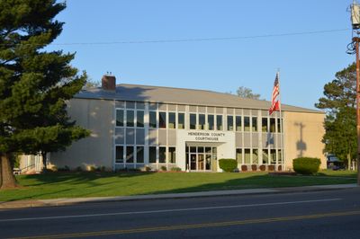
Henderson County, County administrative division in Tennessee, US

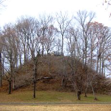
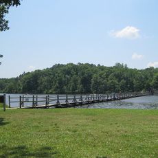
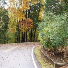
Henderson County is an administrative division in western Tennessee that spans several hundred square miles of farmland, waterways, and small communities. Rivers including the Beech River and Forked Deer River run through the land, shaping the regional landscape and water systems.

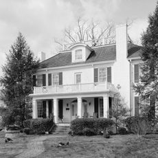
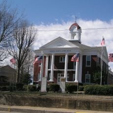
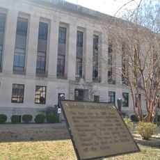
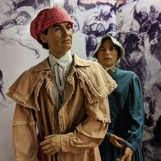
The county was founded in 1821 and named after James Henderson, a soldier from the War of 1812. During the Civil War, different parts of the region sided with opposing causes, reflecting divided political allegiances among residents.

The population of 27,842 residents represents a mix of backgrounds, with 86 percent White, 7 percent African American, and 3 percent Hispanic communities.

The county is well connected through Interstate 40, US Highway 70, and several state routes, making it easy to navigate and reach nearby regional centers. This infrastructure allows visitors to explore the area efficiently and access different communities throughout the region.

During the Civil War, Henderson County divided politically, with western areas supporting Confederate causes while eastern regions maintained Union loyalty.

The community of curious travelers

AroundUs brings together thousands of curated places, local tips, and hidden gems, enriched daily by 60,000 contributors worldwide.

Start exploring
Location
Inception
1821
Capital city
Lexington
Shares border with
Carroll County, Chester County, Decatur County, Hardin County, Madison County
GPS coordinates
35.65000,-88.39000
Latest update
December 7, 2025 19:32
Around this place
Pinson Mounds
United States of America

Pinson Mounds

31.4 km
Natchez Trace State Park
United States of America

Natchez Trace State Park

19 km
Cherry Mansion
United States of America

Cherry Mansion

48.8 km
Chickasaw State Park
United States of America

Chickasaw State Park

50.1 km
Mousetail Landing State Park
United States of America

Mousetail Landing State Park

34.1 km
Chester County Courthouse
United States of America

Chester County Courthouse

32.6 km
Oakslea Place
United States of America

Oakslea Place

38.8 km
Carnegie Center for Arts and History
United States of America

Carnegie Center for Arts and History

38.8 km
Temple B'Nai Israel
United States of America

Temple B'Nai Israel

39.4 km
Murphy Hotel (Jackson, Tennessee)
United States of America

Murphy Hotel (Jackson, Tennessee)

38.7 km
Bethel Springs Presbyterian Church
United States of America

Bethel Springs Presbyterian Church

50.5 km
Ross-Sewell House
United States of America

Ross-Sewell House

38.9 km
The Cedars
United States of America

The Cedars

32.7 km
Madison County Courthouse
United States of America

Madison County Courthouse

39.1 km
Meady White House
United States of America

Meady White House

34.5 km
Hamlett-Smith House
United States of America

Hamlett-Smith House

21.5 km
United States of America

James Dickson House

39.1 km
Thompsie Edwards House
United States of America

Thompsie Edwards House

264 m
William Kirby Walsh House
United States of America

William Kirby Walsh House

38.6 km
United States of America

Medina City Hall

38.8 km
United States of America

Captain H.P. Farrar House

39.2 km
Rusty's TV & Movie Car Museum
United States of America

Rusty's TV & Movie Car Museum

40.3 km
National Teacher's Normal and Business College Administration Building
United States of America

National Teacher's Normal and Business College Administration Building

32.5 km
Buford Pusser Home & Museum
United States of America

Buford Pusser Home & Museum

46.5 km
Parker's Crossroads Visitor Center
United States of America

Parker's Crossroads Visitor Center

15.2 km
Tennessee River Museum
United States of America

Tennessee River Museum

49 km
Jackson NC&SL Railroad Museum and Depot
United States of America

Jackson NC&SL Railroad Museum and Depot

38.6 km
Court Theatre
United States of America

Court Theatre

39.2 km
Show the full map
Administrative divisions
« Henderson County - County administrative division in Tennessee, US » is provided by Around Us (aroundus.com). Images and texts are derived from Wikimedia project under a Creative Commons license. You are allowed to copy, distribute, and modify copies of this page, under the conditions set by the license, as long as this note is clearly visible.

Discover hidden gems everywhere you go!

From secret cafés to breathtaking viewpoints, skip the crowded tourist spots and find places that match your style. Our app makes it easy with voice search, smart filtering, route optimization, and insider tips from travelers worldwide. Download now for the complete mobile experience.

Around Us App Screenshot

A unique approach to discovering new places

Le Figaro

All the places worth exploring

France Info

A tailor-made excursion in just a few clicks

20 Minutes

Around Us
Travel Guide & Maps
Download

Send to your phone

QR Code
1

Open the camera app on your mobile.

2

Point at the QR code with your camera. A notification will appear.

3

Tap the notification to open the link.