·

Enable Location

We need your location to show you interesting places around you

Discover nearby places

Find interesting locations and hidden gems around you

Precise directions

Get accurate directions and distances to places

Your location is never shared with other users. It's only used when you tap the location button.

Bedford County

Log in to your account

Start exploring — it's free

Trusted by 62,690 travelers worldwide

Continue with Google
Continue with Apple
or

We will send you a code to connect

By continuing, you accept our Terms and Conditions and our Privacy Policy

Check your inbox

We've sent a pincode in your inbox. Please enter the code below.

Bedford County, Administrative division in Tennessee, United States

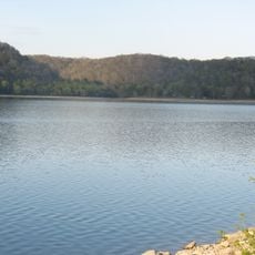
Bedford County is an administrative division in Tennessee that spans rural land with the Duck River flowing through it. The area consists of farmland, forests, and residential communities arranged around Shelbyville and smaller towns.

The county was established in 1807 when residents south of the Duck River and Stones River separated from Rutherford County. It was named after Thomas Bedford and later served as territory from which other counties were formed.

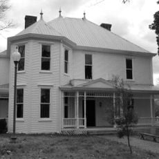
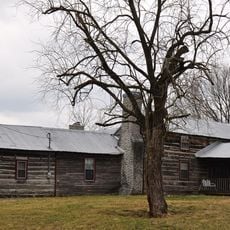
The region's character reflects the values of farming communities that have shaped its towns and neighborhoods over generations. Local traditions around agriculture and craftsmanship remain part of daily life in the smaller villages and along rural roads.

The county is accessible by multiple highways, including Interstate 24 and US Route 41A, connecting it to surrounding regions. Visitors should plan drives carefully since rural areas have limited services along smaller roads.

The region was originally Tennessee's largest county before portions of it were divided off. This gradual separation resulted in the creation of four distinct counties that emerged from the original territory.

The community of curious travelers

AroundUs brings together thousands of curated places, local tips, and hidden gems, enriched daily by 60,000 contributors worldwide.

Start exploring
Location
Inception
December 3, 1807
Capital city
Shelbyville
Shares border with
Rutherford County, Lincoln County, Coffee County, Moore County, Marshall County
GPS coordinates
35.51000,-86.46000
Latest update
December 7, 2025 10:06
Around this place
Old Stone Fort
United States of America

Old Stone Fort

32.1 km
United States of America

Henry Horton State Park

23.7 km
Nathan Bedford Forrest Boyhood Home
United States of America

Nathan Bedford Forrest Boyhood Home

30 km
Snail Shell Cave
United States of America

Snail Shell Cave

31.1 km
River Side Farmhouse
United States of America

River Side Farmhouse

9.8 km
Absalom Lowe Landis House
United States of America

Absalom Lowe Landis House

14.2 km
Gov. Prentice Cooper House
United States of America

Gov. Prentice Cooper House

2.8 km
Tennessee Walking Horse National Museum
United States of America

Tennessee Walking Horse National Museum

11.7 km
Shelbyville Courthouse Square Historic District
United States of America

Shelbyville Courthouse Square Historic District

3 km
United States of America

Shofners' Lutheran Church and Cemetery

13.8 km
Harris/Morgan House (Fosterville, Tennessee)
United States of America

Harris/Morgan House (Fosterville, Tennessee)

16.3 km
Lynchburg Historic District
United States of America

Lynchburg Historic District

26.5 km
Wartrace Historic District
United States of America

Wartrace Historic District

11.5 km
United States of America

Palmetto Farm

18.6 km
Green-Evans House
United States of America

Green-Evans House

24.7 km
Henry A. Clark House
United States of America

Henry A. Clark House

12.4 km
Murray Farm
United States of America

Murray Farm

32.6 km
United States of America

John Green Sims House

12.6 km
Martin House
United States of America

Martin House

20.5 km
Heidt Tavern-Singleton House
United States of America

Heidt Tavern-Singleton House

17.3 km
Frierson-Coble House
United States of America

Frierson-Coble House

2.8 km
Joe Chase Adams House
United States of America

Joe Chase Adams House

30.1 km
Winston Evans House
United States of America

Winston Evans House

2.7 km
United States of America

Swaim House

24.8 km
L.D. Hickerson House
United States of America

L.D. Hickerson House

27.8 km
William Harrison McCord House
United States of America

William Harrison McCord House

31.5 km
Normandy Lake
United States of America

Normandy Lake

24 km
Jack Daniel's Distillery
United States of America

Jack Daniel's Distillery

26.4 km
Show the full map
Administrative divisions
« Bedford County - Administrative division in Tennessee, United States » is provided by Around Us (aroundus.com). Images and texts are derived from Wikimedia project under a Creative Commons license. You are allowed to copy, distribute, and modify copies of this page, under the conditions set by the license, as long as this note is clearly visible.

Discover hidden gems everywhere you go!

From secret cafés to breathtaking viewpoints, skip the crowded tourist spots and find places that match your style. Our app makes it easy with voice search, smart filtering, route optimization, and insider tips from travelers worldwide. Download now for the complete mobile experience.

Around Us App Screenshot

A unique approach to discovering new places

Le Figaro

All the places worth exploring

France Info

A tailor-made excursion in just a few clicks

20 Minutes

Around Us
Travel Guide & Maps
Download

Send to your phone

QR Code
1

Open the camera app on your mobile.

2

Point at the QR code with your camera. A notification will appear.

3

Tap the notification to open the link.