Enable Location

We need your location to show you interesting places around you

Discover nearby places

Find interesting locations and hidden gems around you

Precise directions

Get accurate directions and distances to places

Your location is never shared with other users. It's only used when you tap the location button.

Charles City

Log in to your account

Start exploring — it's free

Trusted by 66,055 travelers worldwide

Continue with Google
Continue with Apple
or

We will send you a code to connect

By continuing, you accept our Terms and Conditions and our Privacy Policy

Check your inbox

We've sent a pincode in your inbox. Please enter the code below.

Discussion Reviews 1 Photos
18.2k Popularity

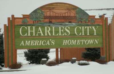
Charles City, city in Iowa, United States

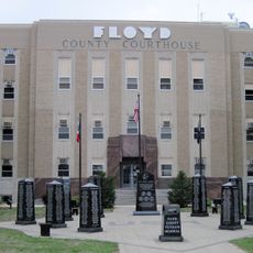
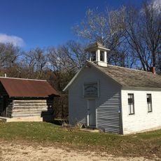
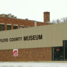
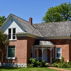
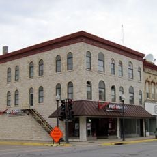
Charles City is the county seat of Floyd County in northeast Iowa, sitting along the Cedar River. The town has a county museum with farm equipment and local artifacts, public art spread through the streets, and walking trails that follow the river.

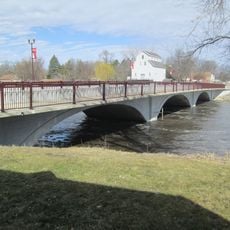
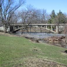
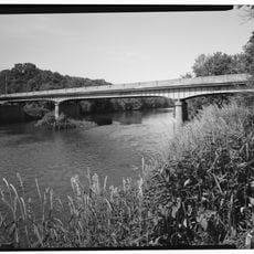
The town was founded in 1851 and grew as a trading point along the Cedar River. A suspension bridge built in 1906 became a landmark, and after being destroyed by a major flood, it was rebuilt and reopened in 2010.

The town celebrates local creativity through craft fairs and seasonal markets where artisans sell their work throughout the year. Walking through the streets, you notice murals and sculptures that reflect how the community values art and history in everyday life.

The museum, river trails, and public art are all close together, so a single day is enough to see the main points of interest. Summer brings the most activity, with outdoor festivals and farmers markets taking place around town.

The local library holds an art collection that includes works attributed to Rembrandt, which is very unusual for a town of this size. The town also has the All Iowa Lawn Tennis Club, which plays on a grass court surface that is rare in the United States.

The community of curious travelers

AroundUs brings together thousands of curated places, local tips, and hidden gems, enriched daily by 60,000 contributors worldwide.

Start exploring
Location
Elevation above the sea
307 m
GPS coordinates
43.06639,-92.67583
Latest update
March 3, 2026 08:23
Around this place
Alvin Miller House
United States of America

Alvin Miller House

650 m
United States of America

Waverly Public Library

40.8 km
Shell Rock Bridge
United States of America

Shell Rock Bridge

40.3 km
Chickasaw County Courthouse
United States of America

Chickasaw County Courthouse

31.2 km
Floyd County Court House
United States of America

Floyd County Court House

483 m
Walnut Grove School
United States of America

Walnut Grove School

27.5 km
First Lutheran Church
United States of America

First Lutheran Church

40.4 km
Dr. Salsbury's Laboratories, Main Office and Production Laboratory Building
United States of America

Dr. Salsbury's Laboratories, Main Office and Production Laboratory Building

447 m
Old Main
United States of America

Old Main

40.7 km
Wildwood Park Historic District
United States of America

Wildwood Park Historic District

1.5 km
Butler County Courthouse
United States of America

Butler County Courthouse

35.9 km
Osage Commercial Historic District
United States of America

Osage Commercial Historic District

26.6 km
Waverly House
United States of America

Waverly House

41.3 km
Cherry Street Bridge
United States of America

Cherry Street Bridge

40.6 km
Sherman Nursery Company Historic District
United States of America

Sherman Nursery Company Historic District

1.1 km
A. B. C. Dodd House
United States of America

A. B. C. Dodd House

622 m
Charles H. & Theresa H. McBride Bungalow
United States of America

Charles H. & Theresa H. McBride Bungalow

40.2 km
James C. Fellows House
United States of America

James C. Fellows House

34.7 km
Charles Henry Parr House
United States of America

Charles Henry Parr House

906 m
Charles Walter Hart House
United States of America

Charles Walter Hart House

1.2 km
Main Street Bridge
United States of America

Main Street Bridge

340 m
Howardville Wesleyan Church
United States of America

Howardville Wesleyan Church

14.2 km
Lucius and Maria Clinton Lane House
United States of America

Lucius and Maria Clinton Lane House

6.3 km
Central Park-North Main Street Historic District
United States of America

Central Park-North Main Street Historic District

313 m
Nathaniel Cobb and Lucetia Baily Deering House
United States of America

Nathaniel Cobb and Lucetia Baily Deering House

26.4 km
Harmon and LeValley Northwest Historic District
United States of America

Harmon and LeValley Northwest Historic District

41.1 km
Mitchell County Courthouse
United States of America

Mitchell County Courthouse

31.5 km
Cedar River Bridge
United States of America

Cedar River Bridge

18.3 km
Show the full map
Reviews
Share your experience

No review yet

Discussions
Start a discussion...

No discussion yet

« Charles City - city in Iowa, United States » is provided by Around Us (aroundus.com). Images and texts are derived from Wikimedia project under a Creative Commons license. You are allowed to copy, distribute, and modify copies of this page, under the conditions set by the license, as long as this note is clearly visible.

Discover hidden gems everywhere you go!

From secret cafés to breathtaking viewpoints, skip the crowded tourist spots and find places that match your style. Our app makes it easy with voice search, smart filtering, route optimization, and insider tips from travelers worldwide. Download now for the complete mobile experience.

Around Us App Screenshot

A unique approach to discovering new places

Le Figaro

All the places worth exploring

France Info

A tailor-made excursion in just a few clicks

20 Minutes

Around Us
Travel Guide & Maps
Download

Send to your phone

QR Code
1

Open the camera app on your mobile.

2

Point at the QR code with your camera. A notification will appear.

3

Tap the notification to open the link.