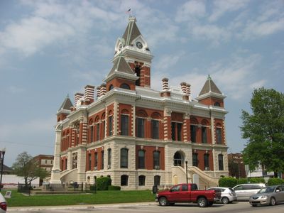
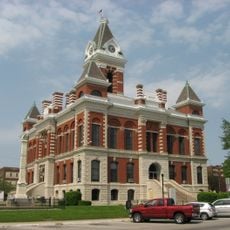
Gibson County, County in southwestern Indiana, United States.
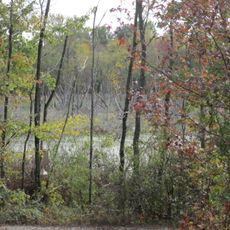
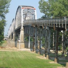
Gibson County is an administrative division in southwestern Indiana that spans diverse terrain shaped by two major river systems. The Patoka and White Rivers flow through valleys, hills, and marshlands that define the county's natural landscape.
The county was established in 1813 and named after John Gibson, a military officer who served during the French and Indian War and the American Revolution. This naming honors his contributions to early American military campaigns.
The county maintains three educational districts - East Gibson, North Gibson, and South Gibson - serving students through various academic and extracurricular programs.
The county has an extensive road network with US Route 41 and Interstate 69 providing connections to larger urban areas. Visitors traveling through the region can expect a mix of highways and local roads depending on their destination.
Two major industrial facilities dominate the economy: a large automotive manufacturing plant and a major power generation station. These operations have shaped the region's employment and infrastructure for decades.
Location: Indiana
Inception: March 9, 1813
Capital city: Princeton
Shares border with: Knox County, Pike County, Warrick County, Vanderburgh County, Posey County, White County, Wabash County
Website: http://gibsoncountyin.org
GPS coordinates: 38.31000,-87.58000
Latest update: December 7, 2025 19:24
New Harmony's Atheneum
37.1 km
Roofless Church
36.9 km
Patoka River National Wildlife Refuge and Management Area
25.3 km
Gibson County Courthouse
5.2 km
St. John's Episcopal Church
42.3 km
William W. Gray House
36.8 km
Wabash County Courthouse
19.3 km
Amon Clarence Thomas House
37.1 km
Bridge at Thirteenth Street
32.1 km
Mattias Scholle House
36.9 km
George Bentel House
36.7 km
Beall-Orr House
19.3 km
Patoka Bridges Historic District
22.4 km
Ludwig Epple House
36.8 km
William M. Cockrum House
20 km
Charles Sweeton House
28.1 km
Pike County Courthouse
33.2 km
Indiana Military Museum
40.7 km
Welborn-Ross House
4.5 km
Hooker-Ensle-Pierce House
31.1 km
McJohnston Chapel and Cemetery
27.8 km
Historic New Harmony Atheneum
37.1 km
New Harmony Toll Bridge
37.4 km
Lyles Station Historic School & Museum
9.6 km
New Harmony Historic District
37 km
James Elliott Farm
36.2 km
The Labyrinth State Memorial
37.5 km
Princeton Public Library
5.1 kmVisited this place? Tap the stars to rate it and share your experience / photos with the community! Try now! You can cancel it anytime.
Discover hidden gems everywhere you go!
From secret cafés to breathtaking viewpoints, skip the crowded tourist spots and find places that match your style. Our app makes it easy with voice search, smart filtering, route optimization, and insider tips from travelers worldwide. Download now for the complete mobile experience.
A unique approach to discovering new places❞
— Le Figaro
All the places worth exploring❞
— France Info
A tailor-made excursion in just a few clicks❞
— 20 Minutes