Grant County

Log in to your account

AroundUs is a community-driven map of interesting places, built by curious explorers like you. It grows with every review, story, and photo you share.
Connect to save your favorite spots, contribute locations, and create personalized routes.
Continue with Google
Continue with Apple
Continue with X
Continue with Facebook
Continue with email
By continuing, you accept our Terms and Conditions and our Privacy Policy
Create an account
Add to collection
Map
Suggest a change
Share

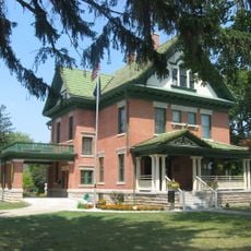
Grant County, Administrative county in Indiana, United States

Grant County is an administrative county located in north-central Indiana that encompasses both rural farmland and developed areas. The region includes several municipalities and serves as a functioning center for local governance and community services.

Grant County was established in 1831 as part of Indiana's territorial expansion and administrative organization during the early statehood period. This founding enabled systematic settlement and governance of the region during the 19th century.

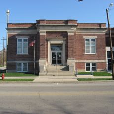
The county maintains several educational institutions, including vocational training centers and higher education facilities that shape the local educational landscape.

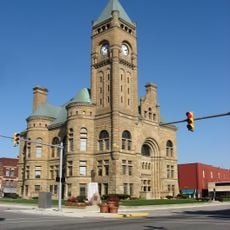
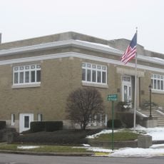
Marion functions as the county seat and houses the main governmental offices and administrative facilities for the region. Residents and visitors can access local services and resources through the county's central hub.

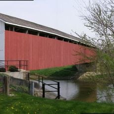
The county played a significant role in Indiana's railroad development, with multiple railway lines crossing through its territory. These transportation connections contributed to the region's economic growth during the 19th and early 20th centuries.

Location: Indiana

Inception: February 10, 1831

Capital city: Marion

Shares border with: Huntington County, Wells County, Delaware County, Madison County, Wabash County, Tipton County, Howard County, Blackford County, Miami County

Website: http://grantcounty.net

GPS coordinates: 40.52000,-85.65000

Latest update: December 7, 2025 19:22

Photos
Around this place
Dr. Richard Davis House
United States of America

Dr. Richard Davis House

7.9 km
Marie Webster House
United States of America

Marie Webster House

3.7 km
Gene Stratton-Porter Cabin
United States of America

Gene Stratton-Porter Cabin

25.9 km
Marion National Cemetery
United States of America

Marion National Cemetery

1.7 km
Blackford County Courthouse
United States of America

Blackford County Courthouse

25.1 km
First Presbyterian Church
United States of America

First Presbyterian Church

25 km
Hartford City Courthouse Square Historic District
United States of America

Hartford City Courthouse Square Historic District

25.1 km
Cumberland Covered Bridge
United States of America

Cumberland Covered Bridge

20.2 km
Grant County Jail and Sheriff's Residence
United States of America

Grant County Jail and Sheriff's Residence

4.4 km
Mount Zion Methodist Episcopal Church
United States of America

Mount Zion Methodist Episcopal Church

28.1 km
Miami Indian
United States of America

Miami Indian

31.7 km
Israel Jenkins House
United States of America

Israel Jenkins House

10.7 km
Gas City High School
United States of America

Gas City High School

5.2 km
Marion Downtown Commercial Historic District
United States of America

Marion Downtown Commercial Historic District

4.3 km
Elwood Downtown Historic District
United States of America

Elwood Downtown Historic District

31.6 km
Montpelier Carnegie Library
United States of America

Montpelier Carnegie Library

31.7 km
Aaron Swayzee House
United States of America

Aaron Swayzee House

4.9 km
J. Woodrow Wilson House
United States of America

J. Woodrow Wilson House

4.5 km
Hominy Ridge Shelter House
United States of America

Hominy Ridge Shelter House

32.3 km
West Ward School
United States of America

West Ward School

4.4 km
Meshingomesia Cemetery and Indian School Historic District
United States of America

Meshingomesia Cemetery and Indian School Historic District

15.1 km
Baldwin Addition Historic District
United States of America

Baldwin Addition Historic District

11.3 km
Thompson-Ray House
United States of America

Thompson-Ray House

4.9 km
LaFontaine Historic District
United States of America

LaFontaine Historic District

18.2 km
Abijah C. Jay House
United States of America

Abijah C. Jay House

4 km
J.W. Patterson House
United States of America

J.W. Patterson House

11.6 km
Converse-Jackson Township Public Library
United States of America

Converse-Jackson Township Public Library

20 km
Fairmount Commercial Historic District
United States of America

Fairmount Commercial Historic District

11.6 km
Show the full map
Reviews

Visited this place? Tap the stars to rate it and share your experience / photos with the community! Try now! You can cancel it anytime.

Administrative divisions
« Grant County - Administrative county in Indiana, United States » is provided by Around Us (aroundus.com). Images and texts are derived from Wikimedia project under a Creative Commons license. You are allowed to copy, distribute, and modify copies of this page, under the conditions set by the license, as long as this note is clearly visible.

Discover hidden gems everywhere you go!

From secret cafés to breathtaking viewpoints, skip the crowded tourist spots and find places that match your style. Our app makes it easy with voice search, smart filtering, route optimization, and insider tips from travelers worldwide. Download now for the complete mobile experience.

Around Us App Screenshot

A unique approach to discovering new places

Le Figaro

All the places worth exploring

France Info

A tailor-made excursion in just a few clicks

20 Minutes