Ottawa County

Log in to your account

AroundUs is a community-driven map of interesting places, built by curious explorers like you. It grows with every review, story, and photo you share.
Connect to save your favorite spots, contribute locations, and create personalized routes.
Continue with Google
Continue with Apple
Continue with X
Continue with Facebook
Continue with email
By continuing, you accept our Terms and Conditions and our Privacy Policy
Create an account
Add to collection
Map
Suggest a change
Share

Ottawa County, Administrative county in northeastern Oklahoma, United States.

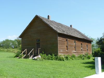
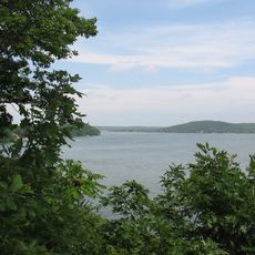
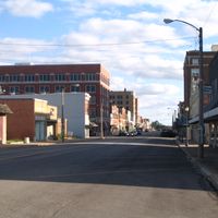
Ottawa County occupies the northeastern corner of Oklahoma, with Miami functioning as the governmental and social hub of the territory. The landscape features woodlands, prairie sections, and waterways that characterize life and economic activity across the region.

The county was established as an administrative division in 1907 when Oklahoma achieved statehood, receiving its name from the Ottawa Tribe that had long inhabited the area. Lead and zinc discoveries in the early 1900s sparked mining operations that shaped the region's economic development and created lasting environmental concerns.

The territory is home to several Native American nations, including the Modoc and Quapaw peoples, whose presence shapes the community's identity and daily rhythms. Miami serves as the county seat and functions as a gathering point for residents.

Visitors can use Miami as their main entry point to access governmental services and get oriented in the region. Spring and autumn offer the most pleasant conditions for exploring, as the weather is comfortable and the landscape looks inviting.

The region contains historical lead and zinc mining sites that are part of the Tar Creek Superfund Site, now representing environmental recovery efforts. These former mining locations tell the story of Oklahoma's industrial past and offer insight into how the landscape has changed over time.

Location: Oklahoma

Inception: 1907

Capital city: Miami

Shares border with: Cherokee County, Delaware County, Newton County, McDonald County, Craig County

Website: http://ottawacountygov.com

GPS coordinates: 36.84000,-94.81000

Latest update: December 7, 2025 19:25

Photos
Around this place
Ghost light
United States of America

Ghost light

18.8 km
Bonnie & Clyde Garage Apartment
United States of America

Bonnie & Clyde Garage Apartment

35.2 km
Grand Lake o' the Cherokees
United States of America

Grand Lake o' the Cherokees

25.5 km
Rainbow Bridge
United States of America

Rainbow Bridge

26.7 km
St. Peter the Apostle Catholic Church and Rectory
United States of America

St. Peter the Apostle Catholic Church and Rectory

36 km
Wildcat Glades Conservation and Audubon Center
United States of America

Wildcat Glades Conservation and Audubon Center

33.5 km
Coleman Theatre
United States of America

Coleman Theatre

7.3 km
Splitlog Church
United States of America

Splitlog Church

25.8 km
Fifth and Main Historic District
United States of America

Fifth and Main Historic District

38 km
Attucks School
United States of America

Attucks School

38.3 km
John Patrick McNaughton Barn
United States of America

John Patrick McNaughton Barn

6.8 km
Scottish Rite Cathedral
United States of America

Scottish Rite Cathedral

37.8 km
First Methodist Episcopal Church, South
United States of America

First Methodist Episcopal Church, South

38.3 km
George L. Coleman Sr. House
United States of America

George L. Coleman Sr. House

6.6 km
Edgar Backus Schermerhorn House
United States of America

Edgar Backus Schermerhorn House

31.2 km
Johnston Library
United States of America

Johnston Library

21.8 km
Olivia Apartments
United States of America

Olivia Apartments

37.8 km
Joplin Carnegie Library
United States of America

Joplin Carnegie Library

37.6 km
Rial A. Niles House
United States of America

Rial A. Niles House

21.7 km
Elks Club Lodge No. 501
United States of America

Elks Club Lodge No. 501

38 km
Statue of Mickey Mantle
United States of America

Statue of Mickey Mantle

11 km
Columbus Public Carnegie Library
United States of America

Columbus Public Carnegie Library

37.2 km
Main and Eighth Streets Historic District
United States of America

Main and Eighth Streets Historic District

37.6 km
Corey House/Hotel
United States of America

Corey House/Hotel

27.6 km
Rains Brothers Building
United States of America

Rains Brothers Building

37.7 km
Everett J. Ritchie Tri-State Mineral Museum
United States of America

Everett J. Ritchie Tri-State Mineral Museum

36 km
Galena Mining & Historical Museum
United States of America

Galena Mining & Historical Museum

30.1 km
Splash Park
United States of America

Splash Park

28.9 km
Show the full map
Reviews

Visited this place? Tap the stars to rate it and share your experience / photos with the community! Try now! You can cancel it anytime.

Administrative divisions
« Ottawa County - Administrative county in northeastern Oklahoma, United States » is provided by Around Us (aroundus.com). Images and texts are derived from Wikimedia project under a Creative Commons license. You are allowed to copy, distribute, and modify copies of this page, under the conditions set by the license, as long as this note is clearly visible.

Discover hidden gems everywhere you go!

From secret cafés to breathtaking viewpoints, skip the crowded tourist spots and find places that match your style. Our app makes it easy with voice search, smart filtering, route optimization, and insider tips from travelers worldwide. Download now for the complete mobile experience.

Around Us App Screenshot

A unique approach to discovering new places

Le Figaro

All the places worth exploring

France Info

A tailor-made excursion in just a few clicks

20 Minutes