Enable Location

We need your location to show you interesting places around you

Discover nearby places

Find interesting locations and hidden gems around you

Precise directions

Get accurate directions and distances to places

Your location is never shared with other users. It's only used when you tap the location button.

Millburn

Log in to your account

Start exploring — it's free

Trusted by 61,984 travelers worldwide

Continue with Google
Continue with Apple
or

We will send you a code to connect

By continuing, you accept our Terms and Conditions and our Privacy Policy

Check your inbox

We've sent a pincode in your inbox. Please enter the code below.

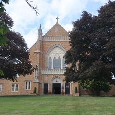
Millburn, Township in Essex County, New Jersey, US.

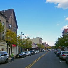
Millburn is a township in Essex County, New Jersey, combining residential neighborhoods with commercial areas throughout its boundaries. The West Branch of the Rahway River runs through the region and helps define its geography.

The New Jersey Legislature created Millburn Township in 1857 by separating it from Springfield Township to form its own municipality. This establishment allowed the growing community to manage its own affairs and development as an independent township.

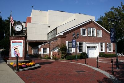
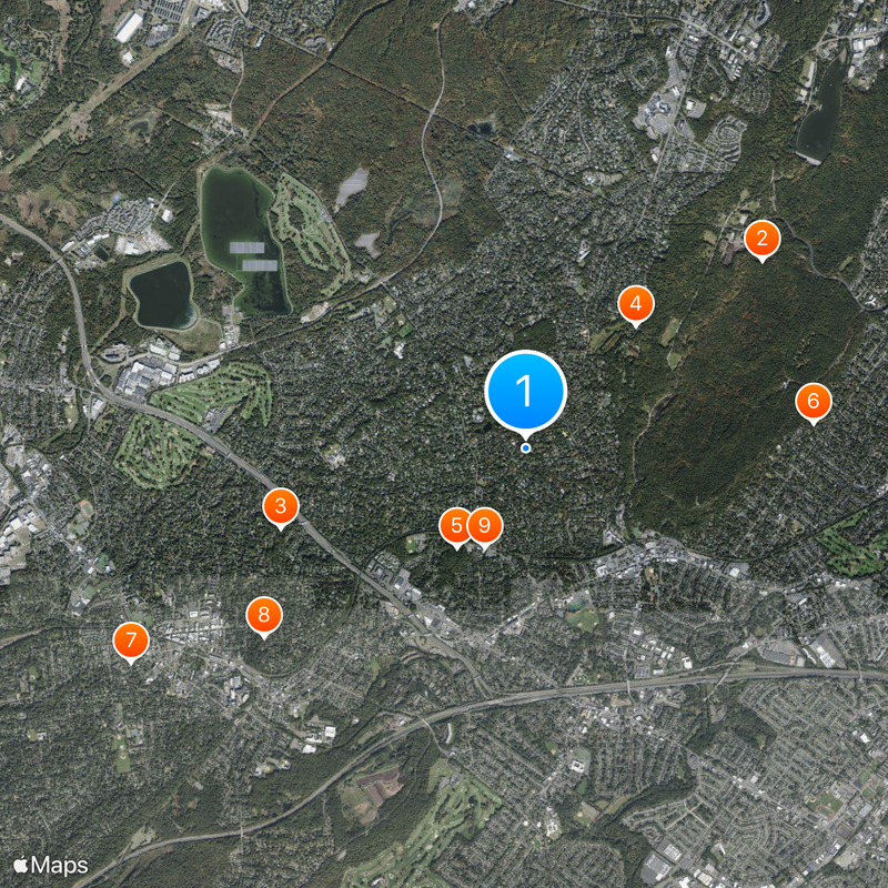
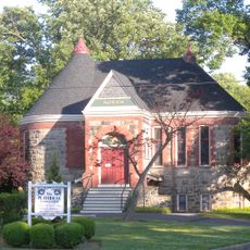
The Paper Mill Playhouse sits along the West Branch of the Rahway River and draws visitors for theater and arts performances year-round. This venue has become a gathering place where the community shares stories and celebrates creative expression together.

New Jersey Transit train stations provide direct connections to Manhattan, making daily commuting convenient for residents and visitors. The township is easily accessible by public transportation and offers straightforward routes for getting around the area.

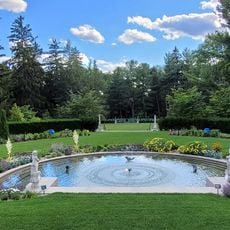
The name Millburn comes from the Scottish word 'burn' for stream, referencing the waterway that powered mills during early settlement. This connection to water and mill operations shaped how the original community grew and functioned.

The community of curious travelers

AroundUs brings together thousands of curated places, local tips, and hidden gems, enriched daily by 60,000 contributors worldwide.

Start exploring
Location
Elevation above the sea
93 m
Shares border with
Florham Park, Livingston, West Orange, Maplewood, Union Township, Springfield Township, Summit, Chatham Borough
GPS coordinates
40.73361,-74.32000
Latest update
December 17, 2025 07:40
Around this place
South Mountain Reservation
United States of America

South Mountain Reservation

2.9 km
Reeves-Reed Arboretum
United States of America

Reeves-Reed Arboretum

2.5 km
Greenwood Gardens
United States of America

Greenwood Gardens

1.6 km
Cora Hartshorn Arboretum and Bird Sanctuary
United States of America

Cora Hartshorn Arboretum and Bird Sanctuary

1.2 km
St. Mary's Abbey Church
United States of America

St. Mary's Abbey Church

2.8 km
Summit Playhouse
United States of America

Summit Playhouse

4.3 km
Twin Maples
United States of America

Twin Maples

3.1 km
Short Hills Park Historic District
United States of America

Short Hills Park Historic District

1 km
Summit Downtown Historic District
United States of America

Summit Downtown Historic District

4.3 km
United States of America

Summit Historical Society

4.2 km
Dominican Monastery of Our Lady of the Rosary
United States of America

Dominican Monastery of Our Lady of the Rosary

4.2 km
United States of America

Hemlock Falls

3.3 km
United States of America

Hawk Hill

1.4 km
United States of America

Beacon Hill 5

3.5 km
599 Springfield Avenue, Summit, NJ
United States of America

599 Springfield Avenue, Summit, NJ

4.6 km
Record Building
United States of America

Record Building

3.8 km
6 Karen Way, Summit, NJ
United States of America

6 Karen Way, Summit, NJ

4 km
United States of America

Footpath between Edgar Street and the high school

4.5 km
11 Blackburn Rd, Summit, NJ
United States of America

11 Blackburn Rd, Summit, NJ

4.6 km
16 Middle Ave, Summit, NJ
United States of America

16 Middle Ave, Summit, NJ

2.3 km
18 Middle Ave, Summit, NJ
United States of America

18 Middle Ave, Summit, NJ

2.2 km
United States of America

Footpath between Montrose Avenue and the high school

4.6 km
United States of America

Taylor Lake

2.6 km
United States of America

Canoe Brook Country Club South Course

3.5 km
United States of America

Canoe Brook Country Club North Course

3.1 km
United States of America

East Orange Golf Course

2.9 km
United States of America

Curate

1.6 km
United States of America

Washington Rock

1.7 km
Show the full map
« Millburn - Township in Essex County, New Jersey, US » is provided by Around Us (aroundus.com). Images and texts are derived from Wikimedia project under a Creative Commons license. You are allowed to copy, distribute, and modify copies of this page, under the conditions set by the license, as long as this note is clearly visible.

Discover hidden gems everywhere you go!

From secret cafés to breathtaking viewpoints, skip the crowded tourist spots and find places that match your style. Our app makes it easy with voice search, smart filtering, route optimization, and insider tips from travelers worldwide. Download now for the complete mobile experience.

Around Us App Screenshot

A unique approach to discovering new places

Le Figaro

All the places worth exploring

France Info

A tailor-made excursion in just a few clicks

20 Minutes

Around Us
Travel Guide & Maps
Download

Send to your phone

QR Code
1

Open the camera app on your mobile.

2

Point at the QR code with your camera. A notification will appear.

3

Tap the notification to open the link.