Nottoway County

Log in to your account

AroundUs is a community-driven map of interesting places, built by curious explorers like you. It grows with every review, story, and photo you share.
Connect to save your favorite spots, contribute locations, and create personalized routes.
Continue with Google
Continue with Apple
Continue with X
Continue with Facebook
Continue with email
By continuing, you accept our Terms and Conditions and our Privacy Policy
Create an account
Add to collection
Map
Suggest a change
Share

Nottoway County, Administrative county in southern Virginia, United States

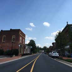
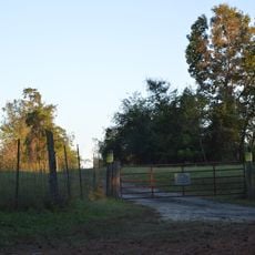
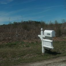
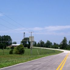
Nottoway County is a county in southern Virginia with three incorporated towns: Blackstone, Burkeville, and Crewe positioned along major transportation corridors. The county extends across a significant rural area where these settlements serve as local centers.

Nottoway County was formed in 1788 from Nottoway Parish of Amelia County, taking its name from the Nadowa Native American tribe meaning rattlesnake. This naming choice reflects the indigenous presence that once shaped the region.

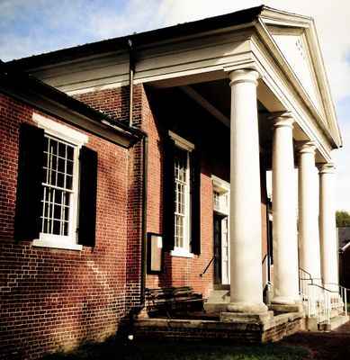
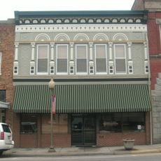
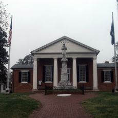
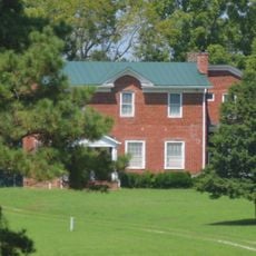
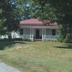
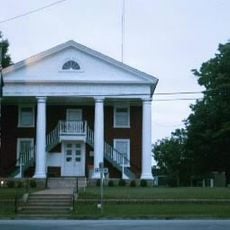
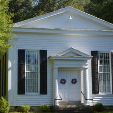
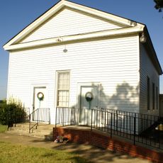
The courthouse in the county seat stands as a key landmark recognized for its historical value. Visitors can see how this structure reflects the area's past through its architecture.

County government services operate through convenience centers with adjusted hours during major holidays such as Thanksgiving. Plan visits around these periods if you need to access public services or local facilities.

In 1860, Nottoway County had the highest proportion of enslaved people among all Virginia counties. This figure underscores the difficult historical circumstances that shaped the area during that period.

Location: Virginia

Inception: 1789

Capital city: Nottoway

Shares border with: Amelia County, Brunswick County, Dinwiddie County, Lunenburg County, Prince Edward County

Website: http://nottoway.org

GPS coordinates: 37.14000,-78.05000

Latest update: December 7, 2025 19:30

Photos
Around this place
High Bridge Trail State Park
United States of America

High Bridge Trail State Park

30.5 km
Twin Lakes State Park
United States of America

Twin Lakes State Park

20.2 km
Sailor's Creek Battlefield Historical State Park
United States of America

Sailor's Creek Battlefield Historical State Park

24.2 km
Cumberland State Forest
United States of America

Cumberland State Forest

16.2 km
Hyde Park
United States of America

Hyde Park

11 km
Haw Branch
United States of America

Haw Branch

30.2 km
Blackstone Historic District
United States of America

Blackstone Historic District

8.4 km
Nottoway County Courthouse
United States of America

Nottoway County Courthouse

3 km
Victoria High School
United States of America

Victoria High School

22.3 km
St. John's Church
United States of America

St. John's Church

29.7 km
Dykeland
United States of America

Dykeland

32.1 km
Gordonsville Historic District
United States of America

Gordonsville Historic District

8.4 km
Butterwood Methodist Church and Butterwood Cemetery
United States of America

Butterwood Methodist Church and Butterwood Cemetery

18.4 km
Montrose
United States of America

Montrose

28.3 km
Bechelbronn
United States of America

Bechelbronn

13.8 km
Mountain Hall
United States of America

Mountain Hall

8.5 km
Fifth Avenue Historic District
United States of America

Fifth Avenue Historic District

27.8 km
Goodwin Lake Swim Beach
United States of America

Goodwin Lake Swim Beach

20.8 km
Zehmer Farm
United States of America

Zehmer Farm

33.4 km
Millbrook
United States of America

Millbrook

6.3 km
Farmer House
United States of America

Farmer House

18.8 km
Oakridge
United States of America

Oakridge

7.2 km
Lunenburg Courthouse Historic District
United States of America

Lunenburg Courthouse Historic District

27.8 km
Rocky Run Methodist Church
United States of America

Rocky Run Methodist Church

25.2 km
Ingleside
United States of America

Ingleside

27.3 km
Rennie Memorial Presbyterian Church
United States of America

Rennie Memorial Presbyterian Church

18.6 km
Robert Russa Moton Boyhood Home
United States of America

Robert Russa Moton Boyhood Home

28.1 km
Lunenburg Fire Tower
United States of America

Lunenburg Fire Tower

27.7 km
Show the full map
Reviews

Visited this place? Tap the stars to rate it and share your experience / photos with the community! Try now! You can cancel it anytime.

Administrative divisions
« Nottoway County - Administrative county in southern Virginia, United States » is provided by Around Us (aroundus.com). Images and texts are derived from Wikimedia project under a Creative Commons license. You are allowed to copy, distribute, and modify copies of this page, under the conditions set by the license, as long as this note is clearly visible.

Discover hidden gems everywhere you go!

From secret cafés to breathtaking viewpoints, skip the crowded tourist spots and find places that match your style. Our app makes it easy with voice search, smart filtering, route optimization, and insider tips from travelers worldwide. Download now for the complete mobile experience.

Around Us App Screenshot

A unique approach to discovering new places

Le Figaro

All the places worth exploring

France Info

A tailor-made excursion in just a few clicks

20 Minutes