Enable Location

We need your location to show you interesting places around you

Discover nearby places

Find interesting locations and hidden gems around you

Precise directions

Get accurate directions and distances to places

Your location is never shared with other users. It's only used when you tap the location button.

Quechee

Log in to your account

Start exploring — it's free

Trusted by 61,911 travelers worldwide

Continue with Google
Continue with Apple
or

We will send you a code to connect

By continuing, you accept our Terms and Conditions and our Privacy Policy

Check your inbox

We've sent a pincode in your inbox. Please enter the code below.

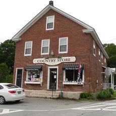
Quechee, Census-designated place in Hartford, Vermont, United States.

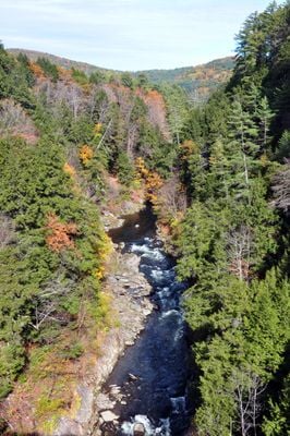
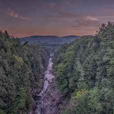
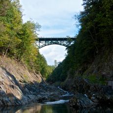
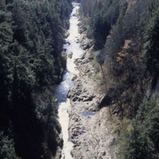
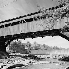
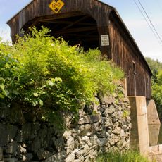
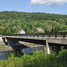
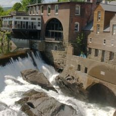
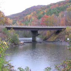
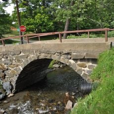
Quechee is a village in central Vermont where the Ottauquechee River carves through layers of rock, creating a dramatic gorge that defines the landscape. A covered bridge crosses the river, and mill buildings line its banks, now converted into shops and galleries.

Native people of the Abenaki nation settled along the river thousands of years ago, leaving traces of villages in the region. European settlers later harnessed the river's power for mills, transforming the landscape into an industrial center during the 1800s.

The Simon Pearce glass studio preserves traditional hand-blowing techniques in a restored mill next to the covered bridge spanning the Ottauquechee River. Visitors watch artisans at work and can purchase pieces made using time-honored methods.

The village sits along U.S. Route 4, making it accessible by car from nearby towns, with ample parking near the river and gorge area. Fall offers the most crowded visiting conditions when leaf colors peak, but spring through summer provide pleasant walking weather.

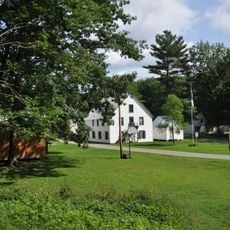
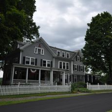
Quechee Lakes, a planned residential development created in the late 1960s, added ski slopes and homes to the surrounding landscape, reshaping how the area developed. This neighborhood exists alongside the older mill district, showing two different eras of growth.

The community of curious travelers

AroundUs brings together thousands of curated places, local tips, and hidden gems, enriched daily by 60,000 contributors worldwide.

Start exploring
Location
GPS coordinates
43.64556,-72.41833
Latest update
December 7, 2025 19:31
Around this place
Quechee Gorge
United States of America

Quechee Gorge

1.4 km
Marsh-Billings-Rockefeller National Historical Park
United States of America

Marsh-Billings-Rockefeller National Historical Park

9.5 km
Quechee Gorge Bridge
United States of America

Quechee Gorge Bridge

1.2 km
Quechee State Park
United States of America

Quechee State Park

1.7 km
Taftsville Covered Bridge
United States of America

Taftsville Covered Bridge

4.3 km
George Perkins Marsh Boyhood Home
United States of America

George Perkins Marsh Boyhood Home

8.3 km
The Main Street Museum
United States of America

The Main Street Museum

8 km
Taftsville Historic District
United States of America

Taftsville Historic District

4.8 km
White River Junction Historic District
United States of America

White River Junction Historic District

8 km
King Farm
United States of America

King Farm

10.5 km
Willard Covered Bridge
United States of America

Willard Covered Bridge

8 km
West Hartford Bridge
United States of America

West Hartford Bridge

7.4 km
Quechee Historic Mill District
United States of America

Quechee Historic Mill District

187 m
Jericho Rural Historic District
United States of America

Jericho Rural Historic District

7.4 km
Advent Camp Meeting Grounds Historic District
United States of America

Advent Camp Meeting Grounds Historic District

8.8 km
Hartford Library
United States of America

Hartford Library

6.3 km
Billings Farm Museum
United States of America

Billings Farm Museum

8 km
Jedediah Strong II House
United States of America

Jedediah Strong II House

1.4 km
Stone Arch Underpass
United States of America

Stone Arch Underpass

9.2 km
Abbott Memorial Library
United States of America

Abbott Memorial Library

10 km
Dewey House
United States of America

Dewey House

1.1 km
Progressive Market
United States of America

Progressive Market

8 km
Charles Marsh Law Office
United States of America

Charles Marsh Law Office

7.4 km
Ottauquechee River Bridge
United States of America

Ottauquechee River Bridge

7 km
Kendron Brook Bridge
United States of America

Kendron Brook Bridge

10.6 km
Joseph and Daniel Marsh House
United States of America

Joseph and Daniel Marsh House

933 m
Christian Street Rural Historic District
United States of America

Christian Street Rural Historic District

9.4 km
Terraces Historic District
United States of America

Terraces Historic District

7.5 km
Show the full map
« Quechee - Census-designated place in Hartford, Vermont, United States » is provided by Around Us (aroundus.com). Images and texts are derived from Wikimedia project under a Creative Commons license. You are allowed to copy, distribute, and modify copies of this page, under the conditions set by the license, as long as this note is clearly visible.

Discover hidden gems everywhere you go!

From secret cafés to breathtaking viewpoints, skip the crowded tourist spots and find places that match your style. Our app makes it easy with voice search, smart filtering, route optimization, and insider tips from travelers worldwide. Download now for the complete mobile experience.

Around Us App Screenshot

A unique approach to discovering new places

Le Figaro

All the places worth exploring

France Info

A tailor-made excursion in just a few clicks

20 Minutes

Around Us
Travel Guide & Maps
Download

Send to your phone

QR Code
1

Open the camera app on your mobile.

2

Point at the QR code with your camera. A notification will appear.

3

Tap the notification to open the link.