Enable Location

We need your location to show you interesting places around you

Discover nearby places

Find interesting locations and hidden gems around you

Precise directions

Get accurate directions and distances to places

Your location is never shared with other users. It's only used when you tap the location button.

East Hartford

Log in to your account

Start exploring — it's free

Trusted by 61,553 travelers worldwide

Continue with Google
Continue with Apple
or

We will send you a code to connect

By continuing, you accept our Terms and Conditions and our Privacy Policy

Check your inbox

We've sent a pincode in your inbox. Please enter the code below.

East Hartford, Industrial town in Hartford County, Connecticut, United States

Description

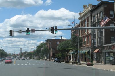
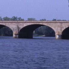
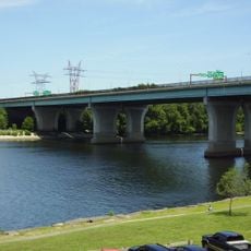
East Hartford spreads along the eastern shore of the Connecticut River, facing the state capital across the water. The town contains residential neighborhoods, commercial districts, and green areas that extend from the riverbank toward gently rolling inland terrain.

History

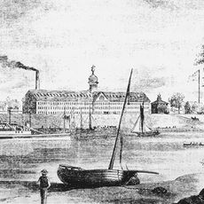
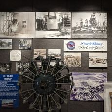
The area belonged to the Podunk before Thomas Burnham acquired land in 1659, opening the way for European settlement. This farming community later grew into an industrial center after aircraft engine production arrived in the 20th century.

Culture

The local arts commission holds readings, exhibitions, and concerts at the library where residents gather to hear writers and musicians. These events bring the community together around creative work in a space that welcomes visitors of all backgrounds.

Practical

Municipal services for land records, bill payments, and permit applications are available online through the government website. Most public facilities and parks are accessible by car, with free parking available in residential areas.

Did you know?

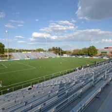
The stadium at Rentschler Field sits on land that once served as an airport, now hosting soccer and football matches for 40,000 guests. Its name honors Frederick Rentschler, founder of the aircraft engine company that shaped the industrial character of the area.

Location
Inception
1783
Elevation above the sea
15 m
GPS coordinates
41.76139,-72.61528
Latest update
December 17, 2025 07:32

AroundUs brings together thousands of curated places, local tips, and hidden gems, enriched daily by 60,000 contributors worldwide. Discover all places nearby (Capitol Planning Region).

Around this place
Pratt & Whitney Stadium
United States of America

Pratt & Whitney Stadium

353 m
Trinity Health Stadium
United States of America

Trinity Health Stadium

3.9 km
Colt Armory
United States of America

Colt Armory

4.1 km
Bulkeley Bridge
United States of America

Bulkeley Bridge

4.2 km
Charter Oak Bridge
United States of America

Charter Oak Bridge

3.3 km
United States of America

Wickham Park

4.1 km
Crossroads Community Cathedral
United States of America

Crossroads Community Cathedral

3.1 km
Downtown Main Street Historic District
United States of America

Downtown Main Street Historic District

2.5 km
Makens Bemont House
United States of America

Makens Bemont House

1.8 km
Connecticut Southern railroad bridge
United States of America

Connecticut Southern railroad bridge

3.9 km
Selden Brewer House
United States of America

Selden Brewer House

3.1 km
Gilman-Hayden House
United States of America

Gilman-Hayden House

3.7 km
Central Avenue-Center Cemetery Historic District
United States of America

Central Avenue-Center Cemetery Historic District

2.3 km
United States of America

Garvan-Carroll Historic District

2.8 km
Pratt & Whitney Hangar Museum
United States of America

Pratt & Whitney Hangar Museum

1.3 km
United States of America

Veterans Memorial Park

2.7 km
United States of America

North End Park

2.6 km
United States of America

Doctor Richard E Gorman Park

3.1 km
United States of America

Hockanum Park

3.3 km
United States of America

Goodwin Playground

2.7 km
United States of America

Dwyer Park

4 km
United States of America

Burnside Theatre

1.9 km
United States of America

Showcase Cinemas East Hartford

1.2 km
United States of America

Career Column

4.1 km
United States of America

Transcontinental

4.1 km
United States of America

A Welcome Conversation

4.1 km
United States of America

Equality

3.6 km
United States of America

The Circuit Rider

4 km
Show the full map
« East Hartford - Industrial town in Hartford County, Connecticut, United States » is provided by Around Us (aroundus.com). Images and texts are derived from Wikimedia project under a Creative Commons license. You are allowed to copy, distribute, and modify copies of this page, under the conditions set by the license, as long as this note is clearly visible.

Discover hidden gems everywhere you go!

From secret cafés to breathtaking viewpoints, skip the crowded tourist spots and find places that match your style. Our app makes it easy with voice search, smart filtering, route optimization, and insider tips from travelers worldwide. Download now for the complete mobile experience.

Around Us App Screenshot

A unique approach to discovering new places

Le Figaro

All the places worth exploring

France Info

A tailor-made excursion in just a few clicks

20 Minutes

Around Us
Travel Guide & Maps
Download

Send to your phone

QR Code
1

Open the camera app on your mobile.

2

Point at the QR code with your camera. A notification will appear.

3

Tap the notification to open the link.