Enable Location

We need your location to show you interesting places around you

Discover nearby places

Find interesting locations and hidden gems around you

Precise directions

Get accurate directions and distances to places

Your location is never shared with other users. It's only used when you tap the location button.

Chillicothe

Log in to your account

Start exploring — it's free

Trusted by 61,899 travelers worldwide

Continue with Google
Continue with Apple
or

We will send you a code to connect

By continuing, you accept our Terms and Conditions and our Privacy Policy

Check your inbox

We've sent a pincode in your inbox. Please enter the code below.

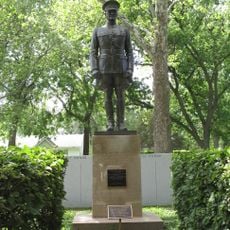
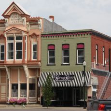
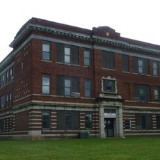
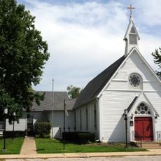
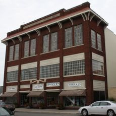
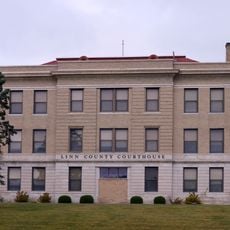
Chillicothe, County seat in Livingston County, Missouri.

Chillicothe is the county seat of Livingston County in north central Missouri. The town sits at the intersection of U.S. Highways 36 and 65 and spreads across rolling terrain at an elevation of approximately 243 meters.

The territory was originally inhabited by the Osage and Missouri peoples before Shawnee and Iowa nations moved to the area around 1800 due to pressure from European settlers. The founding of the modern town followed as part of westward expansion.

The name comes from the Shawnee language and refers to historic settlements of this people. The town carries this name as a connection to the capital that bore the same designation in Ohio.

The town is easily reached via Highways 36 and 65, with direct routes to Kansas City and Saint Joseph. Visitors will find modern facilities and solid infrastructure that make getting around straightforward.

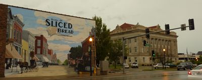
The Chillicothe Baking Company made history here on July 7, 1928, by introducing the first commercially produced pre-sliced bread using the Rohwedder Bread Slicer. This invention transformed bread production worldwide and remains a noteworthy local milestone.

The community of curious travelers

AroundUs brings together thousands of curated places, local tips, and hidden gems, enriched daily by 60,000 contributors worldwide.

Start exploring
Inception
1855
Elevation above the sea
243 m
GPS coordinates
39.79310,-93.55190
Latest update
December 20, 2025 02:31
Around this place
Locust Creek Covered Bridge State Historic Site
United States of America

Locust Creek Covered Bridge State Historic Site

27.2 km
Pershing State Park
United States of America

Pershing State Park

29.1 km
Gen. John J. Pershing Boyhood Home State Historic Site
United States of America

Gen. John J. Pershing Boyhood Home State Historic Site

32.8 km
Crowder State Park
United States of America

Crowder State Park

34.5 km
United States of America

Plaza Hotel

31.8 km
Courthouse Square Historic District
United States of America

Courthouse Square Historic District

129 m
Trenton High School
United States of America

Trenton High School

31.6 km
United States of America

St. Philip's Episcopal Church

31.7 km
Grace Episcopal Church
United States of America

Grace Episcopal Church

1.1 km
Chillicothe Commercial Historic District
United States of America

Chillicothe Commercial Historic District

110 m
United States of America

Linn County Jail and Sheriff's Residence

32.5 km
United States of America

WPA Stock Barn and Pavilion

32 km
United States of America

Plum Grove School

30.1 km
United States of America

Jewett Norris Library

32.1 km
United States of America

Silver Lake

37.3 km
United States of America

Swan Lake Pool

33 km
Linn County Courthouse
United States of America

Linn County Courthouse

32.5 km
United States of America

Crowder State Park Vehicle Bridge

34.6 km
United States of America

Bill Seltzer Lake

37 km
Locust Creek Covered Bridge
United States of America

Locust Creek Covered Bridge

27.2 km
United States of America

Pike Lake

20.5 km
United States of America

Jamesport Municipal Lake

31 km
United States of America

Chillicothe Country Club

1.8 km
United States of America

Maxie, The World's Largest Goose

30.5 km
United States of America

American War Mothers Memorial

29 km
United States of America

Work of art, sculpture

1.4 km
United States of America

Scenic viewpoint

28.8 km
United States of America

Scenic viewpoint

28.6 km
Show the full map
« Chillicothe - County seat in Livingston County, Missouri » is provided by Around Us (aroundus.com). Images and texts are derived from Wikimedia project under a Creative Commons license. You are allowed to copy, distribute, and modify copies of this page, under the conditions set by the license, as long as this note is clearly visible.

Discover hidden gems everywhere you go!

From secret cafés to breathtaking viewpoints, skip the crowded tourist spots and find places that match your style. Our app makes it easy with voice search, smart filtering, route optimization, and insider tips from travelers worldwide. Download now for the complete mobile experience.

Around Us App Screenshot

A unique approach to discovering new places

Le Figaro

All the places worth exploring

France Info

A tailor-made excursion in just a few clicks

20 Minutes

Around Us
Travel Guide & Maps
Download

Send to your phone

QR Code
1

Open the camera app on your mobile.

2

Point at the QR code with your camera. A notification will appear.

3

Tap the notification to open the link.