Enable Location

We need your location to show you interesting places around you

Discover nearby places

Find interesting locations and hidden gems around you

Precise directions

Get accurate directions and distances to places

Your location is never shared with other users. It's only used when you tap the location button.

Middlebury

Log in to your account

Start exploring — it's free

Trusted by 61,891 travelers worldwide

Continue with Google
Continue with Apple
or

We will send you a code to connect

By continuing, you accept our Terms and Conditions and our Privacy Policy

Check your inbox

We've sent a pincode in your inbox. Please enter the code below.

Middlebury, County seat in western central Vermont, US

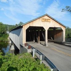
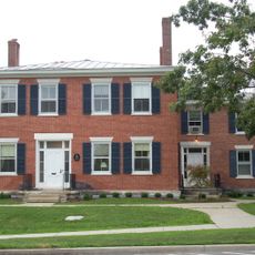
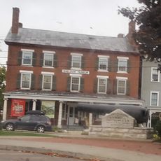
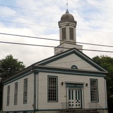
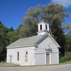
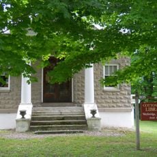
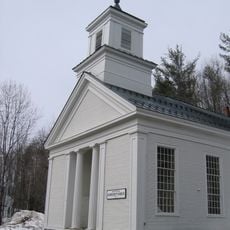
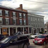
Middlebury is the county seat of Addison County in western central Vermont, nestled among Green Mountain foothills with Otter Creek flowing through its heart. The downtown area clusters around this waterway, blending historic buildings with shops, restaurants, and community services.

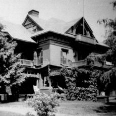
The town received its charter in 1761 from a Colonial official and grew rapidly into an important regional center. By 1830 it had become Vermont's second-largest city, driven by strong economic development and mill industries.

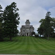
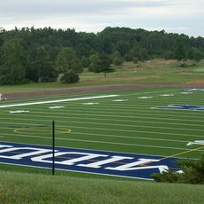
Middlebury College shapes daily life here, with students walking through town and events happening throughout the year. The college forms a strong community presence that influences how locals and visitors experience the place.

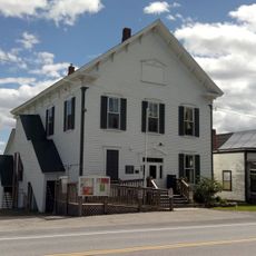
The downtown core is easily walkable with shops, restaurants, and services spread along its streets and near the river. Start in the center and stroll along the waterfront to get a sense of how locals move through the community.

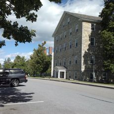
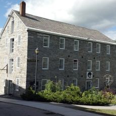
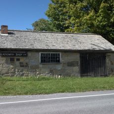
For over a century, the town ran mills along the river for sawing, paper making, and textiles, drawing power from the waterway to fuel production. Though most mills closed long ago, their stone buildings still stand as reminders of that industrial past.

The community of curious travelers

AroundUs brings together thousands of curated places, local tips, and hidden gems, enriched daily by 60,000 contributors worldwide.

Start exploring
Location
Inception
November 2, 1761
Elevation above the sea
139 m
GPS coordinates
44.00427,-73.12237
Latest update
December 12, 2025 17:45
Around this place
Robert Frost Farm
United States of America

Robert Frost Farm

10.3 km
Pulp Mill Covered Bridge
United States of America

Pulp Mill Covered Bridge

5 km
Emma Willard House
United States of America

Emma Willard House

4.2 km
Shard Villa
United States of America

Shard Villa

7.6 km
Youngman Field at Alumni Stadium
United States of America

Youngman Field at Alumni Stadium

4.4 km
Henry Sheldon Museum of Vermont History
United States of America

Henry Sheldon Museum of Vermont History

3.9 km
Halpin Covered Bridge
United States of America

Halpin Covered Bridge

5.3 km
Vermont Experimental Cold-Hardy Cactus Garden
United States of America

Vermont Experimental Cold-Hardy Cactus Garden

3.2 km
Old Stone Row
United States of America

Old Stone Row

4.3 km
Lampson School
United States of America

Lampson School

9.8 km
Middlebury Gorge Concrete Arch Bridge
United States of America

Middlebury Gorge Concrete Arch Bridge

4.8 km
Stone Mill
United States of America

Stone Mill

4.2 km
Wesleyan Methodist Church
United States of America

Wesleyan Methodist Church

10.1 km
Cornwall General Store
United States of America

Cornwall General Store

8.5 km
Bridge 26
United States of America

Bridge 26

9.6 km
Union Church
United States of America

Union Church

9.9 km
Old Stone Blacksmith Shop
United States of America

Old Stone Blacksmith Shop

7.3 km
Brooksville Advent Church
United States of America

Brooksville Advent Church

7.9 km
The Heights
United States of America

The Heights

4.7 km
Cornwall Town Hall
United States of America

Cornwall Town Hall

8.5 km
Cotton Free Library
United States of America

Cotton Free Library

10.1 km
First Congregational Church of Cornwall Parsonage
United States of America

First Congregational Church of Cornwall Parsonage

8.5 km
Middlebury to Her Soldiers
United States of America

Middlebury to Her Soldiers

3.7 km
Fenn Farm
United States of America

Fenn Farm

3.1 km
Ripton Community House
United States of America

Ripton Community House

7.6 km
Salisbury Fish Hatchery
United States of America

Salisbury Fish Hatchery

9.1 km
Middlebury College Museum of Art
United States of America

Middlebury College Museum of Art

4.3 km
Robert Frost Interpretive Area
United States of America

Robert Frost Interpretive Area

10.3 km
Show the full map
Administrative divisions
« Middlebury - County seat in western central Vermont, US » is provided by Around Us (aroundus.com). Images and texts are derived from Wikimedia project under a Creative Commons license. You are allowed to copy, distribute, and modify copies of this page, under the conditions set by the license, as long as this note is clearly visible.

Discover hidden gems everywhere you go!

From secret cafés to breathtaking viewpoints, skip the crowded tourist spots and find places that match your style. Our app makes it easy with voice search, smart filtering, route optimization, and insider tips from travelers worldwide. Download now for the complete mobile experience.

Around Us App Screenshot

A unique approach to discovering new places

Le Figaro

All the places worth exploring

France Info

A tailor-made excursion in just a few clicks

20 Minutes

Around Us
Travel Guide & Maps
Download

Send to your phone

QR Code
1

Open the camera app on your mobile.

2

Point at the QR code with your camera. A notification will appear.

3

Tap the notification to open the link.