Enable Location

We need your location to show you interesting places around you

Discover nearby places

Find interesting locations and hidden gems around you

Precise directions

Get accurate directions and distances to places

Your location is never shared with other users. It's only used when you tap the location button.

Richfield

Log in to your account

Start exploring — it's free

Trusted by 62,922 travelers worldwide

Continue with Google
Continue with Apple
or

We will send you a code to connect

By continuing, you accept our Terms and Conditions and our Privacy Policy

Check your inbox

We've sent a pincode in your inbox. Please enter the code below.

Discussion Reviews 2 Photos
39.2k Popularity

Richfield, Administrative center in suburban Minneapolis, Minnesota, US.

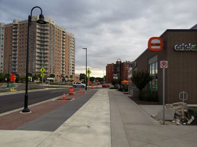
Richfield is a city in Hennepin County located just south of Minneapolis, situated near Minneapolis-Saint Paul International Airport. The area contains residential neighborhoods and commercial zones that developed along major roads and around the downtown area.

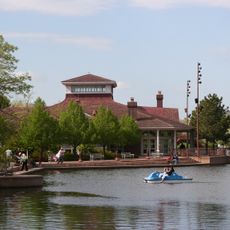
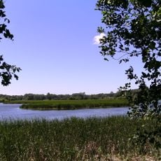
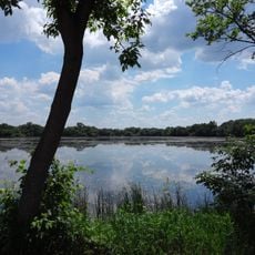
The first settlement began in the 1850s near Wood Lake when Riley Bartholomew opened the area to development. These early foundations transformed the land from farmland into a growing residential community.

The Richfield Public Schools system educates 4,200 students through its network of elementary, middle, and high school facilities across the city.

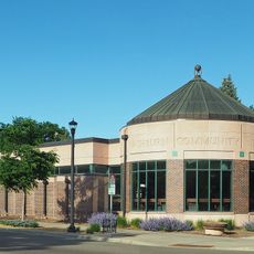
City Hall on Portland Avenue serves as the administrative center with various municipal offices and services. The location makes it easy to reach from Minneapolis and offers convenient access to the airport.

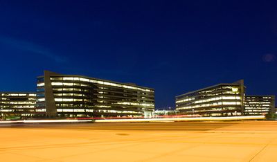
A major technology corporation operates its global headquarters here, making it an important economic center for the region. This presence attracts skilled workers from around the world and shapes the local business landscape.

The community of curious travelers

AroundUs brings together thousands of curated places, local tips, and hidden gems, enriched daily by 60,000 contributors worldwide.

Start exploring
Location
Inception
1908
Elevation above the sea
256 m
Shares border with
Minneapolis, Fort Snelling, Bloomington, Edina
GPS coordinates
44.88333,-93.28333
Latest update
December 17, 2025 09:16
Around this place
Water Park of America
United States of America

Water Park of America

3.6 km
United States of America

Dar Al-Farooq Islamic Center

3.5 km
Centennial Lakes Park
United States of America

Centennial Lakes Park

3.8 km
Edinborough Park
United States of America

Edinborough Park

3.8 km
Washburn Library
United States of America

Washburn Library

2.7 km
Wood Lake Nature Center
United States of America

Wood Lake Nature Center

1.2 km
Southdale Library
United States of America

Southdale Library

3 km
Augsburg Park Library
United States of America

Augsburg Park Library

1.1 km
Riley Lucas Bartholomew House
United States of America

Riley Lucas Bartholomew House

722 m
United States of America

Oxboro Library

4.5 km
The Museum of Russian Art
United States of America

The Museum of Russian Art

2.3 km
Richfield Municipal Pool
United States of America

Richfield Municipal Pool

1.4 km
Washburn Library millstone
United States of America

Washburn Library millstone

2.7 km
Diamond Lake Park
United States of America

Diamond Lake Park

2.1 km
Veterans Memorial Park
United States of America

Veterans Memorial Park

1.6 km
United States of America

Amphitheater at Lyndale Gardens

619 m
United States of America

Work of art, sculpture

222 m
United States of America

Work of art, installation artwork

602 m
United States of America

Work of art

595 m
United States of America

Installation artwork, Work of art

598 m
United States of America

Installation artwork, Work of art

574 m
United States of America

Installation artwork, Work of art

588 m
United States of America

Work of art, statue

3.9 km
United States of America

Work of art, statue

4 km
United States of America

Statue, Work of art

3.7 km
United States of America

Statue, Work of art

3.6 km
United States of America

Memorial, commemorative plaque

3.9 km
United States of America

Maetzold Amphitheater

3.9 km
Show the full map
Reviews
Share your experience

No review yet

Discussions
Start a discussion...

No discussion yet

« Richfield - Administrative center in suburban Minneapolis, Minnesota, US » is provided by Around Us (aroundus.com). Images and texts are derived from Wikimedia project under a Creative Commons license. You are allowed to copy, distribute, and modify copies of this page, under the conditions set by the license, as long as this note is clearly visible.

Discover hidden gems everywhere you go!

From secret cafés to breathtaking viewpoints, skip the crowded tourist spots and find places that match your style. Our app makes it easy with voice search, smart filtering, route optimization, and insider tips from travelers worldwide. Download now for the complete mobile experience.

Around Us App Screenshot

A unique approach to discovering new places

Le Figaro

All the places worth exploring

France Info

A tailor-made excursion in just a few clicks

20 Minutes

Around Us
Travel Guide & Maps
Download

Send to your phone

QR Code
1

Open the camera app on your mobile.

2

Point at the QR code with your camera. A notification will appear.

3

Tap the notification to open the link.