Enable Location

We need your location to show you interesting places around you

Discover nearby places

Find interesting locations and hidden gems around you

Precise directions

Get accurate directions and distances to places

Your location is never shared with other users. It's only used when you tap the location button.

Keystone Corridor

Log in to your account

Start exploring — it's free

Trusted by 62,436 travelers worldwide

Continue with Google
Continue with Apple
or

We will send you a code to connect

By continuing, you accept our Terms and Conditions and our Privacy Policy

Check your inbox

We've sent a pincode in your inbox. Please enter the code below.

Keystone Corridor

Keystone Corridor, railway line

The Keystone Corridor is a 353-mile railroad route that connects Pittsburgh with Philadelphia, running across Pennsylvania. The line carries both passenger and freight trains, with Norfolk Southern operating the western section and Amtrak managing the eastern portion from Harrisburg to Philadelphia.

The corridor was built starting in the 1830s and 1850s by the Pennsylvania Railroad to support growing industries like coal and iron. The eastern section was electrified in the 1930s, allowing for faster and cleaner train operation.

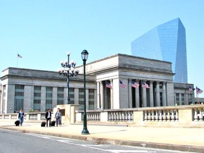
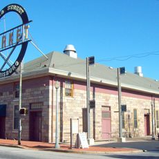
The corridor links major cities with smaller towns along a route that shapes how people and goods move through Pennsylvania. Train stations serve as gathering points where communities connect to larger networks, supporting local economic activity and social exchange.

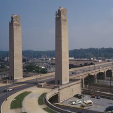
The corridor travels through varying elevations and curves, notably the famous Horseshoe Curve near Altoona that helps trains navigate mountains. Visitors should know that passenger and freight services share portions of the route and schedules may vary depending on the time of day.

The famous Horseshoe Curve near Altoona is an engineering solution over 150 years old that allows trains to climb steep mountain grades without reversing direction. This distinctive curve remains a striking feature of the route and demonstrates the ingenuity of early railroad planners.

The community of curious travelers

AroundUs brings together thousands of curated places, local tips, and hidden gems, enriched daily by 60,000 contributors worldwide.

Start exploring
Location
Part of
Amtrak
GPS coordinates
40.28580,-76.86170
Latest update
February 7, 2026 09:31
Around this place
Pennsylvania State Capitol
United States of America

Pennsylvania State Capitol

3 km
Pennsylvania State Capitol Complex
United States of America

Pennsylvania State Capitol Complex

2.9 km
Whitaker Center for Science and the Arts
United States of America

Whitaker Center for Science and the Arts

3.3 km
United States of America

Commonwealth

3 km
Broad Street Market
United States of America

Broad Street Market

2.9 km
State Street Bridge
United States of America

State Street Bridge

2.6 km
Cathedral of Saint Patrick
United States of America

Cathedral of Saint Patrick

3.2 km
Susquehanna Art Museum
United States of America

Susquehanna Art Museum

2.9 km
Ronald Reagan Federal Building
United States of America

Ronald Reagan Federal Building

3.2 km
Harrisburg Military Post
United States of America

Harrisburg Military Post

1.4 km
Harris Switch Tower
United States of America

Harris Switch Tower

2.7 km
Kesher Israel Congregation
United States of America

Kesher Israel Congregation

3.2 km
Mulberry Street Bridge
United States of America

Mulberry Street Bridge

3 km
Harrisburg Midtown Arts Center
United States of America

Harrisburg Midtown Arts Center

3 km
National Civil War Museum
United States of America

National Civil War Museum

1.6 km
Pennsylvania National Fire Museum
United States of America

Pennsylvania National Fire Museum

2.8 km
Old Uptown Historic District
United States of America

Old Uptown Historic District

3.1 km
Old Midtown Historic District
United States of America

Old Midtown Historic District

3.2 km
Harrisburg Technical High School
United States of America

Harrisburg Technical High School

3 km
Mount Pleasant Historic District
United States of America

Mount Pleasant Historic District

2.6 km
Sheffield Apartments
United States of America

Sheffield Apartments

3 km
Wesley Union African Methodist Episcopal Zion Church
United States of America

Wesley Union African Methodist Episcopal Zion Church

2.7 km
Simon Cameron School
United States of America

Simon Cameron School

3 km
William Donaldson House
United States of America

William Donaldson House

3 km
William Seel Building
United States of America

William Seel Building

3.1 km
State Museum of Pennsylvania
United States of America

State Museum of Pennsylvania

3 km
Old Downtown Harrisburg Commercial Historic District
United States of America

Old Downtown Harrisburg Commercial Historic District

3.2 km
Kunkel Building
United States of America

Kunkel Building

3.2 km
Show the full map
« Keystone Corridor - railway line » is provided by Around Us (aroundus.com). Images and texts are derived from Wikimedia project under a Creative Commons license. You are allowed to copy, distribute, and modify copies of this page, under the conditions set by the license, as long as this note is clearly visible.

Discover hidden gems everywhere you go!

From secret cafés to breathtaking viewpoints, skip the crowded tourist spots and find places that match your style. Our app makes it easy with voice search, smart filtering, route optimization, and insider tips from travelers worldwide. Download now for the complete mobile experience.

Around Us App Screenshot

A unique approach to discovering new places

Le Figaro

All the places worth exploring

France Info

A tailor-made excursion in just a few clicks

20 Minutes

Around Us
Travel Guide & Maps
Download

Send to your phone

QR Code
1

Open the camera app on your mobile.

2

Point at the QR code with your camera. A notification will appear.

3

Tap the notification to open the link.