Enable Location

We need your location to show you interesting places around you

Discover nearby places

Find interesting locations and hidden gems around you

Precise directions

Get accurate directions and distances to places

Your location is never shared with other users. It's only used when you tap the location button.

Cabo Rojo

Log in to your account

Start exploring — it's free

Trusted by 63,531 travelers worldwide

Continue with Google
Continue with Apple
or

We will send you a code to connect

By continuing, you accept our Terms and Conditions and our Privacy Policy

Check your inbox

We've sent a pincode in your inbox. Please enter the code below.

Discussion Reviews 2 Photos
26.4k Popularity

Cabo Rojo, Administrative division in southwest Puerto Rico, United States.

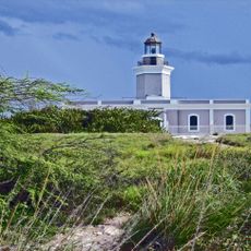
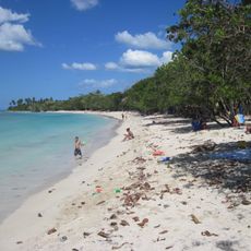
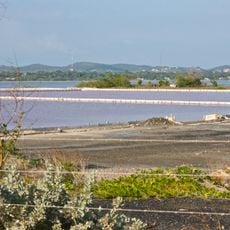
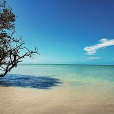
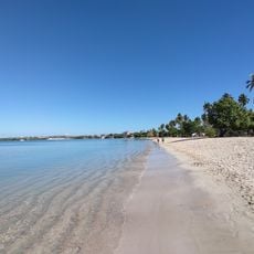
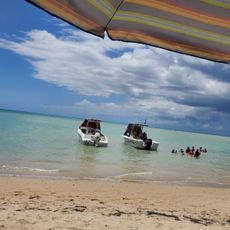
Cabo Rojo is a municipality in southwest Puerto Rico comprising coastal landscapes and diverse habitats. The area includes salt flats, limestone cliffs, mangrove forests, and dry subtropical scrubland that slopes toward the sea.

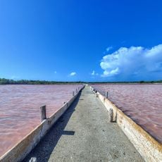
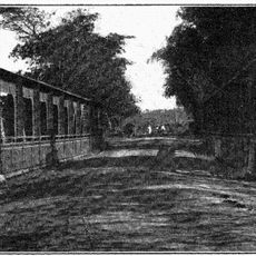
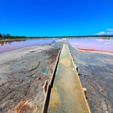
Spanish settlers initiated salt extraction in this region starting in 1525. The settlement was formally established in 1771 and grew into a major salt production center.

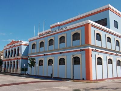
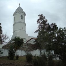
The San Miguel Arcángel Church stands at the heart of the community and showcases neoclassical design from the 18th century. It remains a gathering place that shapes the character of the town.

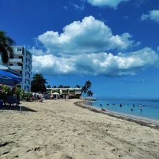
The Cabo Rojo National Wildlife Refuge offers several trails through different landscape types, each with varying difficulty levels. Visitors should arrive early and bring plenty of water, especially during warmer months.

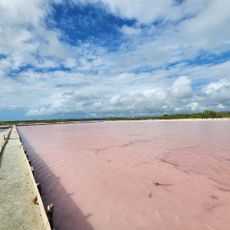
The salt flats and coastal cliffs contain minerals that tint the surrounding water reddish. This natural process inspired the area's name and creates an unusual color display at sunrise and sunset.

The community of curious travelers

AroundUs brings together thousands of curated places, local tips, and hidden gems, enriched daily by 60,000 contributors worldwide.

Start exploring
Location
Inception
December 17, 1771
Capital city
Cabo Rojo
Elevation above the sea
20 m
Shares border with
Lajas, San Germán, Hormigueros, Mayagüez
GPS coordinates
18.08667,-67.14583
Latest update
December 20, 2025 15:08
Around this place
Show the full map
Reviews
Share your experience

No review yet

Discussions
Start a discussion...

No discussion yet

« Cabo Rojo - Administrative division in southwest Puerto Rico, United States » is provided by Around Us (aroundus.com). Images and texts are derived from Wikimedia project under a Creative Commons license. You are allowed to copy, distribute, and modify copies of this page, under the conditions set by the license, as long as this note is clearly visible.

Discover hidden gems everywhere you go!

From secret cafés to breathtaking viewpoints, skip the crowded tourist spots and find places that match your style. Our app makes it easy with voice search, smart filtering, route optimization, and insider tips from travelers worldwide. Download now for the complete mobile experience.

Around Us App Screenshot

A unique approach to discovering new places

Le Figaro

All the places worth exploring

France Info

A tailor-made excursion in just a few clicks

20 Minutes

Around Us
Travel Guide & Maps
Download

Send to your phone

QR Code
1

Open the camera app on your mobile.

2

Point at the QR code with your camera. A notification will appear.

3

Tap the notification to open the link.