Enable Location

We need your location to show you interesting places around you

Discover nearby places

Find interesting locations and hidden gems around you

Precise directions

Get accurate directions and distances to places

Your location is never shared with other users. It's only used when you tap the location button.

Springfield Township

Log in to your account

Start exploring — it's free

Trusted by 61,990 travelers worldwide

Continue with Google
Continue with Apple
or

We will send you a code to connect

By continuing, you accept our Terms and Conditions and our Privacy Policy

Check your inbox

We've sent a pincode in your inbox. Please enter the code below.

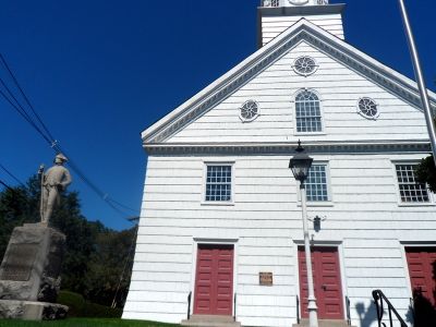
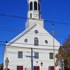
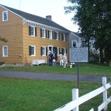
Springfield Township, Township administration center in Delaware County, Pennsylvania, US

Springfield Township is an administrative division in Union County, New Jersey, encompassing residential neighborhoods and public facilities. The township provides municipal services and spaces for its community members.

The township formed during the early development of Union County as a local administrative area. Over time it evolved into a residential community with established municipal structures.

The Board of Supervisors regularly organizes community meetings and events at the township facilities, fostering participation in local decision-making processes.

Administrative offices and municipal buildings are located throughout the area where residents handle permits and services. These facilities operate during standard business hours and offer options for both in-person and online access.

The township implements a specialized robocall notification system that keeps residents informed about emergency updates and municipal announcements.

The community of curious travelers

AroundUs brings together thousands of curated places, local tips, and hidden gems, enriched daily by 60,000 contributors worldwide.

Start exploring
Location
Inception
April 14, 1794
Elevation above the sea
54 m
Shares border with
Union Township, Kenilworth, Cranford, Westfield, Mountainside, Summit, Millburn
GPS coordinates
40.69790,-74.33450
Latest update
December 17, 2025 08:51
Around this place
Baltusrol Golf Club
United States of America

Baltusrol Golf Club

959 m
Reeves-Reed Arboretum
United States of America

Reeves-Reed Arboretum

3.4 km
Cora Hartshorn Arboretum and Bird Sanctuary
United States of America

Cora Hartshorn Arboretum and Bird Sanctuary

3.1 km
Summit Playhouse
United States of America

Summit Playhouse

3.2 km
Springfield Presbyterian Church
United States of America

Springfield Presbyterian Church

2.5 km
United States of America

William Miller Sperry Observatory

3.6 km
Twin Maples
United States of America

Twin Maples

2.5 km
United States of America

Summit Free Public Library

2.9 km
Short Hills Park Historic District
United States of America

Short Hills Park Historic District

3.1 km
Summit Downtown Historic District
United States of America

Summit Downtown Historic District

3.2 km
Hutchings Homestead
United States of America

Hutchings Homestead

2.7 km
Dominican Monastery of Our Lady of the Rosary
United States of America

Dominican Monastery of Our Lady of the Rosary

3.3 km
United States of America

Beacon Hill 5

2.9 km
United States of America

Islamic Center of Union County

4 km
29 Druid Hill Road, Smmit, NJ
United States of America

29 Druid Hill Road, Smmit, NJ

2.8 km
34 Laurel Avenue, Summi, NJ
United States of America

34 Laurel Avenue, Summi, NJ

2.6 km
49 Baltusrol Road, Summit, NJ
United States of America

49 Baltusrol Road, Summit, NJ

1.8 km
Record Building
United States of America

Record Building

3 km
24 Oak Ridge Ave, Summit, NJ
United States of America

24 Oak Ridge Ave, Summit, NJ

2.2 km
11 Blackburn Rd, Summit, NJ
United States of America

11 Blackburn Rd, Summit, NJ

3.3 km
17 Stiles Road, Summit, NJ
United States of America

17 Stiles Road, Summit, NJ

2 km
United States of America

Footpath from Glenside to Oakridge

2.4 km
18 Middle Ave, Summit, NJ
United States of America

18 Middle Ave, Summit, NJ

2.2 km
34 Stockton Road, Summit, NJ
United States of America

34 Stockton Road, Summit, NJ

1.8 km
16 Middle Ave, Summit, NJ
United States of America

16 Middle Ave, Summit, NJ

2.1 km
9 High Street, Summit, NJ
United States of America

9 High Street, Summit, NJ

3.4 km
Sylvan Lane Footpath
United States of America

Sylvan Lane Footpath

1.6 km
United States of America

Curate

3.8 km
Show the full map
« Springfield Township - Township administration center in Delaware County, Pennsylvania, US » is provided by Around Us (aroundus.com). Images and texts are derived from Wikimedia project under a Creative Commons license. You are allowed to copy, distribute, and modify copies of this page, under the conditions set by the license, as long as this note is clearly visible.

Discover hidden gems everywhere you go!

From secret cafés to breathtaking viewpoints, skip the crowded tourist spots and find places that match your style. Our app makes it easy with voice search, smart filtering, route optimization, and insider tips from travelers worldwide. Download now for the complete mobile experience.

Around Us App Screenshot

A unique approach to discovering new places

Le Figaro

All the places worth exploring

France Info

A tailor-made excursion in just a few clicks

20 Minutes

Around Us
Travel Guide & Maps
Download

Send to your phone

QR Code
1

Open the camera app on your mobile.

2

Point at the QR code with your camera. A notification will appear.

3

Tap the notification to open the link.