Chest opened
+${chestReward.xp} XP
Explorer
NOUVEAU ×${chestReward.collectible.quantity}
tapez pour fermer
Chest locked

Open chests in the app

Around Us is built for your phone — chests unlock when you walk, explore and capture nearby places.

Enable Location

We need your location to show you interesting places around you

Discover nearby places

Find interesting locations and hidden gems around you

Precise directions

Get accurate directions and distances to places

Your location is never shared with other users. It's only used when you tap the location button.

Folcroft

Log in to your account

Start exploring — it's free

Trusted by 72,878 travelers worldwide

Continue with Google
Continue with Apple
or

We will send you a code to connect

By continuing, you accept our Terms and Conditions and our Privacy Policy

Check your inbox

We've sent a pincode in your inbox. Please enter the code below.

Discussion Reviews 1 Photos
11.6k Popularity

Folcroft, Administrative borough in Delaware County, Pennsylvania, United States.

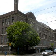
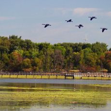
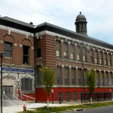
Folcroft is a borough covering roughly 1.4 square miles in Delaware County, situated near Philadelphia International Airport. The area contains residential neighborhoods and commercial zones distributed along principal roadways.

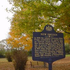
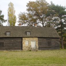
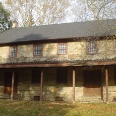
The area traces its roots to Swedish settlements established in the 1600s, with Calcon Hook Road deriving from Swedish terms. Development continued over the centuries, eventually forming a modern residential community adjacent to Philadelphia's growth.

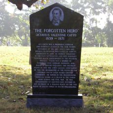
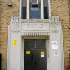
The community holds significance in civil rights history that remains visible in local consciousness and community identity. Its diverse population reflects decades of change and integration within residential neighborhoods.

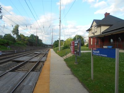
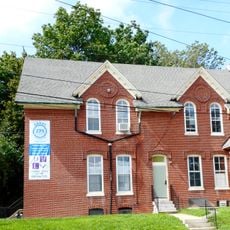
The borough is accessible via SEPTA rail service offering direct connections to Philadelphia and surrounding areas. Borough Hall on Elmwood Avenue provides access to municipal services and local information for visitors.

The community became the first municipality in Delaware County to adopt marijuana possession decriminalization measures in 2020. This early policy shift demonstrated a forward-thinking approach to local governance.

The community of curious travelers

AroundUs brings together thousands of curated places, local tips, and hidden gems, enriched daily by 60,000 contributors worldwide.

Start exploring
GPS coordinates
39.89095,-75.28380
Latest update
December 7, 2025 20:50
Around this place
United States of America

Fort Mifflin

6.3 km
John Bartram High School
United States of America

John Bartram High School

5.4 km
Simeone Foundation Automotive Museum
United States of America

Simeone Foundation Automotive Museum

5.4 km
Philadelphia Lazaretto
United States of America

Philadelphia Lazaretto

3.7 km
Girard Point Bridge
United States of America

Girard Point Bridge

7.4 km
Eden Cemetery
United States of America

Eden Cemetery

3.6 km
George C. Platt Bridge
United States of America

George C. Platt Bridge

6.2 km
The Printzhof
United States of America

The Printzhof

3.7 km
Morton Morton House
United States of America

Morton Morton House

1.3 km
Scott Arboretum
United States of America

Scott Arboretum

6.1 km
Benjamin West Birthplace
United States of America

Benjamin West Birthplace

6 km
Morton Homestead
United States of America

Morton Homestead

2.4 km
Joseph W. Catharine School
United States of America

Joseph W. Catharine School

5.5 km
Tinicum Island Rear Range Light
United States of America

Tinicum Island Rear Range Light

5.5 km
Darby Free Library
United States of America

Darby Free Library

3.7 km
John M. Patterson School
United States of America

John M. Patterson School

4.9 km
Darby Meeting
United States of America

Darby Meeting

3.8 km
Lansdowne Theatre
United States of America

Lansdowne Theatre

5.4 km
Lansdowne Park Historic District
United States of America

Lansdowne Park Historic District

5.4 km
Henry Albertson Subdivision Historic District
United States of America

Henry Albertson Subdivision Historic District

5.9 km
Twentieth Century Club of Lansdowne
United States of America

Twentieth Century Club of Lansdowne

5 km
George Wolf School
United States of America

George Wolf School

4.3 km
Tinicum Island Range Front Light
United States of America

Tinicum Island Range Front Light

5.5 km
John Heinz National Wildlife Refuge at Tinicum
United States of America

John Heinz National Wildlife Refuge at Tinicum

1.9 km
Lower Swedish Cabin
United States of America

Lower Swedish Cabin

5 km
S. Weir Mitchell School
United States of America

S. Weir Mitchell School

7.2 km
William T. Tilden Middle School
United States of America

William T. Tilden Middle School

5.5 km
Thomas Buchanan Read School
United States of America

Thomas Buchanan Read School

3.5 km
Show the full map
Reviews
Share your experience

No review yet

Discussions
Start a discussion...

No discussion yet

« Folcroft - Administrative borough in Delaware County, Pennsylvania, United States » is provided by Around Us (aroundus.com). Images and texts are derived from Wikimedia project under a Creative Commons license. You are allowed to copy, distribute, and modify copies of this page, under the conditions set by the license, as long as this note is clearly visible.

Discover hidden gems everywhere you go!

From secret cafés to breathtaking viewpoints, skip the crowded tourist spots and find places that match your style. Our app makes it easy with voice search, smart filtering, route optimization, and insider tips from travelers worldwide. Download now for the complete mobile experience.

Around Us App Screenshot

A unique approach to discovering new places

Le Figaro

All the places worth exploring

France Info

A tailor-made excursion in just a few clicks

20 Minutes

Around Us
Travel Guide & Maps
Download

Send to your phone

QR Code
1

Open the camera app on your mobile.

2

Point at the QR code with your camera. A notification will appear.

3

Tap the notification to open the link.