Enable Location

We need your location to show you interesting places around you

Discover nearby places

Find interesting locations and hidden gems around you

Precise directions

Get accurate directions and distances to places

Your location is never shared with other users. It's only used when you tap the location button.

Lansdowne Park Historic District

Log in to your account

Start exploring — it's free

Trusted by 62,385 travelers worldwide

Continue with Google
Continue with Apple
or

We will send you a code to connect

By continuing, you accept our Terms and Conditions and our Privacy Policy

Check your inbox

We've sent a pincode in your inbox. Please enter the code below.

Lansdowne Park Historic District, historic district in Pennsylvania, United States

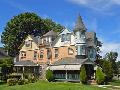
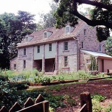
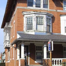
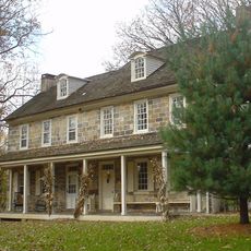
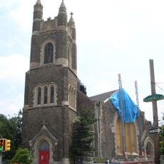
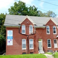
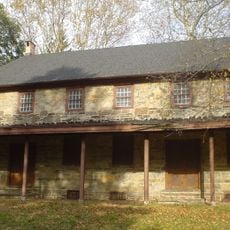
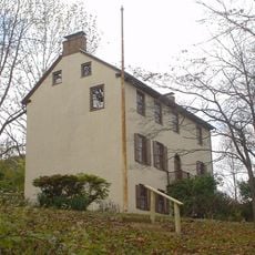
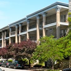
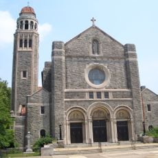
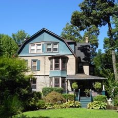
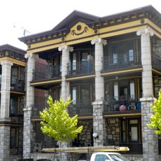
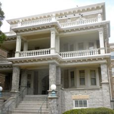
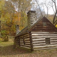
Lansdowne Park Historic District is a historic district in Lansdowne, Pennsylvania, containing over 100 buildings on approximately 33 acres, with residences primarily built between 1889 and 1891. The architecture reflects styles such as Queen Anne, Dutch Colonial Revival, and Georgian Revival, with the oldest structure, the Dickenson Farmstead, dating to 1732 and later expanded in 1790.

The area was originally farmland that rapidly developed into a residential neighborhood after the Pennsylvania Railroad arrived in the 1850s. Most houses were constructed during a building boom between 1889 and 1891, when proximity to the railroad station drove development and expansion.

The name Lansdowne comes from an English town, reflecting early European settlement roots. The streets show how residents gather on front porches and maintain a close-knit community feeling that visitors can observe today.

The district is best explored on foot, with well-maintained sidewalks and tree-lined streets that invite walking. Take time to observe architectural details and notice the different styles of houses, porches, and building facades as you move through the neighborhood.

The oldest structure, the Dickenson Farmstead from 1732, stands as a bridge between the agricultural past and later suburban development. Its expansion in 1790 shows how the property adapted as the landscape transformed from farms to homes.

The community of curious travelers

AroundUs brings together thousands of curated places, local tips, and hidden gems, enriched daily by 60,000 contributors worldwide.

Start exploring
Location
GPS coordinates
39.93940,-75.27580
Latest update
February 9, 2026 07:40
Around this place
Tower Theatre
United States of America

Tower Theatre

2.8 km
Bartram's Garden
United States of America

Bartram's Garden

5.5 km
Simeone Foundation Automotive Museum
United States of America

Simeone Foundation Automotive Museum

5.3 km
Cobbs Creek
United States of America

Cobbs Creek

3 km
Dickens and Little Nell
United States of America

Dickens and Little Nell

5.7 km
Clark Park
United States of America

Clark Park

5.7 km
Darby Creek
United States of America

Darby Creek

4.6 km
Paul Robeson House
United States of America

Paul Robeson House

5.1 km
Collen Brook Farm
United States of America

Collen Brook Farm

4.1 km
United States of America

Gray's Ferry Tavern

5.9 km
Calvary United Methodist Church, Philadelphia
United States of America

Calvary United Methodist Church, Philadelphia

5 km
Darby Free Library
United States of America

Darby Free Library

2.4 km
Darby Meeting
United States of America

Darby Meeting

2.3 km
Nitre Hall
United States of America

Nitre Hall

5 km
Pinehurst Apartments
United States of America

Pinehurst Apartments

5.5 km
City Line Avenue Bridge
United States of America

City Line Avenue Bridge

5.3 km
St. Cyprian Roman Catholic Church
United States of America

St. Cyprian Roman Catholic Church

2.8 km
Lansdowne Theatre
United States of America

Lansdowne Theatre

312 m
Armenian Martyrs' Congregational Church
United States of America

Armenian Martyrs' Congregational Church

4.1 km
Monte Vista
United States of America

Monte Vista

5.1 km
Henry Albertson Subdivision Historic District
United States of America

Henry Albertson Subdivision Historic District

472 m
City of Conquerors, Philadelphia
United States of America

City of Conquerors, Philadelphia

3.5 km
Twentieth Century Club of Lansdowne
United States of America

Twentieth Century Club of Lansdowne

853 m
La Blanche Apartments
United States of America

La Blanche Apartments

4.8 km
Hanson Haines House
United States of America

Hanson Haines House

5.1 km
Breslyn Apartments
United States of America

Breslyn Apartments

5.5 km
Regent-Rennoc Court
United States of America

Regent-Rennoc Court

4.9 km
Lower Swedish Cabin
United States of America

Lower Swedish Cabin

1.7 km
Show the full map
« Lansdowne Park Historic District - historic district in Pennsylvania, United States » is provided by Around Us (aroundus.com). Images and texts are derived from Wikimedia project under a Creative Commons license. You are allowed to copy, distribute, and modify copies of this page, under the conditions set by the license, as long as this note is clearly visible.

Discover hidden gems everywhere you go!

From secret cafés to breathtaking viewpoints, skip the crowded tourist spots and find places that match your style. Our app makes it easy with voice search, smart filtering, route optimization, and insider tips from travelers worldwide. Download now for the complete mobile experience.

Around Us App Screenshot

A unique approach to discovering new places

Le Figaro

All the places worth exploring

France Info

A tailor-made excursion in just a few clicks

20 Minutes

Around Us
Travel Guide & Maps
Download

Send to your phone

QR Code
1

Open the camera app on your mobile.

2

Point at the QR code with your camera. A notification will appear.

3

Tap the notification to open the link.